


| file name | zbc16646_AGIKP_0014a_mapa001_Mapa_ogólna_Król._Pol._z_podz._na_gub._i_pow._COMBINED.jpg |
|---|---|
| file size | 8240600 (7.9 MB) |
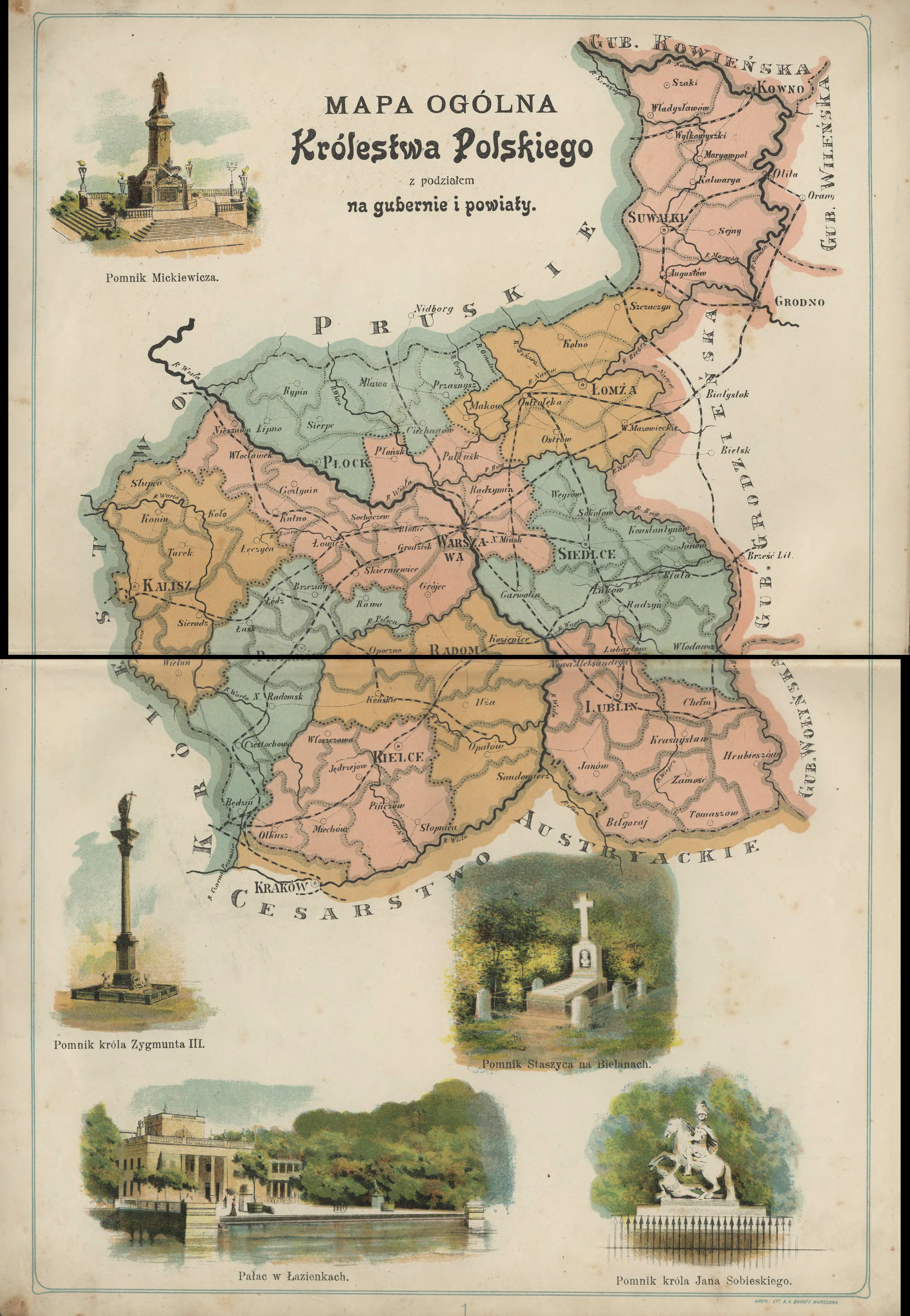
| appendix title | Mapa ogólna Królestwa Polskiego z podziałem na gubernie i powiaty |
| modern name | A general map of the Kingdom of Poland with divisions into governorates and subdistricts |
| publication year | 1907 |
| publisher | -inne- (-others-) |
| entry edited | 2014-03-12 08:52:52 |
| file added | 2014-03-10 |
| from the collection of | |
| source reference | Wojewódzka i Miejska Biblioteka Publiczna w Zielonej Górze; bc id: 16646 |
