


| map file | Zaolzie_1938_1_Slask_Zaolzianski_i_Czadeckie.jpg |
|---|---|
| file size | 4010986 (3.8 MB) |
| sheet number | 1938 |
| map sheet scale | 1:100,000 |
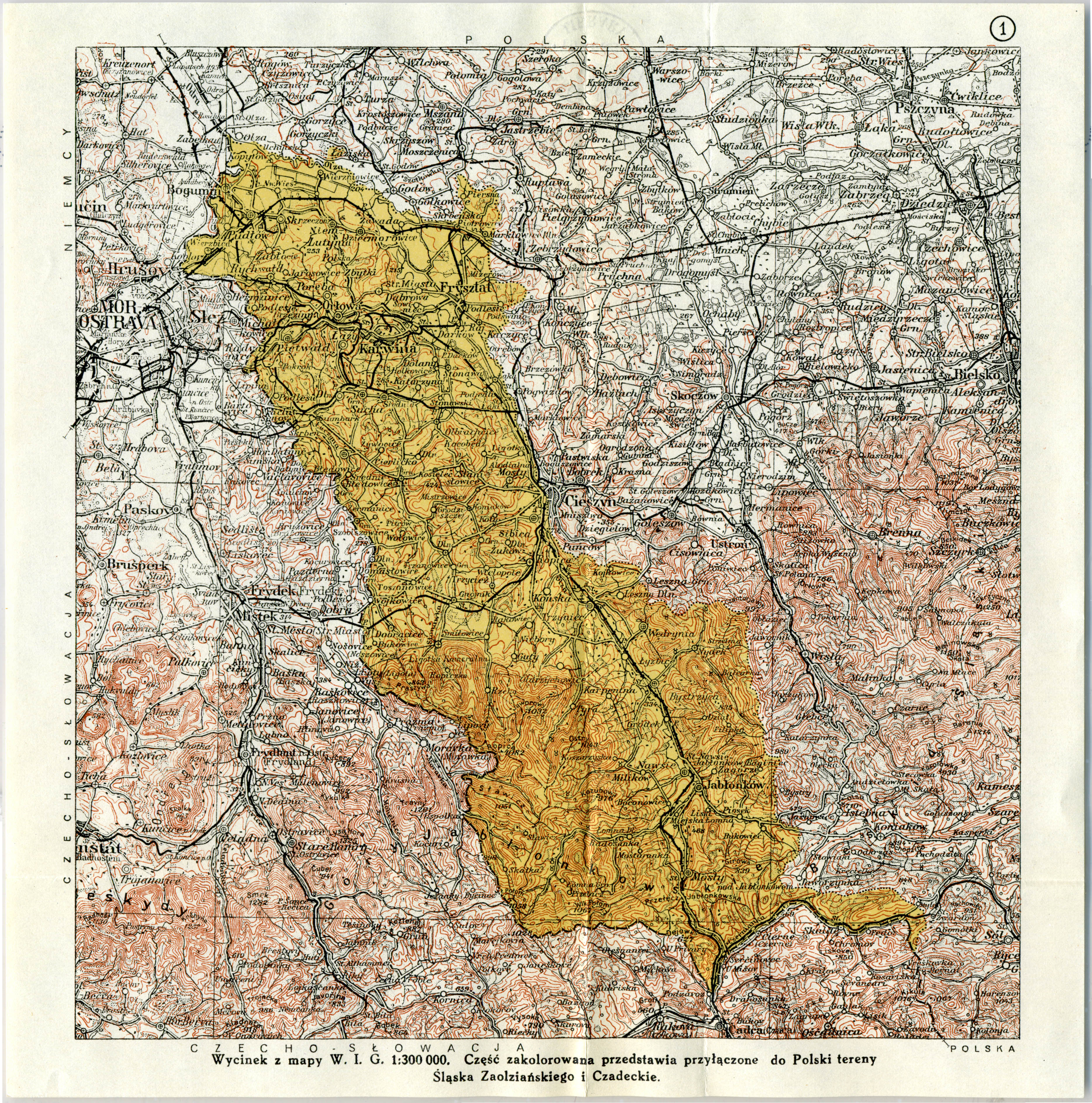
| sheet title | 1 Śląsk Zaolziański i Czadeckie |
| annotation | Mapa miejsca zmiany granicy państwowej Map of a state-border change place |
| publication year | 1938 |
| publisher | Wojskowy Instytut Geograficzny |
| scan resolution | 300 dpi |
| entry edited | 2013-11-30 18:00:53 |
| from the collection of | Archiwum Map WIG |
