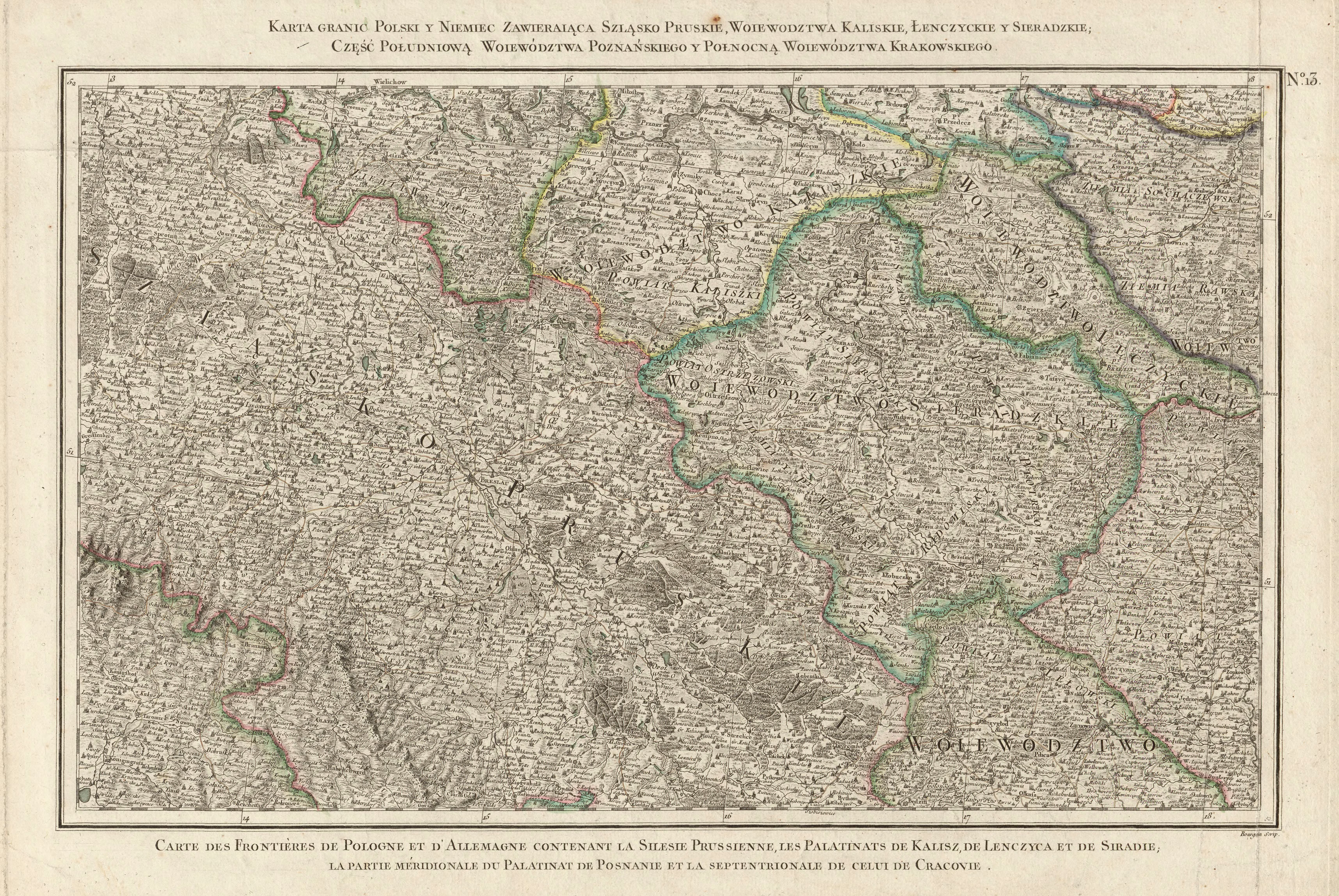
| map file | Zanonni_Carte_De_La_Pologne_sbc37295_Nr_13_Szląsko_Pruskie_Woiewodztwa_Kaliskie_Łenczyckie_y_Sieradzkie.jpg |
|---|
| file size | 9447728 (9.0 MB) |
|---|
| sheet number | 13 |
|---|
| sheet title | Karta granic Polski y Niemiec zawieraiąca Szląsko Pruskie Woiewodztwa, Kaliskie, Łenczyckie y Sieradzkie; część południową Woiewództwa Poznańskiego y północną Woiewództwa Krakowskiego. |
|---|
| modern name | A map of the borders of Poland and Germany , containing the Prussian Silesia and the Voivodships of Kalisz, Łęczyca i Sieradz, the southern part of the Voivodship of Poznań and the northern part of the Voivodship of Cracow. |
|---|
| alternative name | Głogów, Sieradz, Piotrków Trybunalski |
|---|
| alternative name 2 | Glogau |
|---|
| annotation | egz. Śląskiej BC / copy of the Silesian DL |
|---|
| publication year | 1772 |
|---|
| scan resolution | 300 dpi |
|---|
| file added | 2014-01-11 |
|---|
| entry edited | 2014-01-11 21:08:24 |
|---|
| from the collection of | Śląska Biblioteka Cyfrowa |
|---|
| source reference | bc id: 37295 |
|---|


