| Kartedatei | Zanonni_Carte_De_La_Pologne_sbc37485_Nr_24_od_Bałty_aż_do_rzeki_Sina-Woda_Zawieraiąca_Słobody_Kozakow.jpg |
|---|
| Dateigröße | 3959926 (3.8 MB) |
|---|
| Blattnummer | 24 |
|---|
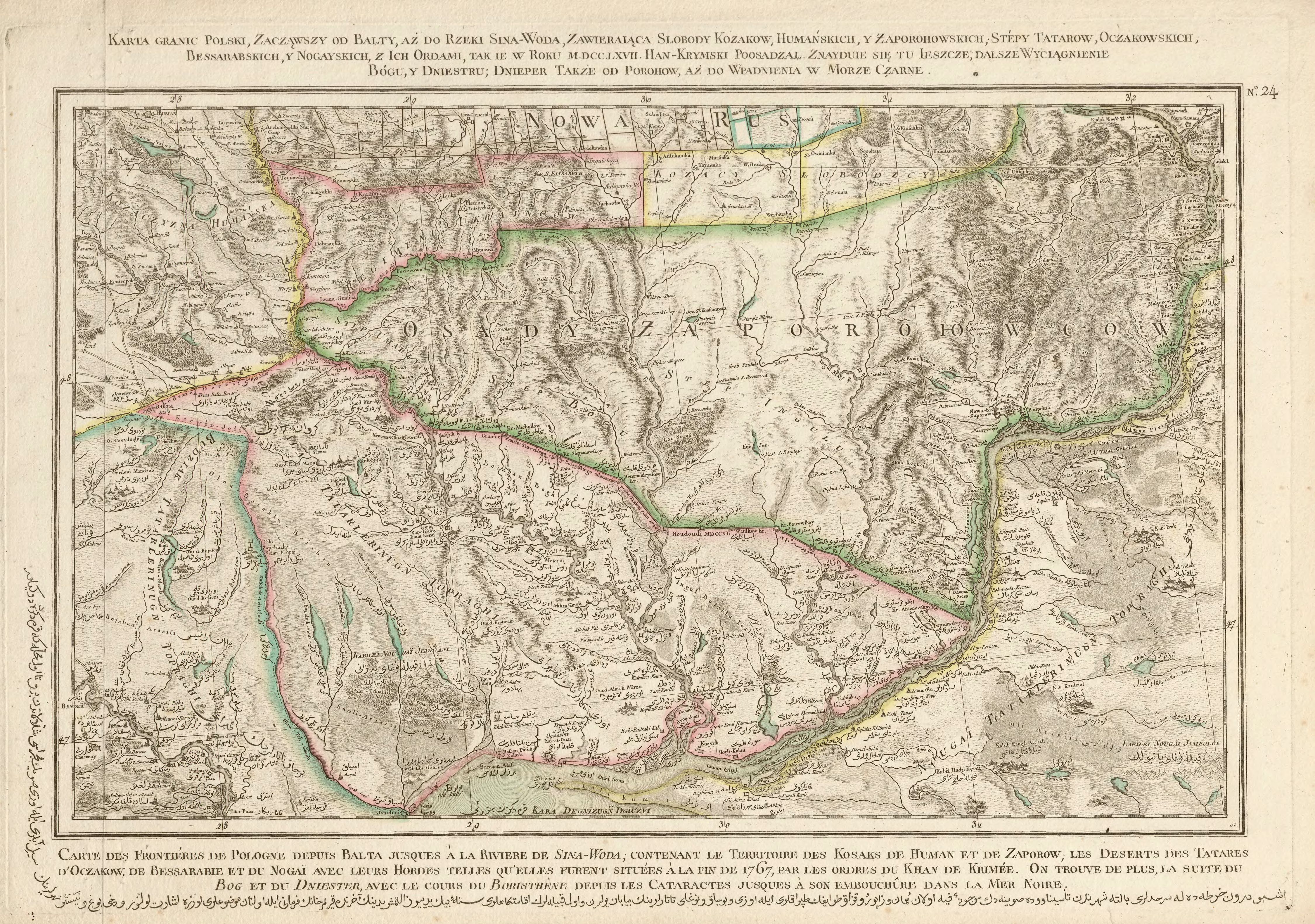
| Blatttitel | Karta granic Polski, zacząwszy od Bałty, aż do rzeki Sina-Woda, zawieraiąca Słobody Kozaków, Humańskich, y Zaporohowskich, Stépy Tatarow, Oczakowskich, Bessarabskich y Nogayskich, z ich ordami, tak ie w roku MDCCLXVII Han-Krymski poosadzał. Znayduie się tu ieszcze, dalsze wyciągnienie Bógu, y Dniestru. |
|---|
| gegenwärtige Name | A map of the borders of Poland, starting from Bałta till the Sina Woda River, which contains villages (słoboda) of the Cossacks of Humań and Zaporoże, the steppes of the Oczaków Tatars, the Bessarabian Tatars and the Nogaj Tatars including their hordes as they were settled in 1767 by the Crimean Khan. It also contains a further course of Boh and Dniestr. |
|---|
| alternative Name | Koniecpol, Nowa Sicz, Oczaków |
|---|
| alternative Name 2 | Кінецьпіль, Нова Січ, Очаків |
|---|
| Notiz | egz. Śląskiej BC / copy of the Silesian DL |
|---|
| Veröffentlichungsjahr | 1772 |
|---|
| Scanauflösung | 300 dpi |
|---|
| Datei hinzugefügt | 2014-01-11 |
|---|
| Eintrag editiert | 2014-01-11 21:08:25 |
|---|
| aus der Sammlung von | Śląska Biblioteka Cyfrowa |
|---|
| Quelleanmerkung | bc id: 37485 |
|---|


