


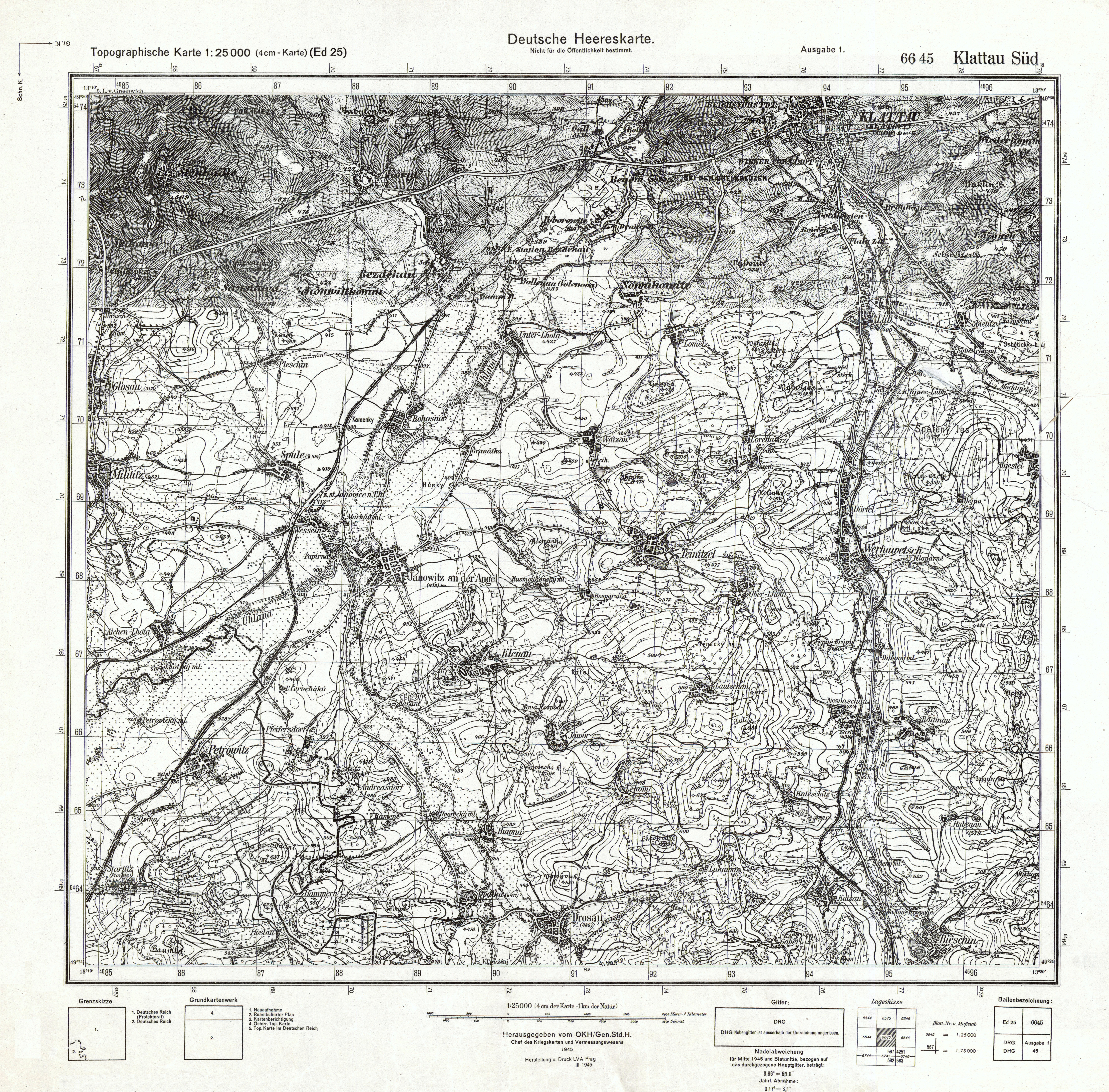
| map file | 6645_Klattau_Sued_DH_Ausg.1_III.1945.jpg |
|---|---|
| file size | 10756800 (10.3 MB) |
| sheet number | 6645 |
| sheet title | Klattau Süd |
| modern name | Klatovy |
| alternative name | Klattau |
| publication year | 1945 |
| publisher | Oberkommando des Heeres / Generalstab |
| printer | D 403 : Kriegskarten- und Vermessungsamt Prag |
| map/scan condition | good |
| scan resolution | 300 dpi |
| scan colors | rgb |
| remarks | Herstellung und Druck LVA Prag III.45 |
| file added | 2014-01-23 |
| entry edited | 2014-01-23 23:03:20 |
| from the collection of | Archiwum Map WIG |
