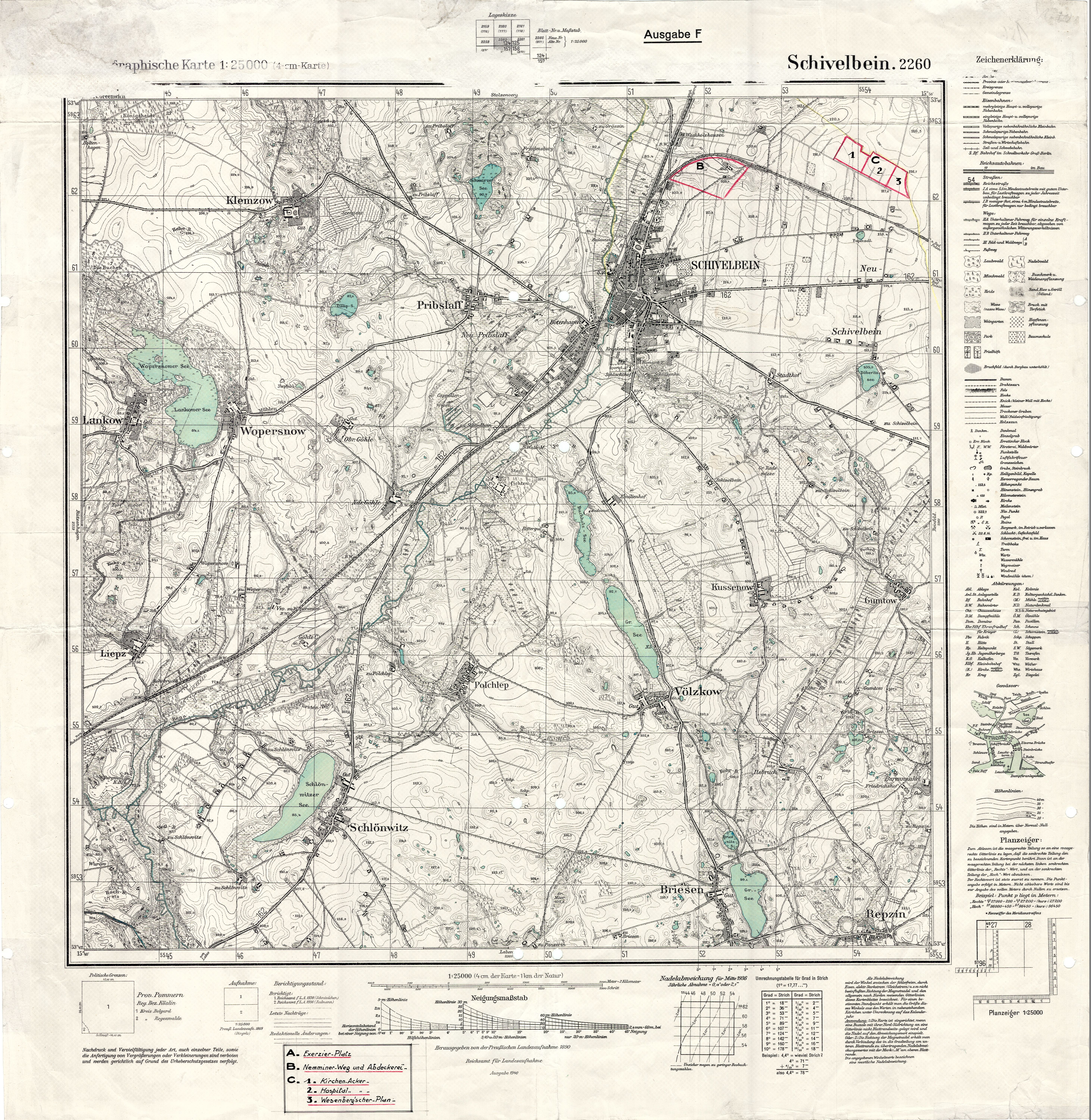
| map file | 2260_Schivelbein_Ausgabe_F_1940_BBC00702.jpg |
|---|
| file size | 9714215 (9.3 MB) |
|---|
| sheet number | 2260 (871) |
|---|
| sheet title | Schivelbein. 2260. Topographische Karte : Ausgabe F |
|---|
| modern name | Świdwin |
|---|
| publication year | 1940 |
|---|
| publisher | Reichsamt für Landesaufnahme |
|---|
| keywords | Ausgabe F |
|---|
| map/scan condition | good |
|---|
| scan resolution | 300 dpi |
|---|
| scan colors | rgb |
|---|
| remarks | Publisher: Preuβische Landesaufnahme ; Reichsamt für Landesaufnahme; Date: 1890 (oryginał), 1940 (druk) |
|---|
| file added | 2014-02-08 |
|---|
| entry edited | 2014-02-08 12:53:52 |
|---|
| from the collection of | Bałtycka Biblioteka Cyfrowa |
|---|
| source reference | The National Archive in Koszalin ; I/156; bc id: 702 |
|---|


