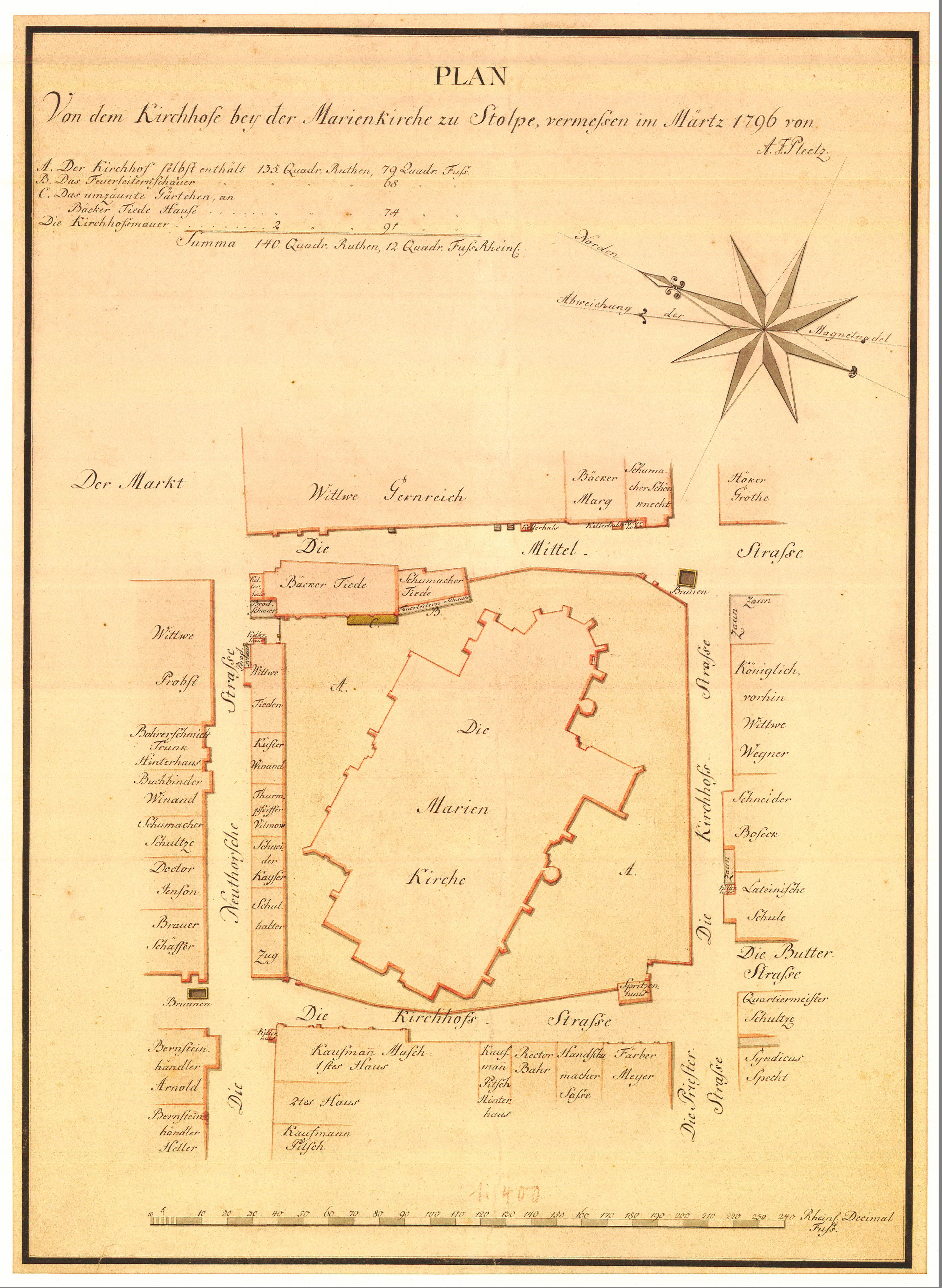
| map file | bbc03272_SŁUPSK-Plan_von_dem_Kirchhofe_bey_der_Marienkirche_zu_Stolpe_1796.jpg |
|---|
| file size | 3644098 (3.5 MB) |
|---|
| sheet number | Słupsk |
|---|
| sheet title | Plan von dem Kirchhofe bey der Marienkirche zu Stolpevermessen im Märtz 1796 von A. F. Pleetz. |
|---|
| modern name | Plan placu przy kościele Mariackim w Słupsku, wymierzony w marcu 1796 r. przez A. F. Pleetza. |
|---|
| alternative name | Słupsk |
|---|
| publication year | 1796 |
|---|
| scan resolution | 300 dpi |
|---|
| remarks | Creator: Pleetz; size 33 x 46 cm |
|---|
| file added | 2014-02-08 |
|---|
| entry edited | 2014-02-08 12:53:54 |
|---|
| from the collection of | Bałtycka Biblioteka Cyfrowa |
|---|
| source reference | The Museum of the Middle Pomerania in Slupsk ; MPŚ/BAK-91; bc id: 3272 |
|---|


