


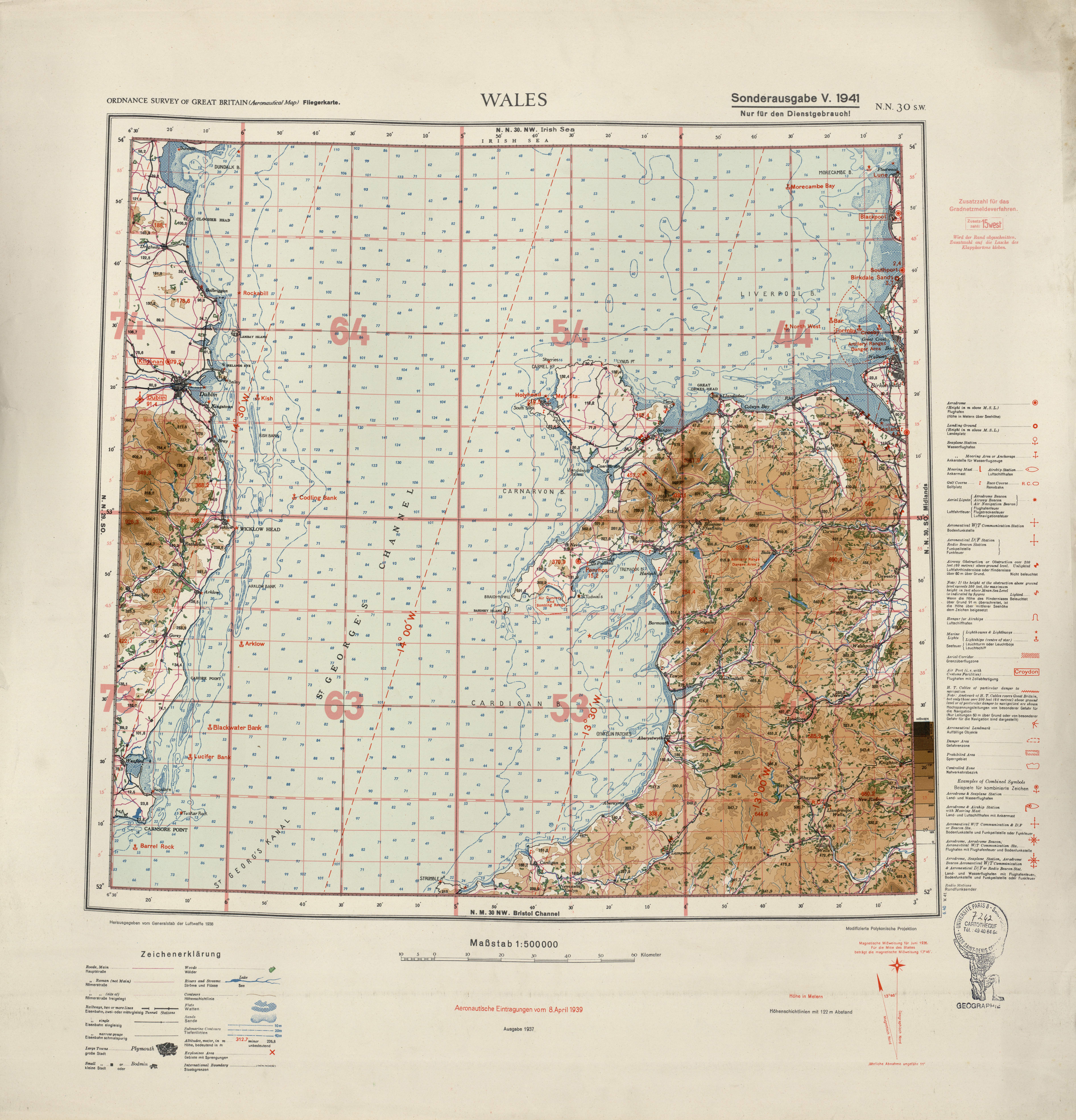
| map file | Ordnance_survey_of_Great_Britain@500K@NN_30-SW@Wales@Generalstab_der_Luftwaffe@1941@univparis8id09522.jpg |
|---|---|
| file size | 6195006 (5.9 MB) |
| sheet number | N30 SW |
| sheet title | Wales |
| publication year | 1941 |
| publisher | Generalstab der Luftwaffe |
| map/scan condition | good |
| scan resolution | 300 dpi |
| scan colors | rgb |
| remarks | Ordnance Survey of Great Britain (Aeronautical Map); Fliegerkarte; Sonderausgabe V. 1941. |
| file added | 2014-02-26 |
| entry edited | 2014-02-26 19:48:21 |
| from the collection of | L'Université Paris 8; La bibliothèque universitaire; 2 rue de la Liberté - 93526 Saint-Denis cedex; France |
| source reference | bc id: 9522.jpg |
