


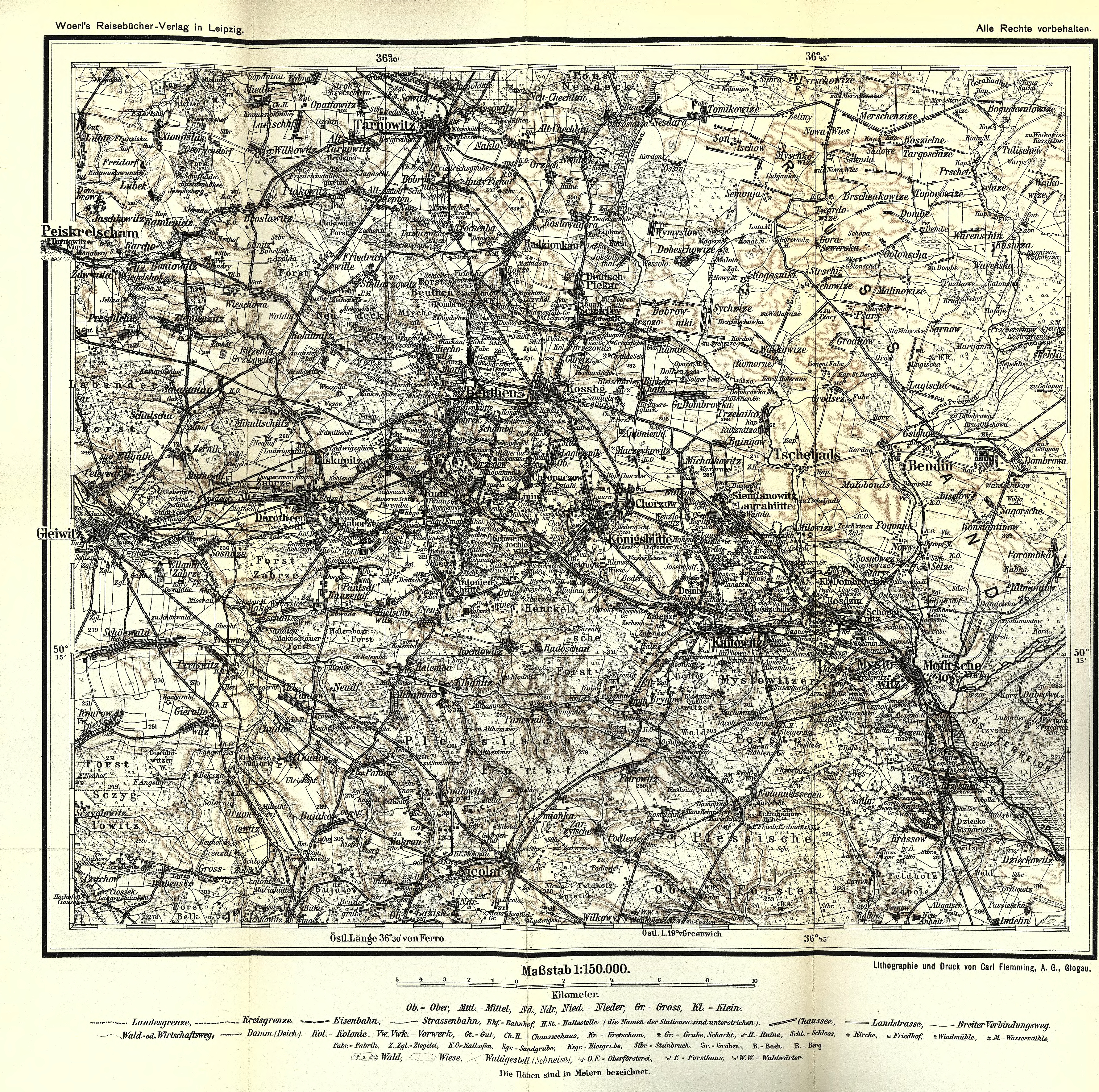
| map file | sbc00943_Illustrierter_Führer_durch_das_Oberschlesische_Industriegebiet-MAP_Upper_Silesia_150K.jpg |
|---|---|
| file size | 18087946 (17.3 MB) |
| sheet number | ŚLĄSK |
| map sheet scale | 1:150,000 |
| sheet title | Oberschlesien |
| modern name | Górny Śląsk |
| publication year | ±1900 |
| map/scan condition | good |
| scan resolution | 200 dpi |
| scan colors | rgb |
| remarks | Załącznik do: "Illustrierter Führer durch das Oberschlesische Industriegebiet" [kategoria przewodniki niemieckie] |
| file added | 2014-03-15 |
| entry edited | 2014-03-15 14:31:33 |
| from the collection of | Śląska Biblioteka Cyfrowa |
| source reference | bc id: 943 |
