


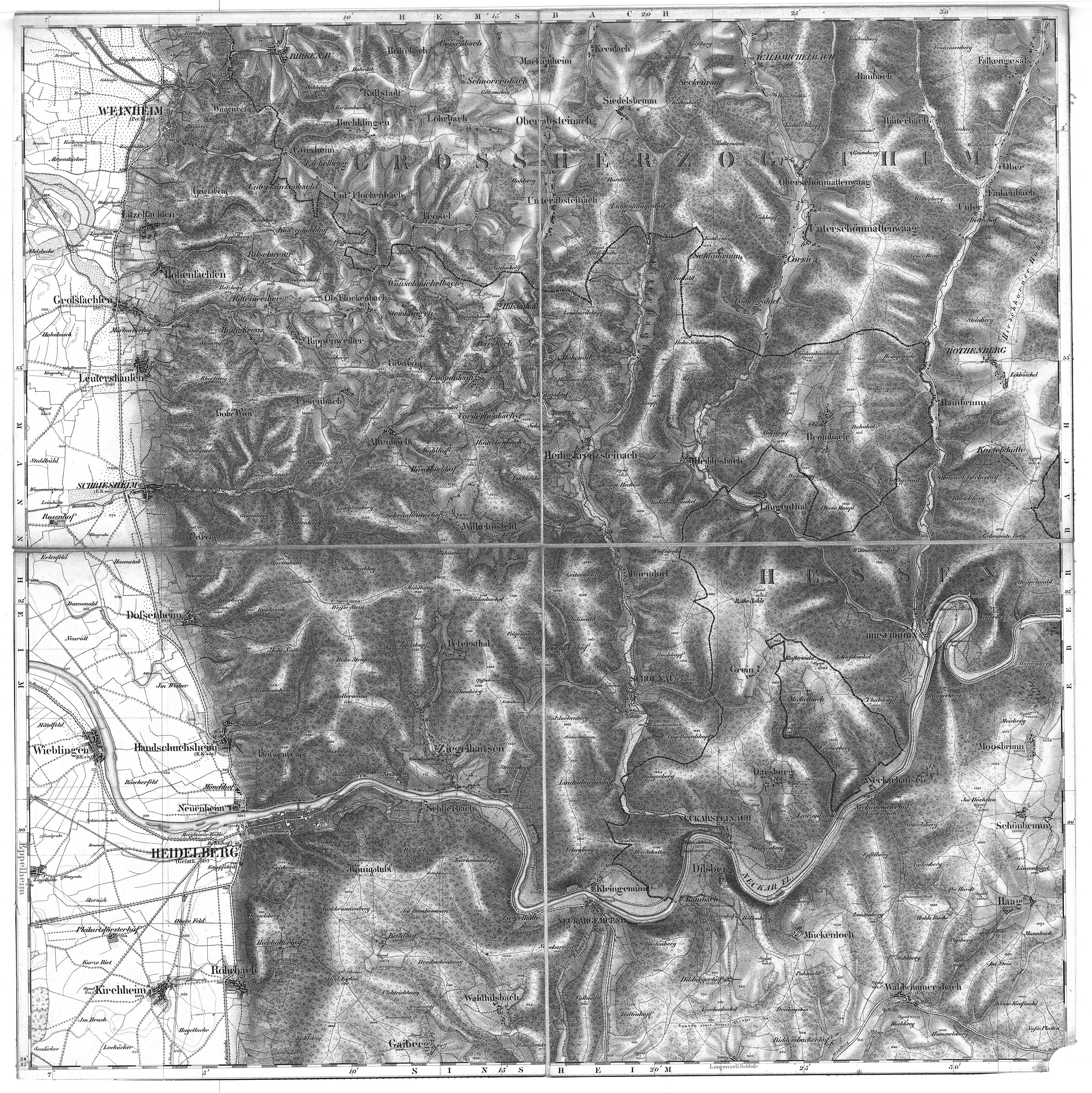
| map file | Baden50K-07_Heidelberg_PROC.jpg |
|---|---|
| file size | 19696722 (18.8 MB) |
| sheet number | 07 |
| sheet title | Heidelberg |
| annotation | obraz przetworzony / processed image |
| publication year | ±1845 |
| publisher | Karten-Bureau des Grossherzoglichen General-Stabes [Baden] |
| map/scan condition | bad |
| scan resolution | 300 dpi |
| scan colors | bw |
| file added | 2014-03-18 |
| entry edited | 2014-03-19 07:41:22 |
| from the collection of | Ernst Moritz Arndt Universität Greifswald GeoGREIF Geographische Sammlungen |
