| map file | Rizzi-Zannoni_Carte_de_la_Pologne_No_22_1772-ssees.jpg |
|---|
| file size | 7197215 (6.9 MB) |
|---|
| sheet number | 22 |
|---|
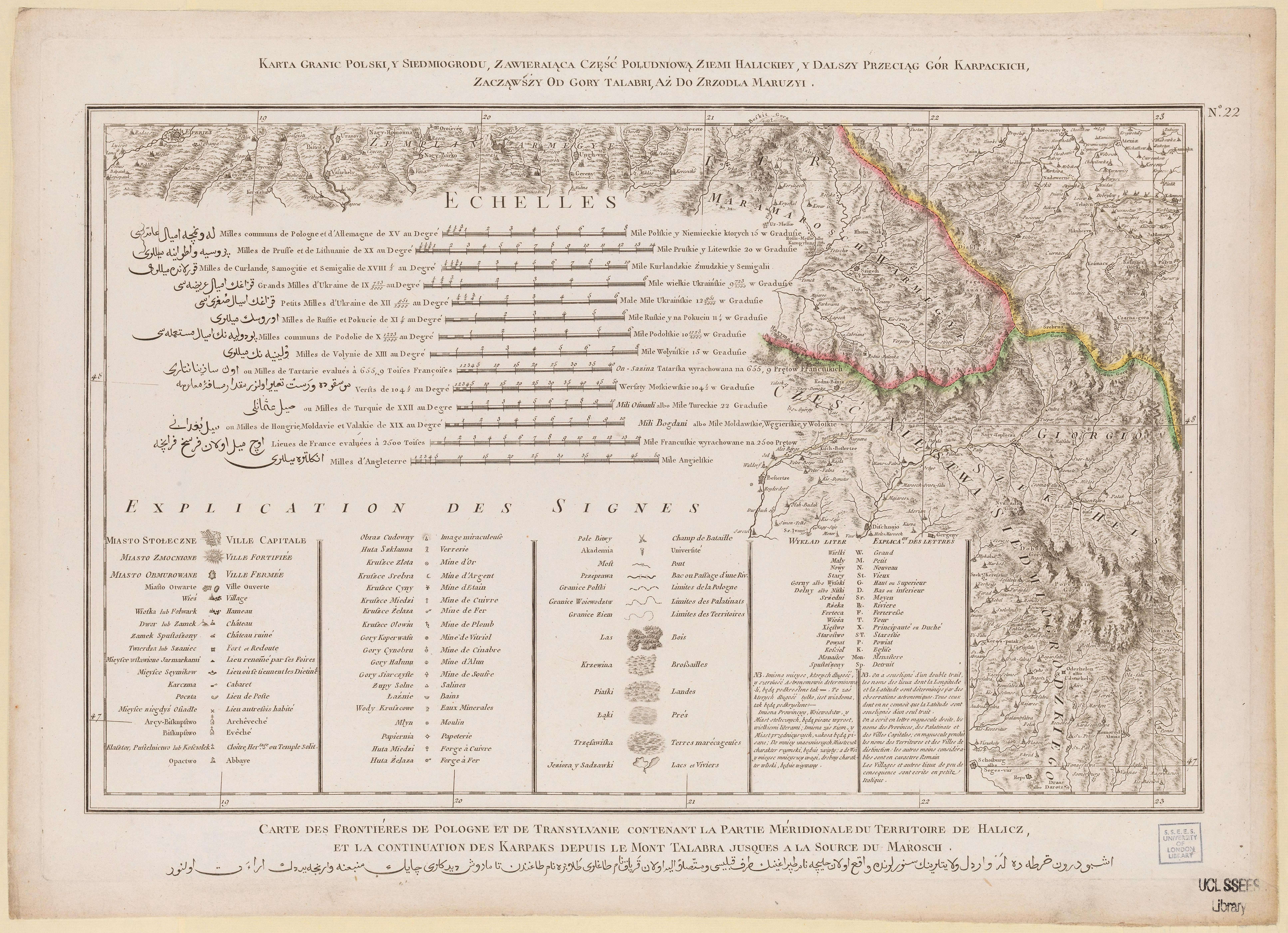
| sheet title | Karta granic Polski, y Siedmiogrodu, zawieraiąca część południową ziemi Halickiey y dalszy przeciąg gór Karpackich, zacząwszy od góry Talabri aż do zrzodła Maruzyi. |
|---|
| modern name | A map of the borders of Poland and Transylvania, containing the southern part of the land of Halicz and the further course of the Carpathian Mountains, from the Talabri Mountain till the springs of Maruzja. |
|---|
| alternative name | Nadwórna |
|---|
| alternative name 2 | Надвірна |
|---|
| annotation | egz. UCL SSEES / copy of UCL SSEES |
|---|
| publication year | 1772 |
|---|
| map/scan condition | good |
|---|
| scan resolution | 300 dpi |
|---|
| scan colors | rgb |
|---|
| file added | 2014-04-09 |
|---|
| entry edited | 2014-04-09 23:45:31 |
|---|
| from the collection of | University College of London, School of Slavonic and East European Studies |
|---|
| supplier's licence | Copyright UCL Library Services, 2010, licensed under Creative Commons Attribution-NonCommercial-ShareAlike 2.0 UK: England and Wales Licence. For further information on this Licence please refer to: http://creativecommons.org/licenses/by-nc-sa/2.0/uk/ |
|---|


