


| plik mapy | ssees0030_A_map_of_the_Propontio_or_Sea_of_Marmora-1770.jpg |
|---|---|
| rozmiar pliku | 5120009 (4.9 MB) |
| godło arkusza | TURKEY |
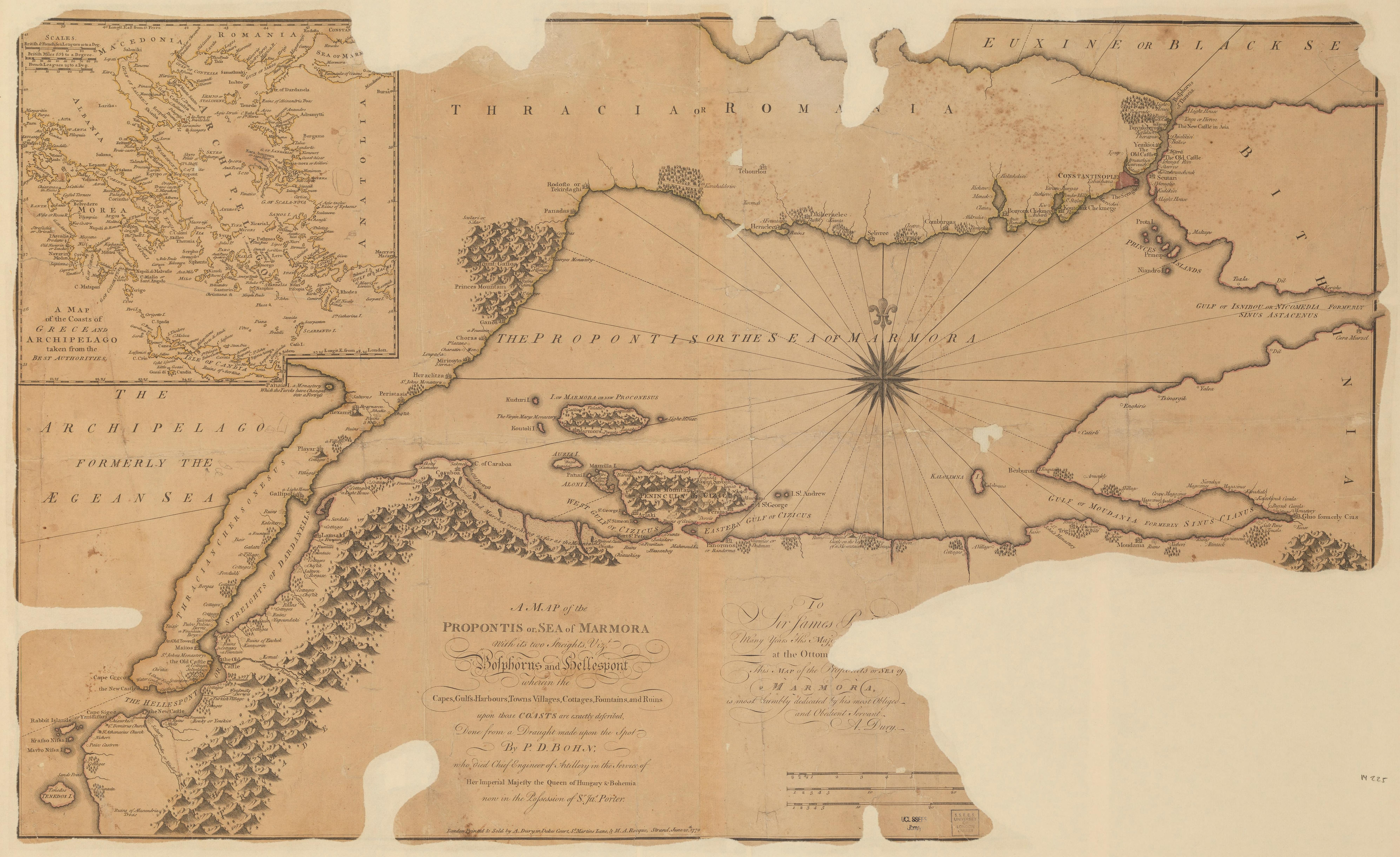
| tytuł arkusza | A map of the Propontio or Sea of Marmora |
| rok wydania | 1770 |
| stan mapy/skanu | dobry |
| rozdzielczość | 300 dpi |
| kolory skanu | rgb |
| uwagi | A map of the Propontio or Sea of Marmora :with its two streights, viz Bosphorus and Hellespont wherein the capes, gulfs, harbours, towns, villages, cottages, fountains and ruins upon those coasts are exactly described /done from a draught made upon the spot by P.D. Bohn, who died Chief Engineer of Artillery in the service of Her Imperial Majesty the Queen of Hungary and Bohemia, now in the possession of Sr. Jas. Porter. Bohn, P. D. From the collections of UCL SSEES Library London : printed and sold by A. Dury in Dukes Court, St. Martins Lane and M.A. Rocque, Strand , 1770 |
| plik dodano | 2014-04-10 |
| wpis edytowano | 2014-04-11 22:14:33 |
| ze zbiorów | University College of London, School of Slavonic and East European Studies |
| licencja dostawcy | Copyright UCL Library Services, 2010, licensed under Creative Commons Attribution-NonCommercial-ShareAlike 2.0 UK: England and Wales Licence. For further information on this Licence please refer to: http://creativecommons.org/licenses/by-nc-sa/2.0/uk/ |
