


| plik mapy | ssees0199_Karte_der_Gegend_um_Belgrad_auf_15_bis_20_meilen_in_Umbreis-ca1788.jpg |
|---|---|
| rozmiar pliku | 5038126 (4.8 MB) |
| godło arkusza | BALKANS |
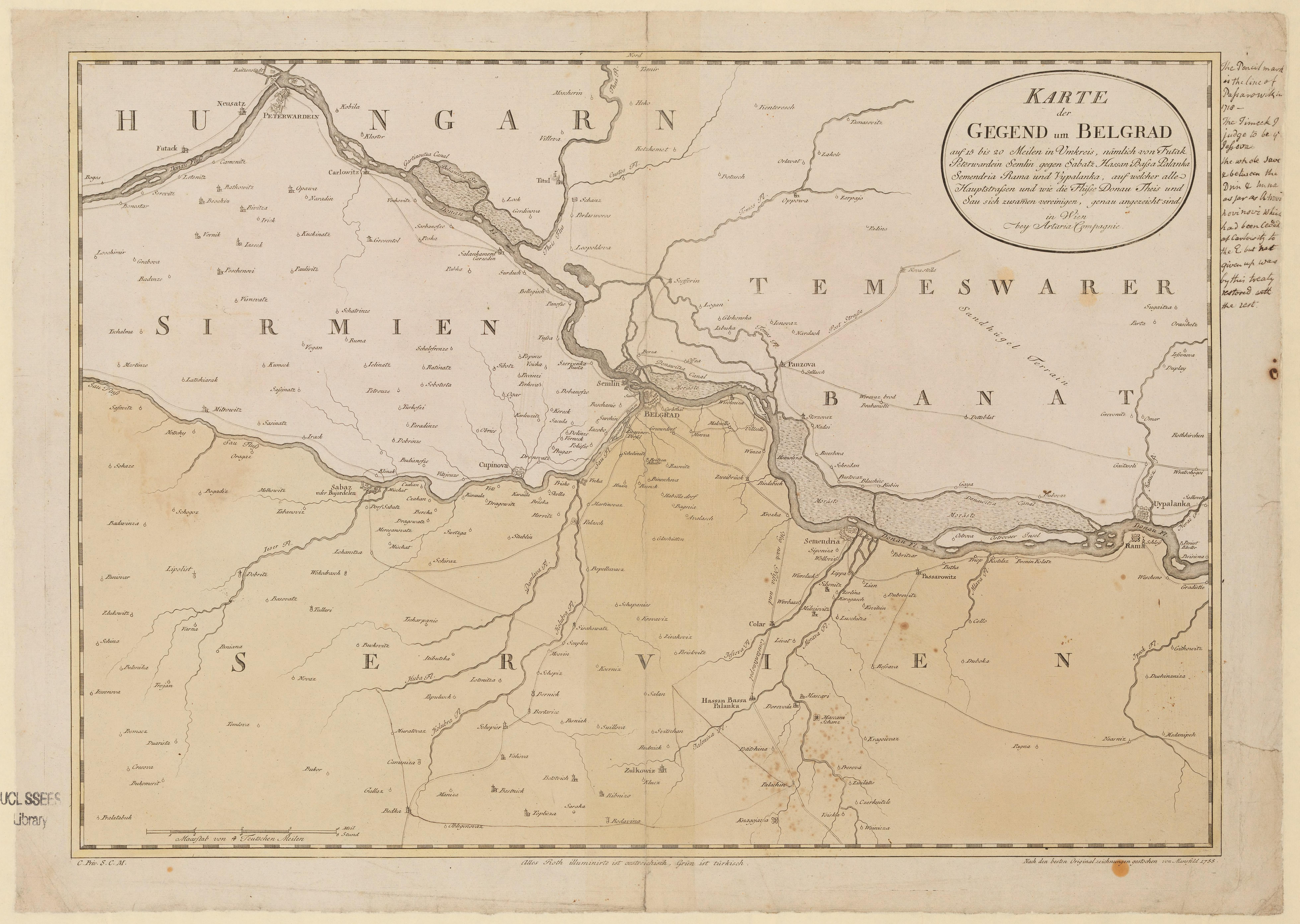
| tytuł arkusza | Karte der Gegend um Belgrad auf 15 bis 20 meilen in Umbreis |
| rok wydania | ±1788 |
| stan mapy/skanu | dobry |
| rozdzielczość | 300 dpi |
| kolory skanu | rgb |
| uwagi | Karte der Gegend um Belgrad auf 15 bis 20 meilen in Umbreis :nämlich von Zutak, Peterwardein, Semlin gegen Sabaty, Hassan, Bassa, Palanka, Semendria, Rama und Vypalanka : auf welcher alle Hauptstrassen und wie die Flüsse Donau, Theis und Sau sich zusamen vereinigen genau angezeichnet sind. From the collections of UCL SSEES Library Wien : Artaria Compagnie , [after 1788] |
| plik dodano | 2014-04-10 |
| wpis edytowano | 2014-04-11 22:14:40 |
| ze zbiorów | University College of London, School of Slavonic and East European Studies |
| licencja dostawcy | Copyright UCL Library Services, 2010, licensed under Creative Commons Attribution-NonCommercial-ShareAlike 2.0 UK: England and Wales Licence. For further information on this Licence please refer to: http://creativecommons.org/licenses/by-nc-sa/2.0/uk/ |
