


| map file | ssees0154_plan_de_la_ville_d'Otschakov_-ca1739.jpg |
|---|---|
| file size | 5508295 (5.3 MB) |
| sheet number | Oczaków |
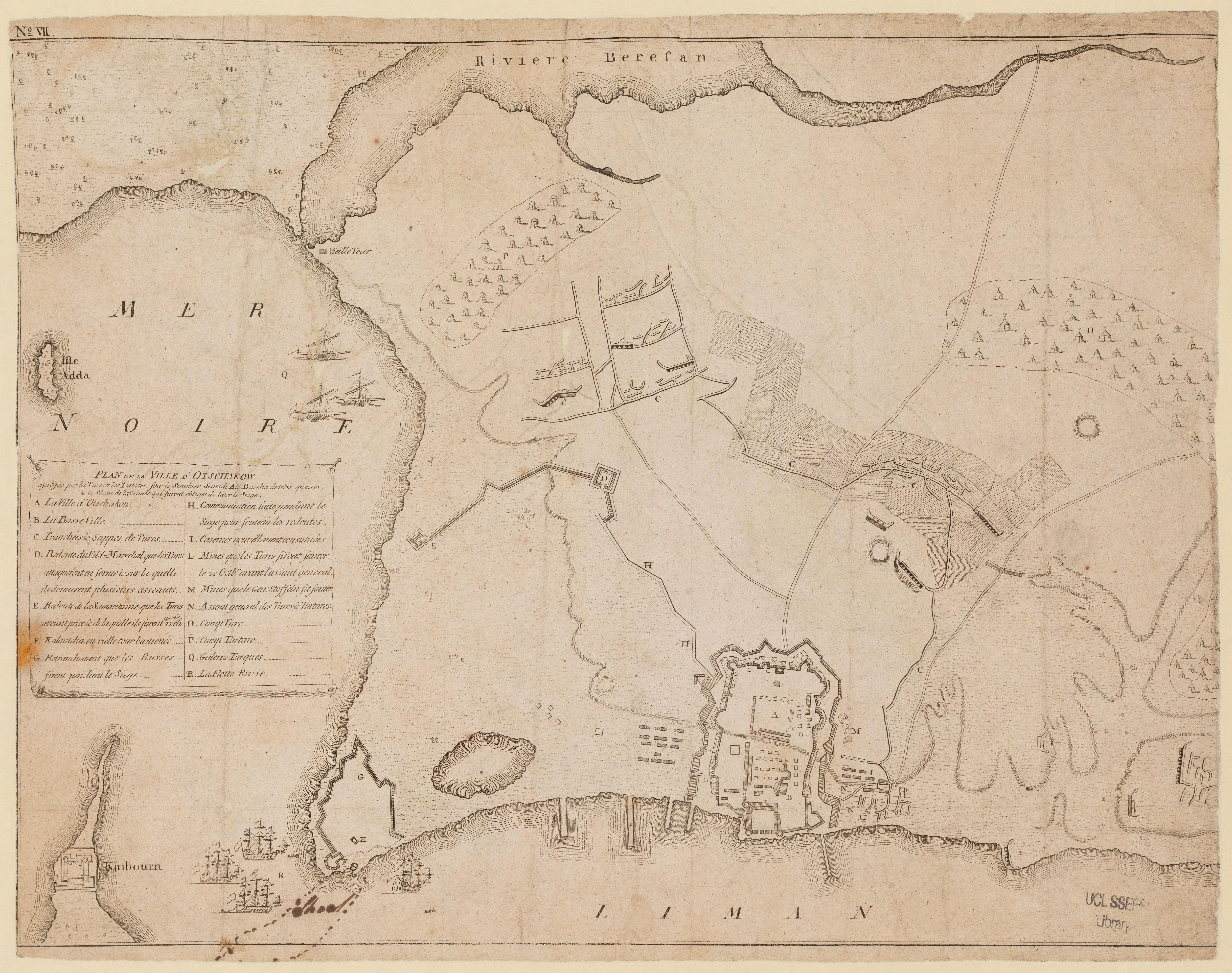
| sheet title | plan de la ville d'Otschakov |
| alternative name | Oczaków |
| publication year | ±1739 |
| map/scan condition | good |
| scan resolution | 300 dpi |
| scan colors | rgb |
| remarks | Plan de la ville d'Otschakov :assiégée par les Turcs et les Tartares, sous le seraskier Jentsch Ali Bascha de trois queues et le Chan de la Crimée qui surent obligés de lever le siège. From the collections of UCL SSEES Library [S.l. : s.n. , ca. 1739] |
| file added | 2014-04-12 |
| entry edited | 2014-04-13 21:27:37 |
| from the collection of | University College of London, School of Slavonic and East European Studies |
| supplier's licence | Copyright UCL Library Services, 2010, licensed under Creative Commons Attribution-NonCommercial-ShareAlike 2.0 UK: England and Wales Licence. For further information on this Licence please refer to: http://creativecommons.org/licenses/by-nc-sa/2.0/uk/ |
