


| Kartedatei | 27_XXVI_Berzaszka_und_O-Ogradina_1910_200dpi_NYPL1226949.jpg |
|---|---|
| Dateigröße | 35566075 (33.9 MB) |
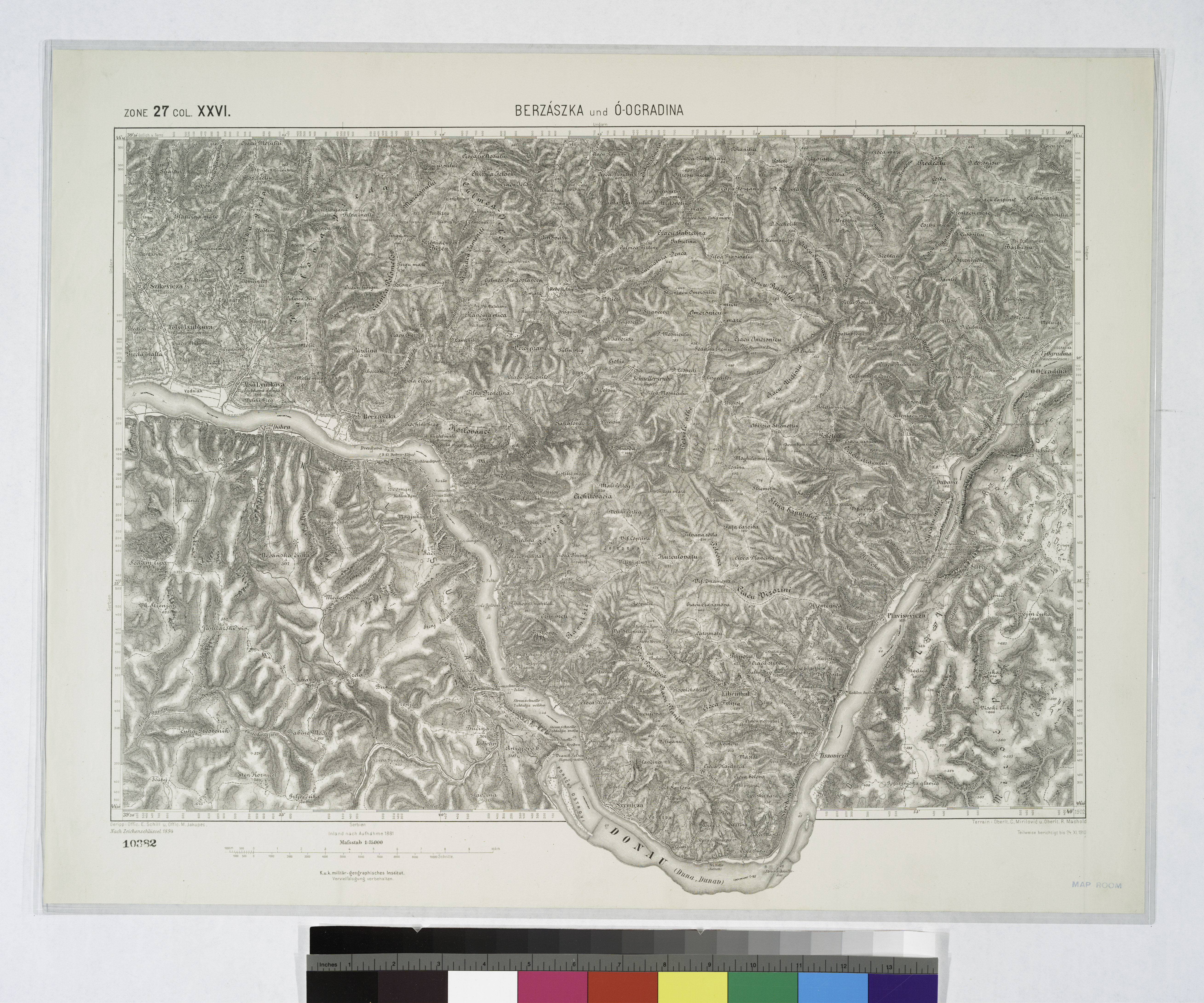
| Blattnummer | 27 XXVI (6168) |
| Blatttitel | Berszászka und Ó-Ogradina |
| gegenwärtige Name | Berzasca, Ogradena [non-existing] |
| alternative Name | Berszászka, Берзаска; Ó-Ogradina |
| alternative Name 2 | Bersaska |
| Veröffentlichungsjahr | 1910 |
| Hersteller | K.u.k. Militärgeographisches Institut in Wien |
| Karte/Scanzustand | schlecht |
| Scanauflösung | 200 dpi |
| Scanfarben | rgb |
| Hinweise | Locality of Ogradena composed of villages Ó-Ogradina, Új-Ogradina (Frauenwiesen) was located approx. near existing Eșelnița (Ieșelnița) Jeselnica; was submerged into Danube upon the construction of the water reservoir. UUID: 069bebf0-c5f0-012f-956e-58d385a7bc34 NYPL catalog ID (B-number): b15888873 RLIN/OCLC: 22951454 |
| Datei hinzugefügt | 2016-09-25 |
| Eintrag editiert | 2016-09-25 19:54:21 |
| aus der Sammlung von | Courtesy of Lionel Pincus and Princess Firyal Map Division. The New York Public Library, NY, USA |
| Shelf locator: Map Div. 04-336 | |
| Quelleanmerkung | DL image id: 1226949 |
