


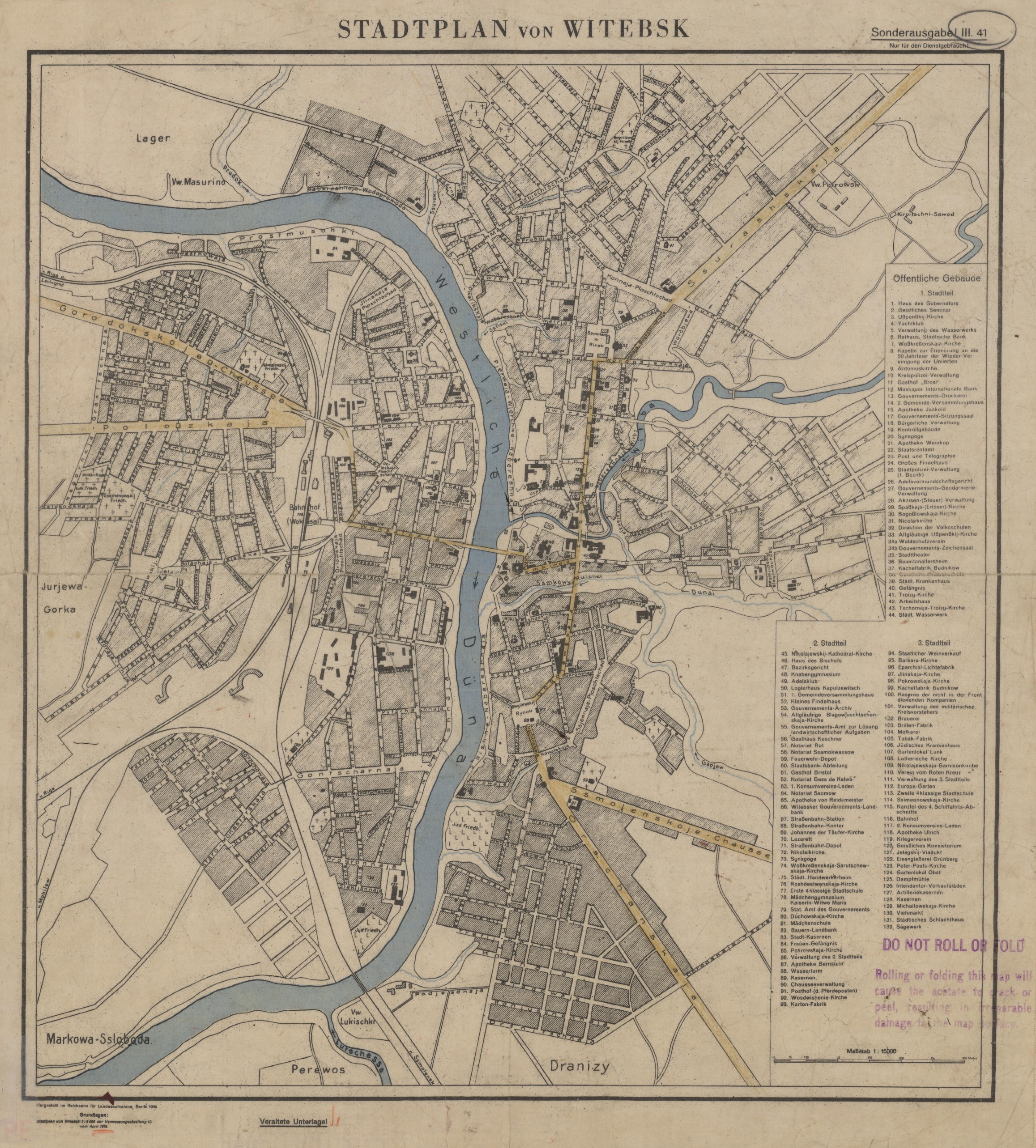
| map file | STADTPLAN_VON_WITEBSK_7.5K_1941_2.jpg |
|---|---|
| file size | 2159061 (2.1 MB) |
| sheet number | Witebsk |
| map sheet scale | 1:7,500 |
| sheet title | STADTPLAN VON WITEBSK |
| publication year | 1941 |
| publisher | Reichsamt für Landesaufnahme |
| map/scan condition | bad |
| scan resolution | 150 dpi |
| scan colors | rgb |
| file added | 2019-12-11 |
| entry edited | 2019-12-11 14:03:15 |
| from the collection of |
