


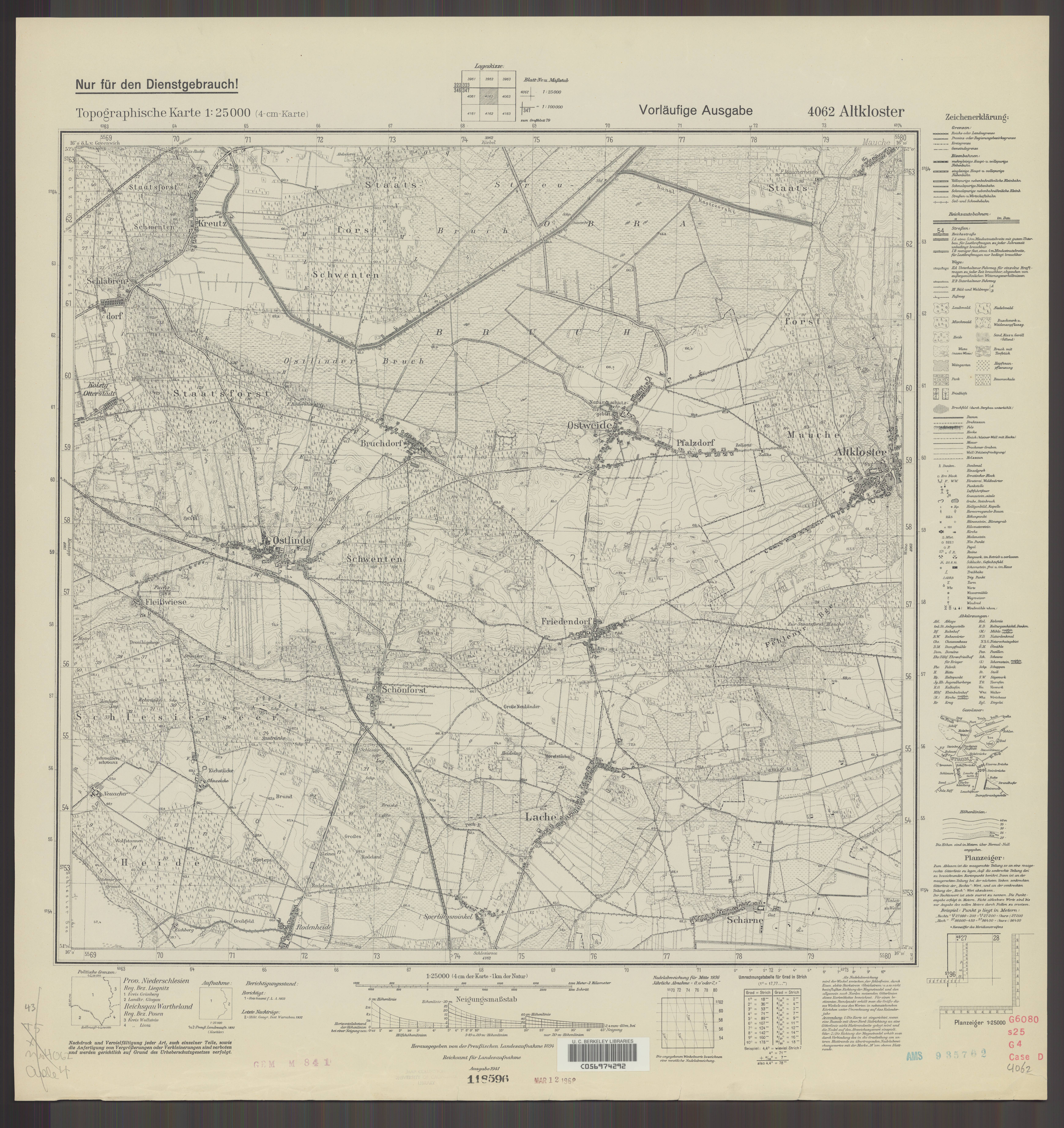
| map file | 4062_Altkloster_1941_uniberk_C056974292.jpg |
|---|---|
| file size | 6680283 (6.4 MB) |
| sheet number | 4062 (2264) |
| map sheet scale | 1:25,000 |
| sheet title | Altkloster |
| publication year | 1941 |
| publisher | Reichsamt für Landesaufnahme |
| scan resolution | 300 dpi |
| scan colors | rgb |
| file added | 2020-10-13 |
| entry edited | 2020-10-13 20:32:32 |
| from the collection of | The University of California Berkeley Library |
| call no | dl id: C056974292 |
