


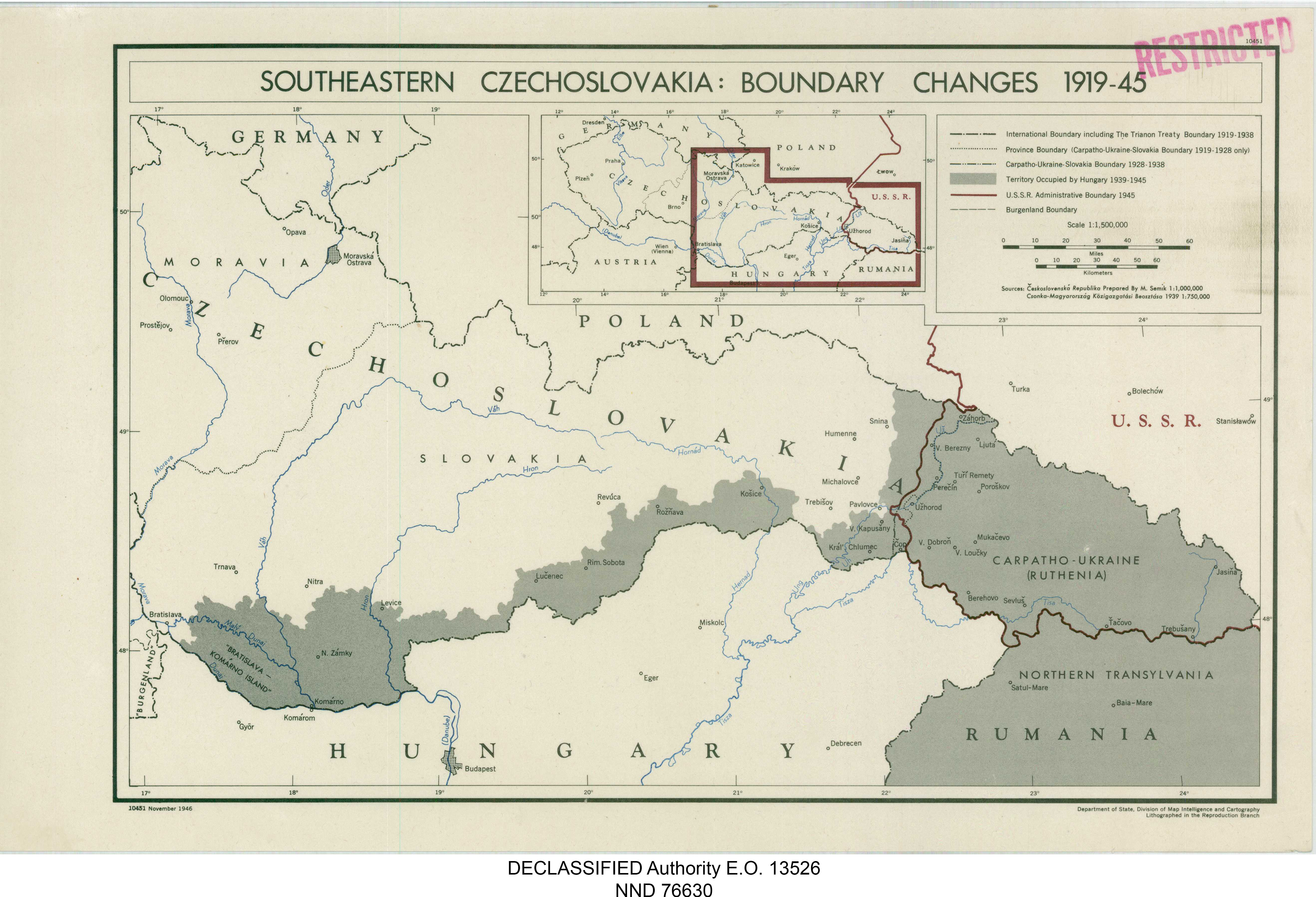
| Kartedatei | 10451_SOUTHERN_CS_BOUNDARY_CHANGES_1919-1945_DoS_1946_nara_305945_10451_01.jpg |
|---|---|
| Dateigröße | 1836802 (1.8 MB) |
| Blattnummer | empty |
| Blattmaßstab | 1:1 500 000 |
| Blatttitel | 10451 SOUTHERN CZECHOSLOVAKIA: BOUNDARY CHANGES 1919-1945 |
| gegenwärtige Name | POŁUDNIOWA CZECHOSŁOWACJA: ZMIANY GRANICZNE W LATACH 1919 - 1945 |
| Veröffentlichungsjahr | 1946 |
| Hersteller | Department of State, Division of Map Intelligence and Cartography |
| Karte/Scanzustand | gut |
| Scanauflösung | 300 dpi |
| Scanfarben | rgb |
| Datei hinzugefügt | 2020-12-26 |
| Eintrag editiert | 2020-12-26 19:49:36 |
| aus der Sammlung von | National Archives and Records Administration (NARA) |
