


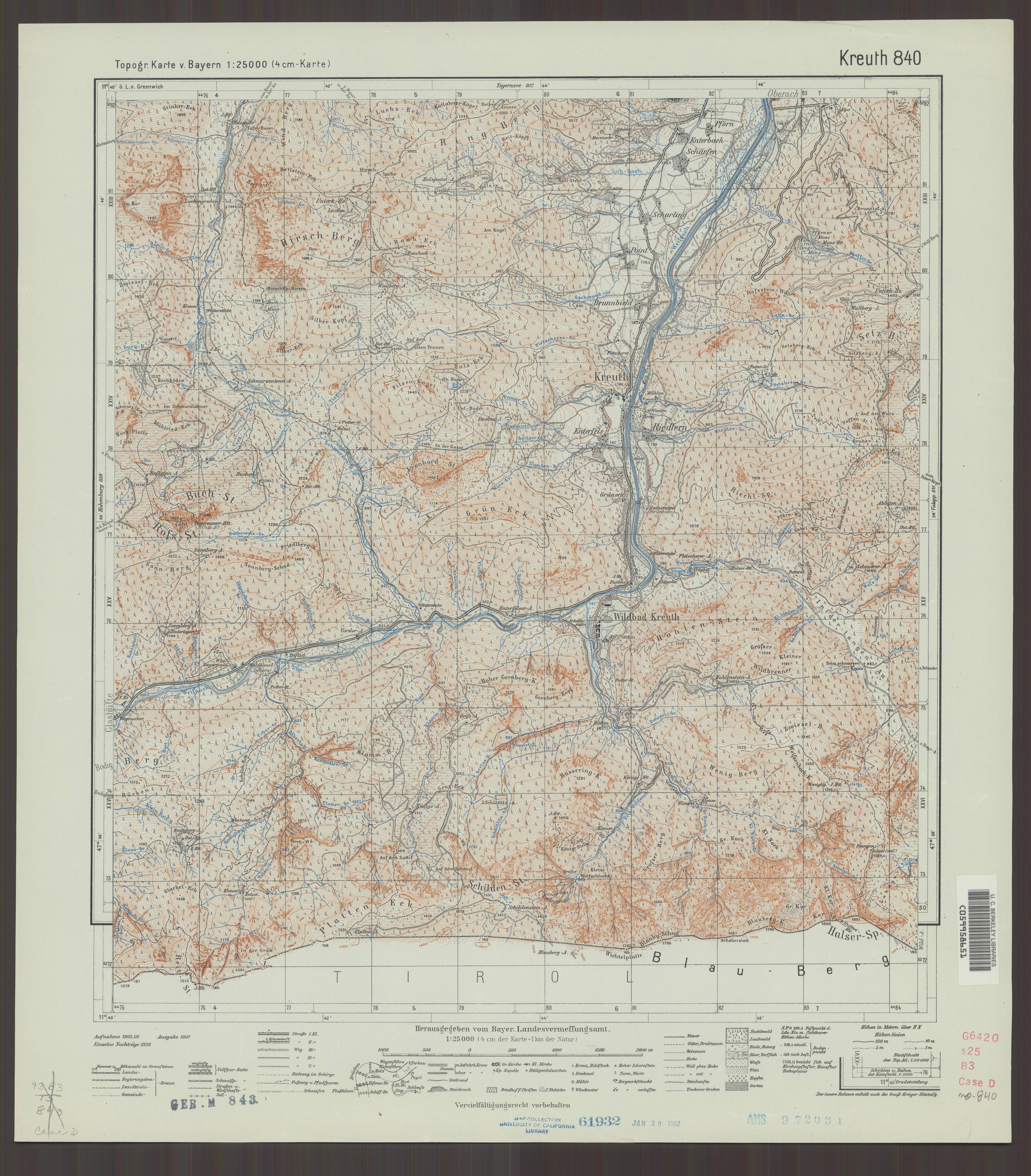
| map file | TKB25_840_Kreuth_1938_uniberk_C059958651.jpg |
|---|---|
| file size | 5744495 (5.5 MB) |
| sheet number | empty |
| map sheet scale | 1:25,000 |
| sheet title | Topogr. Karte v. Bayern Nr. 840 Kreuth |
| publication year | 1938 |
| publisher | Oberkommando des Heeres / Generalstab |
| scan resolution | 300 dpi |
| scan colors | rgb |
| file added | 2021-04-22 |
| entry edited | 2021-04-22 22:58:20 |
| from the collection of | The University of California Berkeley Library |
| call no | dl id: C059958651 |
