


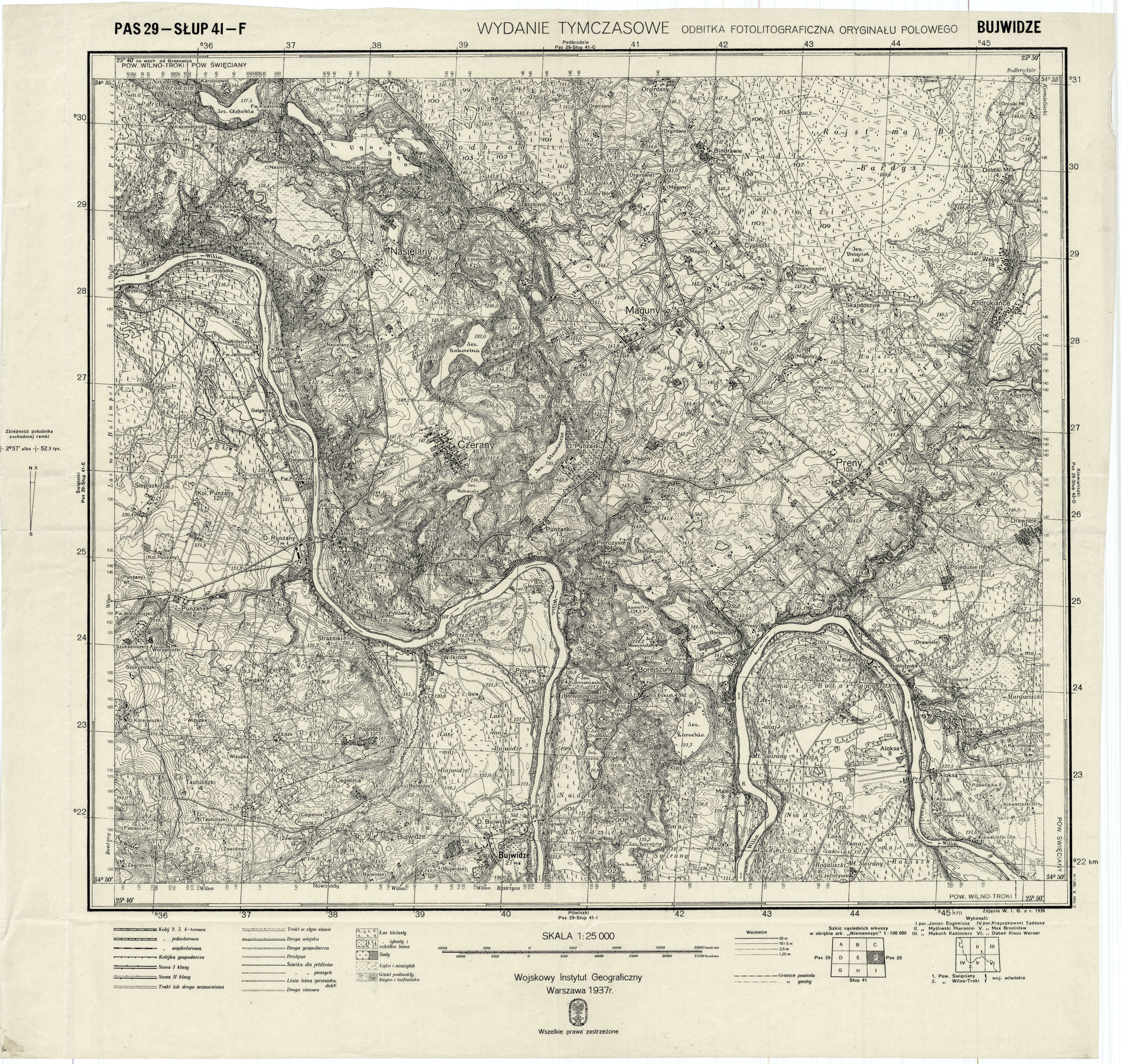
| map file | P29-S41-F_BUJWIDZE_WT_1937.jpg |
|---|---|
| file size | 8575996 (8.2 MB) |
| sheet number | P29 S41 F (2941 F) |
| sheet title | BUJWIDZE |
| publication year | 1937 |
| publisher | Wojskowy Instytut Geograficzny |
| map type | WIG 1:25tys tymczasowy |
| description | The WIG map 1:25,000. Temporary edition. |
| map/scan condition | good |
| scan resolution | 300 dpi |
| scan colors | rgb |
| file added | 2011-09-09 |
| entry edited | 2011-05-02 19:32:56 |
| from the collection of | Archiwum Map WIG |
