


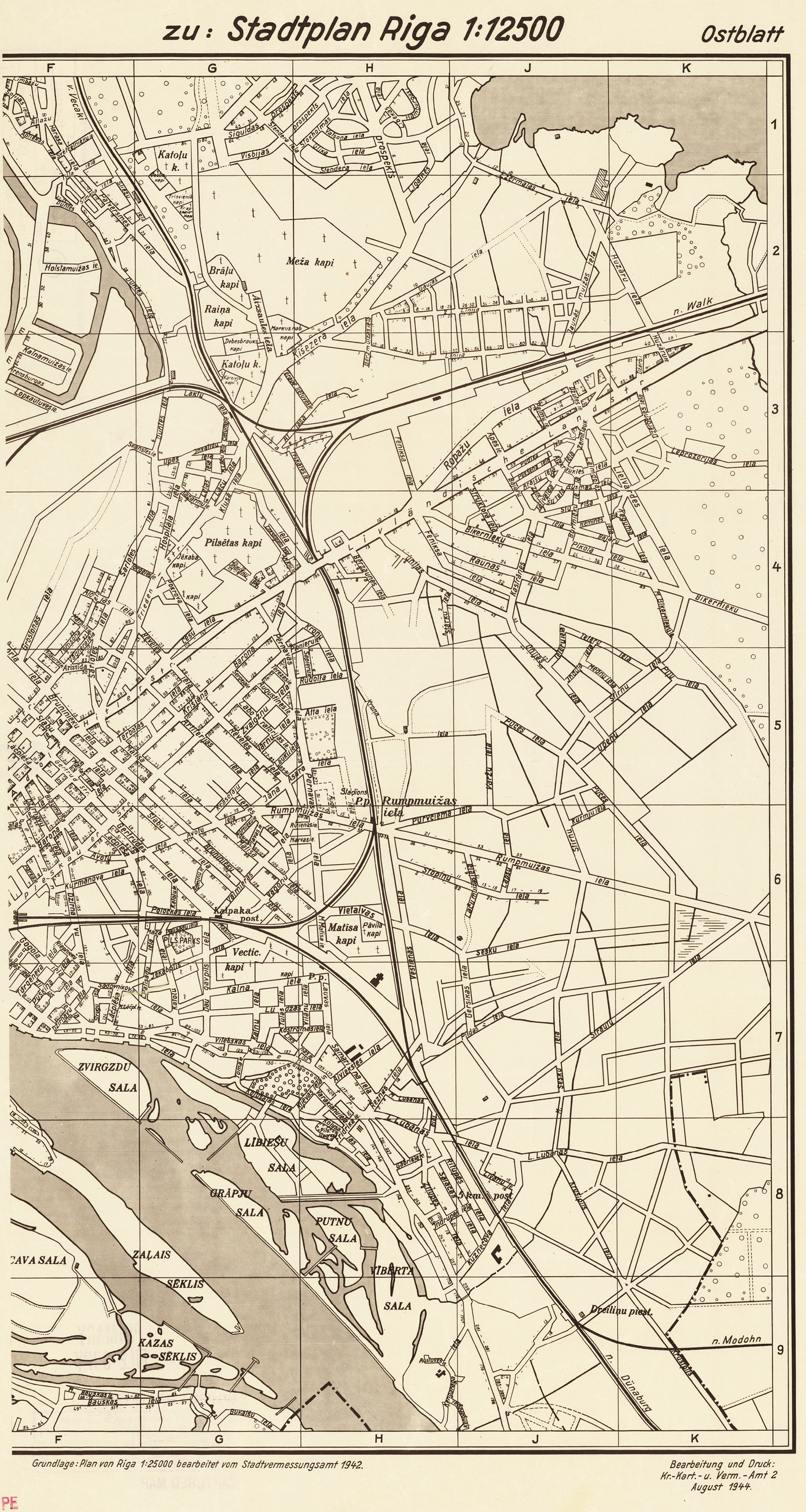
| Kartedatei | Stadtplan_Riga_%28Ostblatt%29_August_1944.jpg |
|---|---|
| Dateigröße | 1900000 (1.8 MB) |
| Blattnummer | Ryga |
| Blattmaßstab | 1:12 500 |
| Blatttitel | Stadplan Riga (Ostblatt) |
| gegenwärtige Name | Rīga |
| alternative Name | Ryga |
| Veröffentlichungsjahr | 1944 |
| Scanauflösung | 200 dpi |
| Hinweise | Data wydania / publication date : August 1944 Wydawca / publisher : Beerbeitung u. Druck: Kr.-Kart.-u. Verm.-Amt 2 Kolory / colours : cz-b / b&w Skala / scale : 1:12 500 Opis / description : Źródła: Plan von Riga w skali 1:25 000 wydany przez Stadtvermessungsamt (1942 r). Wydawca planu (Kr.-Kart.-u. Verm.-Amt 2) o tyle ciekawy, że oddział 2 mieścił się w Warszawie, a powstanie wybuchlo 1 sierpnia. The publisher (Kr.-Kart.-u. Verm.-Amt 2) is interesting, as Amt 2 was based in Warsaw, and as the plan is dated“August 1944” and the Warsaw Rising began on 1st August, the plan is probably forward-dated, but definitely one of the last publications by this Amt |
| Datei hinzugefügt | 2012-10-14 |
| Eintrag editiert | 2012-10-14 23:40:32 |
| aus der Sammlung von | WWII Aerial Photos and Maps |
