


| Kartedatei | P38_S22_MIEDZYCHOD_1927_300dpi.jpg |
|---|---|
| Dateigröße | 6672222 (6.4 MB) |
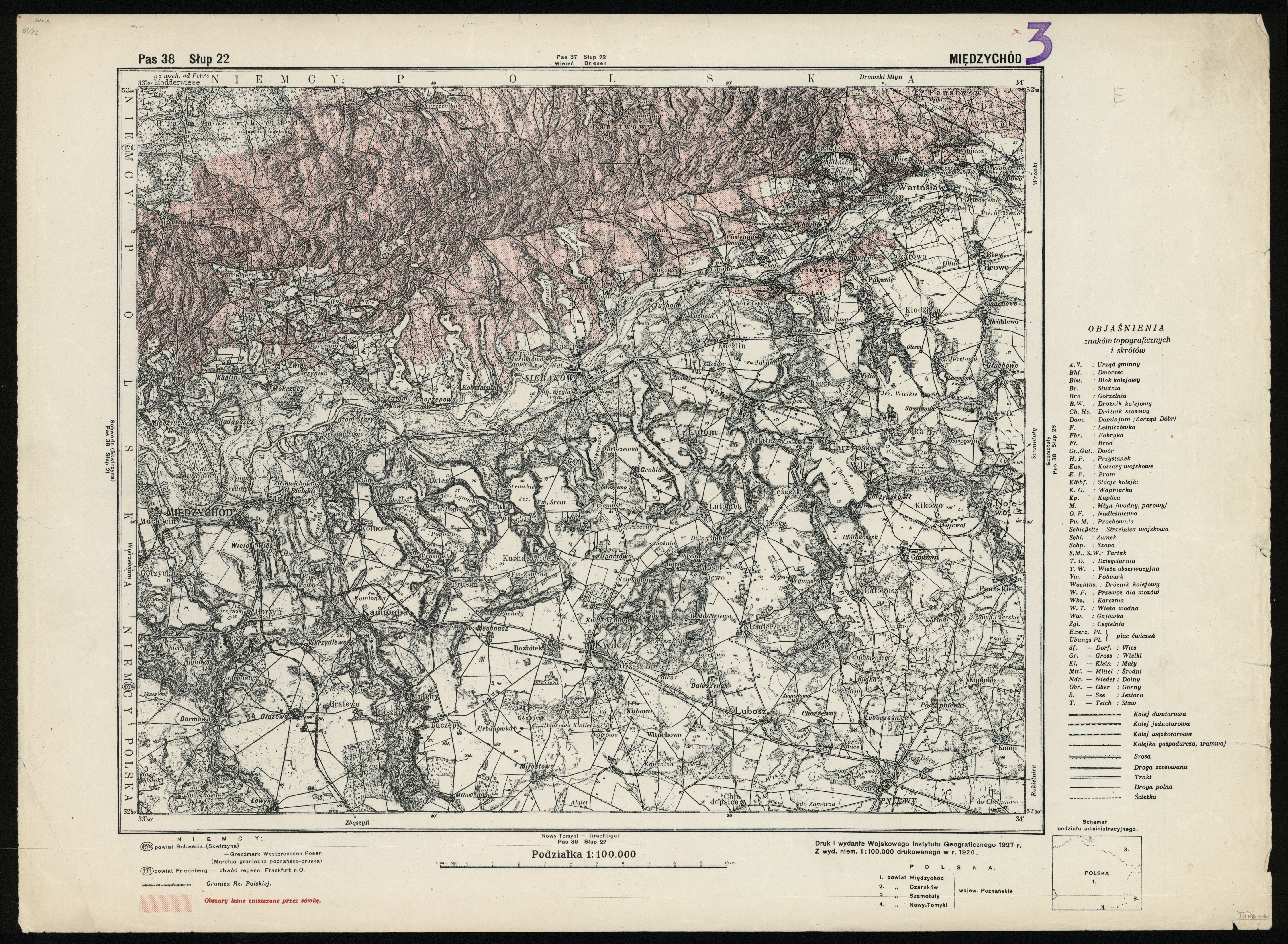
| Blattnummer | Streifen 38 Säule 22 (A38 B22) |
| Blatttitel | MIĘDZYCHÓD |
| gegenwärtige Name | Międzychód |
| Veröffentlichungsjahr | 1927 |
| Hersteller | Wojskowy Instytut Geograficzny |
| Scanauflösung | 300 dpi |
| Hinweise | "Druk i wydanie Wojskowego Instytutu Geograficznego z 1927 r. Z wyd. niem. 1:100 000 drukowanego w r 1920" "Print and edition of the Military Geographical Institute 1927 From a Ger[man] ed[ition] 1:100,000 printed in 1920" -------- Dodatkowy nadruk w kolorze czerwonym: "Obszary leśne zniszczone przez sówkę" An additional overprint in red: "Forest areas destroyed by Noctuidae-family moth" |
| Datei hinzugefügt | 2012-11-20 |
| Eintrag editiert | 2012-11-20 17:59:06 |
| aus der Sammlung von | Piotr Kamiński |
