


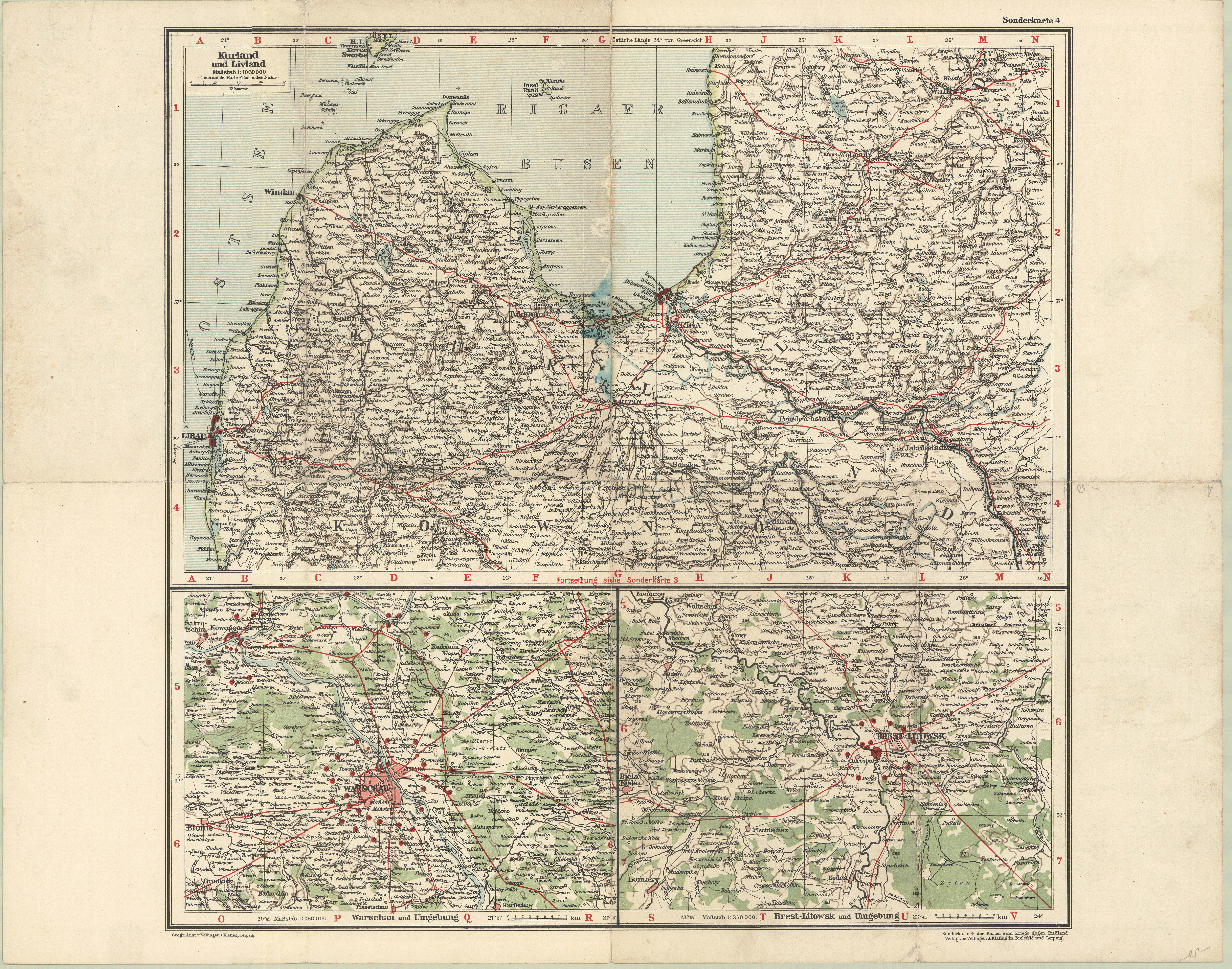
| Kartedatei | Sonderkarte_4_der_Karten_zum_Kriege_gegen_Russland_Kurland_und_Livland_1M.jpg |
|---|---|
| Dateigröße | 7177581 (6.8 MB) |
| Blattnummer | WW1 |
| Blattmaßstab | 1:1 000 000 |
| Blatttitel | Sonderkarte 4 der Karte zum Kriege gegen Rußland - Kurland und Livland |
| gegenwärtige Name | Mapka specjalna nr 4 do mapy dla wojny przeciw Rosji - Kurlandia i Inflanty |
| alternative Name | A special map no 4 to the Map for the war against Russia - Curland and Inflants |
| Veröffentlichungsjahr | ±1920 |
| Scanauflösung | 300 dpi |
| Hinweise | Verlag von Velhagen & Klafing in Bielefeld und Leipzig Geographische Anstalt von Velhagen & Klafing, Leipzig Nieznana bliżej publikacja, prawd. z lat 20. XX wieku, z mapami „wojny z Rosją“ („Die Karten zum Kriege genen Rußland“). Dodatkowo mapa zawiera nieco bardziej dokładne mapki okolic “Twierdzy Warszawa” i Twierdzy Brześć” (Litewski). An unknown publication probably of the 30s of the 20th century, with maps of "war agauinst Russia" („Die Karten zum Kriege genen Rußland“). Addtionally the map includes a bit more detailed small maps of the "Fortress of Warsaw" and the "Fortress of Brześć [Litewski]". |
| Eintrag editiert | 2013-04-29 20:45:24 |
| aus der Sammlung von | Archiwum Map WIG |
