


| map file | Stielers_Handatlas_1891_13.jpg |
|---|---|
| file size | 8167422 (7.8 MB) |
| sheet number | 13 |
| map sheet scale | 1:1,500,000 |
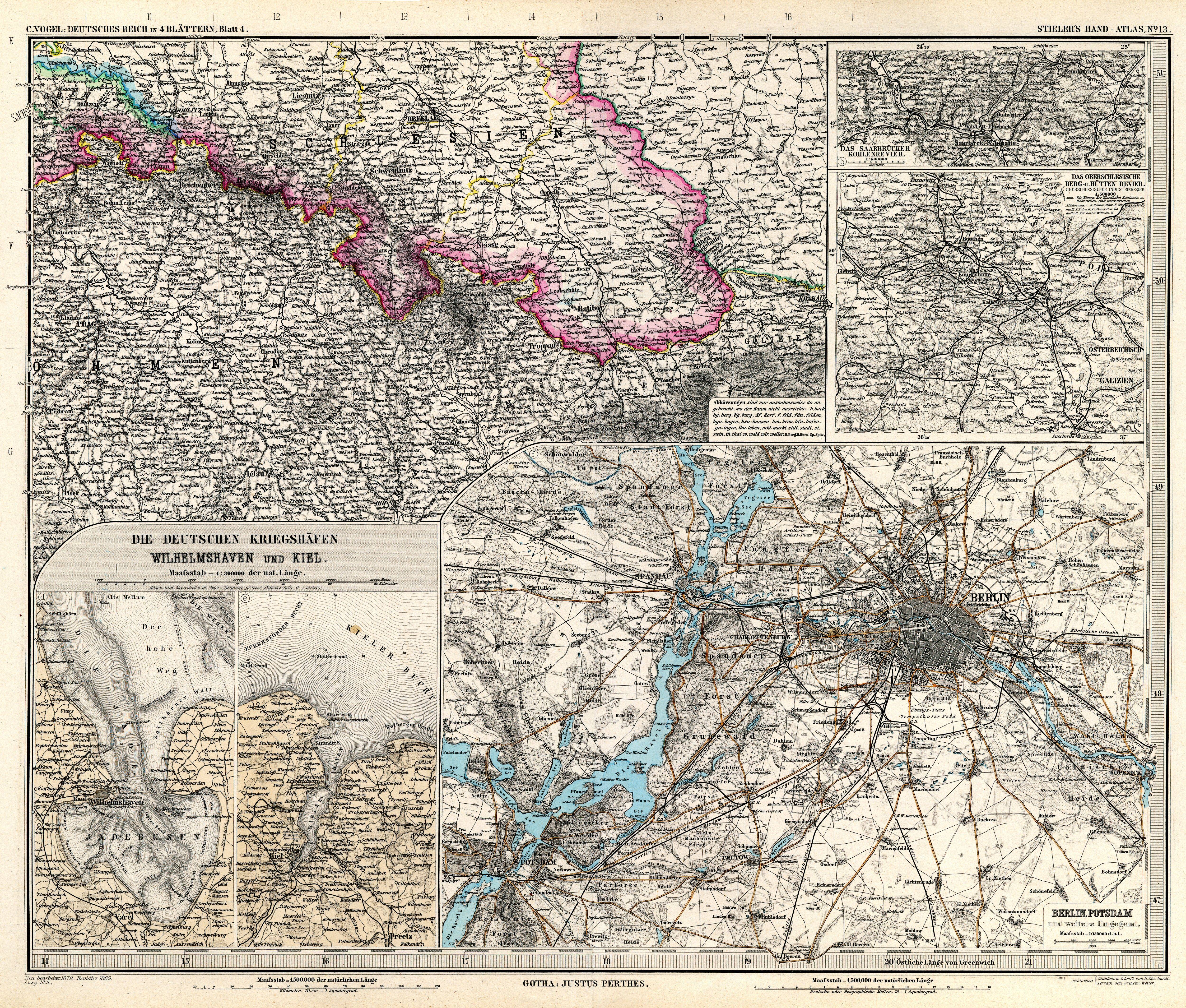
| sheet title | Das Deutsche Reich in 4 Blättern von C. Vogel, Blatt 4 |
| modern name | Rzesza Niemiecka w 4 arkuszach, aut. C. Vogel, arkusz 4 |
| annotation | SE |
| publication year | 1891 |
| scan resolution | 300 dpi |
| remarks | Dodatkowe małe mapy na tym arkuszu: Das Saarbrücker Kohlenrevier 1:500000; Das Oberschlesische Berg-u.Hüttenrevier Oberschlesischer Industriebezirk 1:500000; Berlin, Potsdam und weitere Umgegend 1:150000; Die Deutsche Kriegshäfen Wilhelmshaven und Kiel 1:300000 |
| file added | 2013-05-04 |
| entry edited | 2013-05-05 12:19:30 |
| from the collection of | Wikimedia Commons |
