


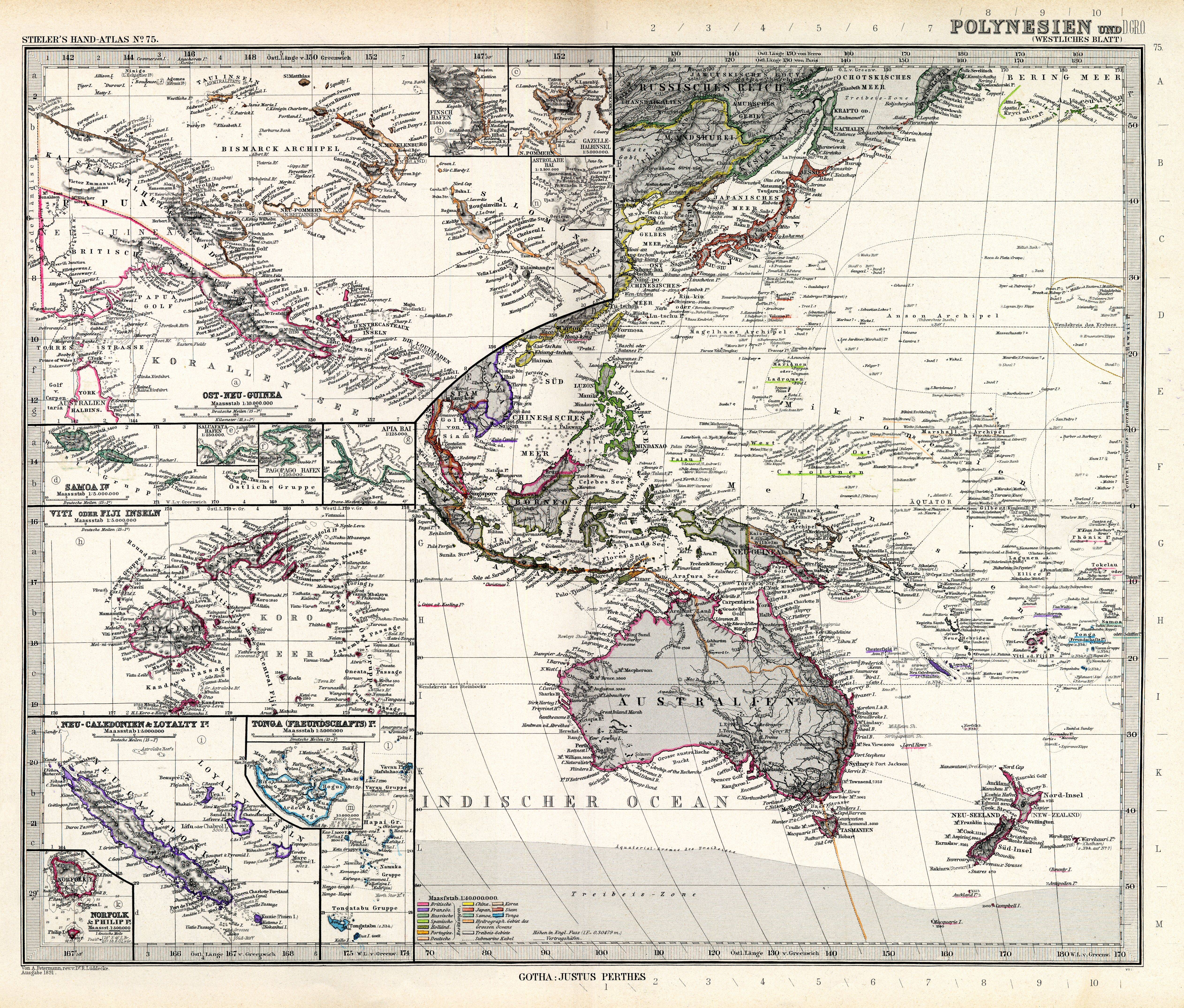
| map file | Stielers_Handatlas_1891_75.jpg |
|---|---|
| file size | 6099806 (5.8 MB) |
| sheet number | 75 |
| map sheet scale | 1:10,000,000 |
| sheet title | Polynesien und der Grosse Ocean (westlisches Blatt) |
| modern name | Polinezja i Wielki Ocean [Pacyfik] (arkusz zachodni) |
| publication year | 1891 |
| scan resolution | 300 dpi |
| remarks | Dodatkowe małe mapy na tym arkuszu: Viti oder Fiji Inseln 1:5000000; Tonga (Freundschafts) In. 1:5000000; Neu-Caledonien und Loyalty In. 1:5000000; Norfolk und Philipp In. 1:500000; Saluafata Hafen 1:250000; PagoPago Hafen 1:250000; Apia Bai 1:125 000; Samoa Inselsn 1:5 000000; Ost-Neu-Guinea 1:10000000; Finsch Hafen 1:500000; Gazelle Halbinsel 1:5000000; Astrolabe Bai 1:2500000 |
| file added | 2013-05-04 |
| entry edited | 2013-05-05 12:19:32 |
| from the collection of | Wikimedia Commons |
