


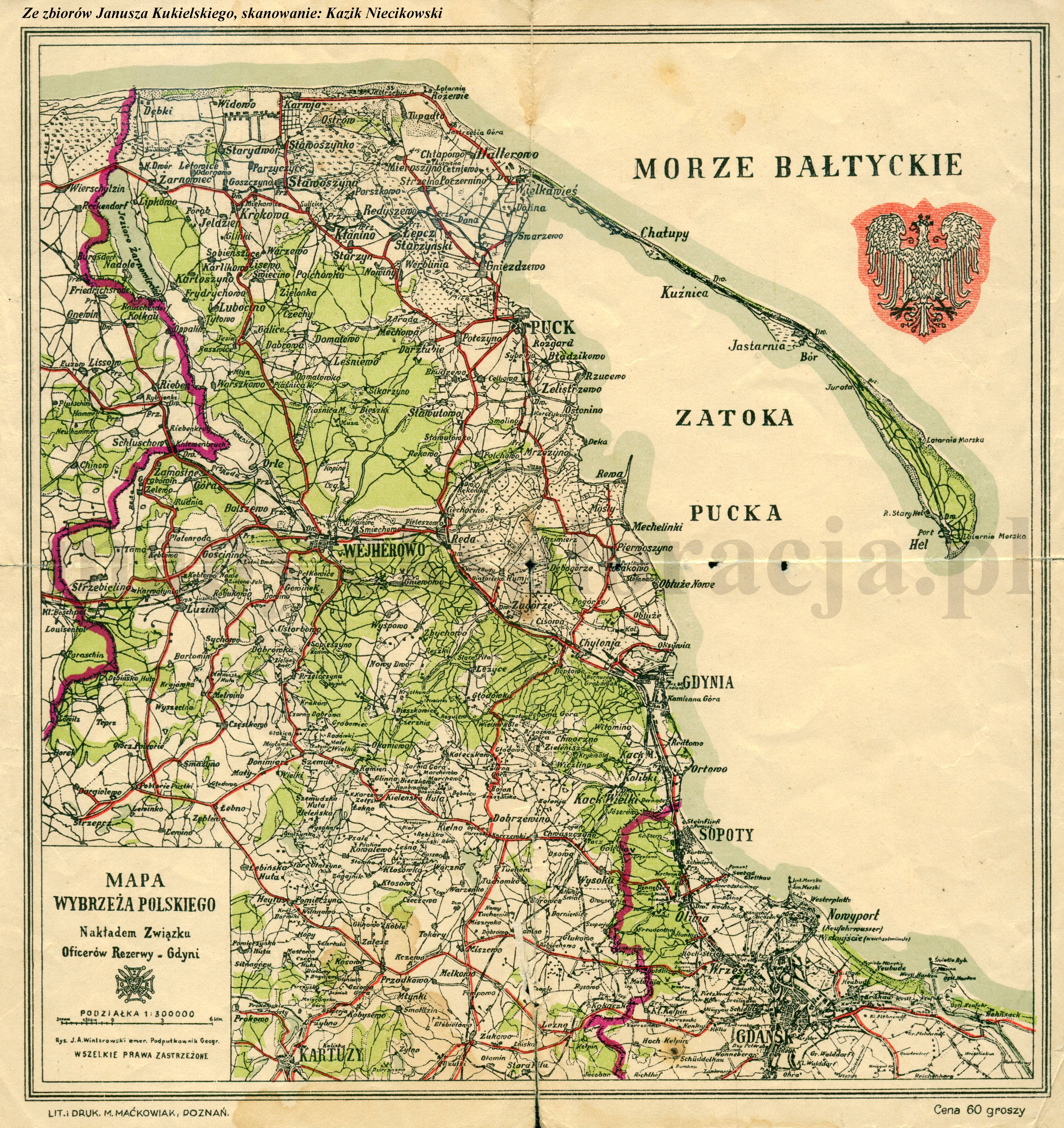
| map file | Mapa_wybrzeza_polskiego_300k_20te_ampg.jpg |
|---|---|
| file size | 4667619 (4.5 MB) |
| sheet number | POMORZE |
| map sheet scale | 1:300,000 |
| sheet title | Mapa wybrzeża polskiego |
| modern name | Map of the Polish seaside |
| annotation | wyd. Związek Oficerów Rezerwy |
| publication year | ±1925 |
| scan resolution | 300 dpi |
| remarks | Nakładem Związku Oficerów Rezerwy w Gdyni. Rys. J. A. Wintarowski emer. Podpułkownik Geogr. Published by the Union of Reserve Officers in Gdynia. Drawn by J. A. Wintarowski emeritus Lieutenant-Colonel Geographer |
| file added | 2013-05-14 |
| entry edited | 2013-05-14 20:17:29 |
| from the collection of | Archiwum Map Pomorza Gdańskiego |
