| Kartedatei | mapa_samochodowa_polski_1939-1940_PBC-001_town_plans1.jpg |
|---|
| Dateigröße | 586599 (0.6 MB) |
|---|
| Blattnummer | POLROADS |
|---|
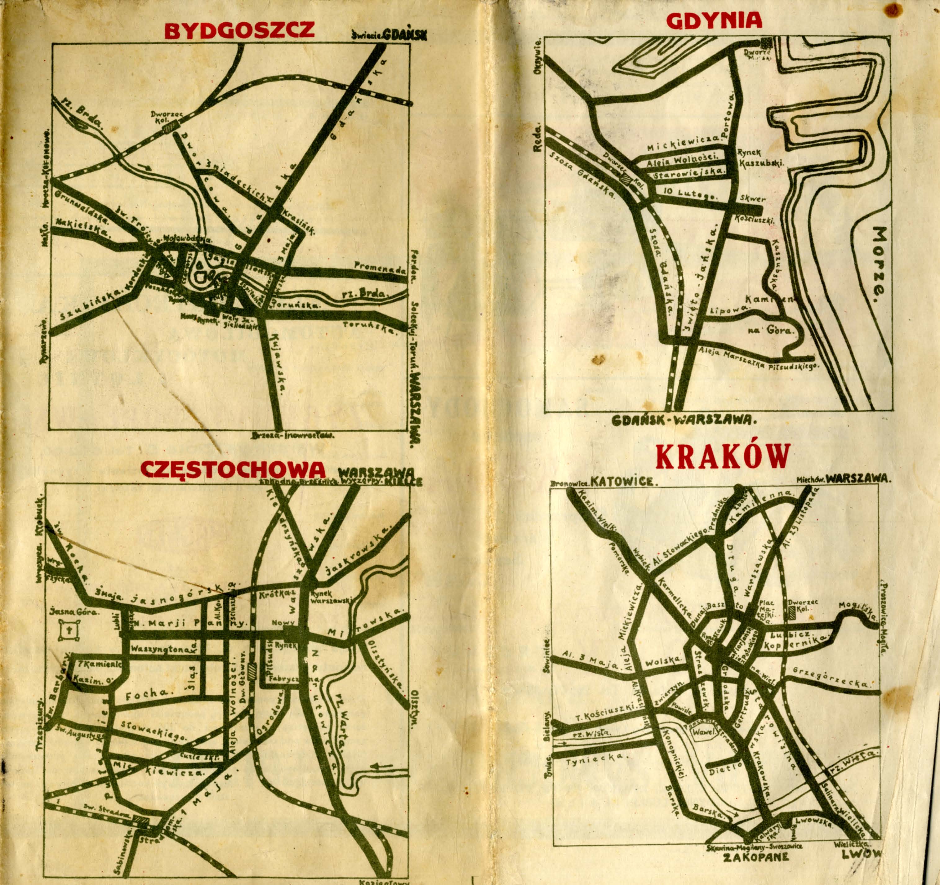
| Blatttitel | Mapa samochodowa Polski (stan dróg) na rok 1939/40 |
|---|
| gegenwärtige Name | An automobile map of Poland (condition of roads) for the year 1939/40 |
|---|
| Notiz | plany miast 1/ town plans 1 |
|---|
| Veröffentlichungsjahr | 1939 |
|---|
| Scanauflösung | 300 dpi |
|---|
| Datei hinzugefügt | 2013-06-22 |
|---|
| Eintrag editiert | 2013-06-22 23:39:51 |
|---|
| aus der Sammlung von | Podlaska Biblioteka Cyfrowa |
|---|
| Quelleanmerkung | Biblioteka Uniwersytecka im. Jerzego Giedroycia w Białymstoku, sygn./call no M-121 |
|---|


