


| map file | mappa_krolestwa_polskiego-002_woj_krakowskie_east_PBC.jpg |
|---|---|
| file size | 1046505 (1.0 MB) |
| sheet number | WKR |
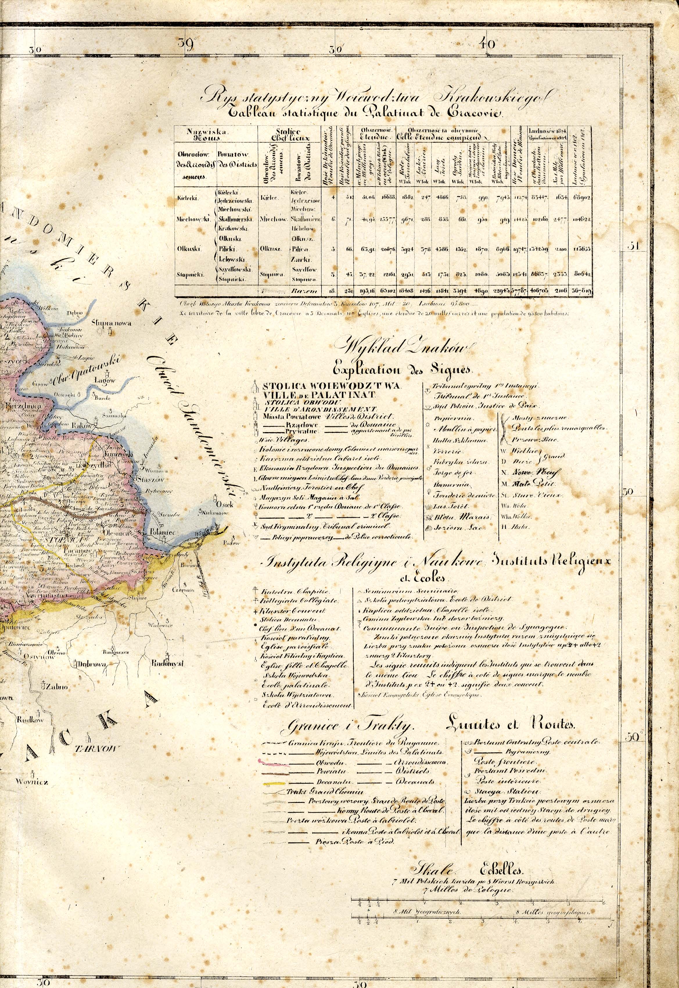
| sheet title | Mappa jeneralna województwa krakowskiego, wraz z Okręgiem Wolnego Miasta Krakowa ułożona według naylepszych źródeł przez Juliosza Colberg 1827. --- część wschodnia |
| modern name | A general map of the Voivodship of Kaków including the district og the Free City of Kaków, based on best authorities, compiled by Juliusz Colberg 1827. --- eastern part |
| annotation | Juliusz Colberg, Mappa Królestwa Polskiego |
| scan resolution | 300 dpi |
| file added | 2013-06-22 |
| entry edited | 2013-06-22 23:39:51 |
| from the collection of | Podlaska Biblioteka Cyfrowa |
