


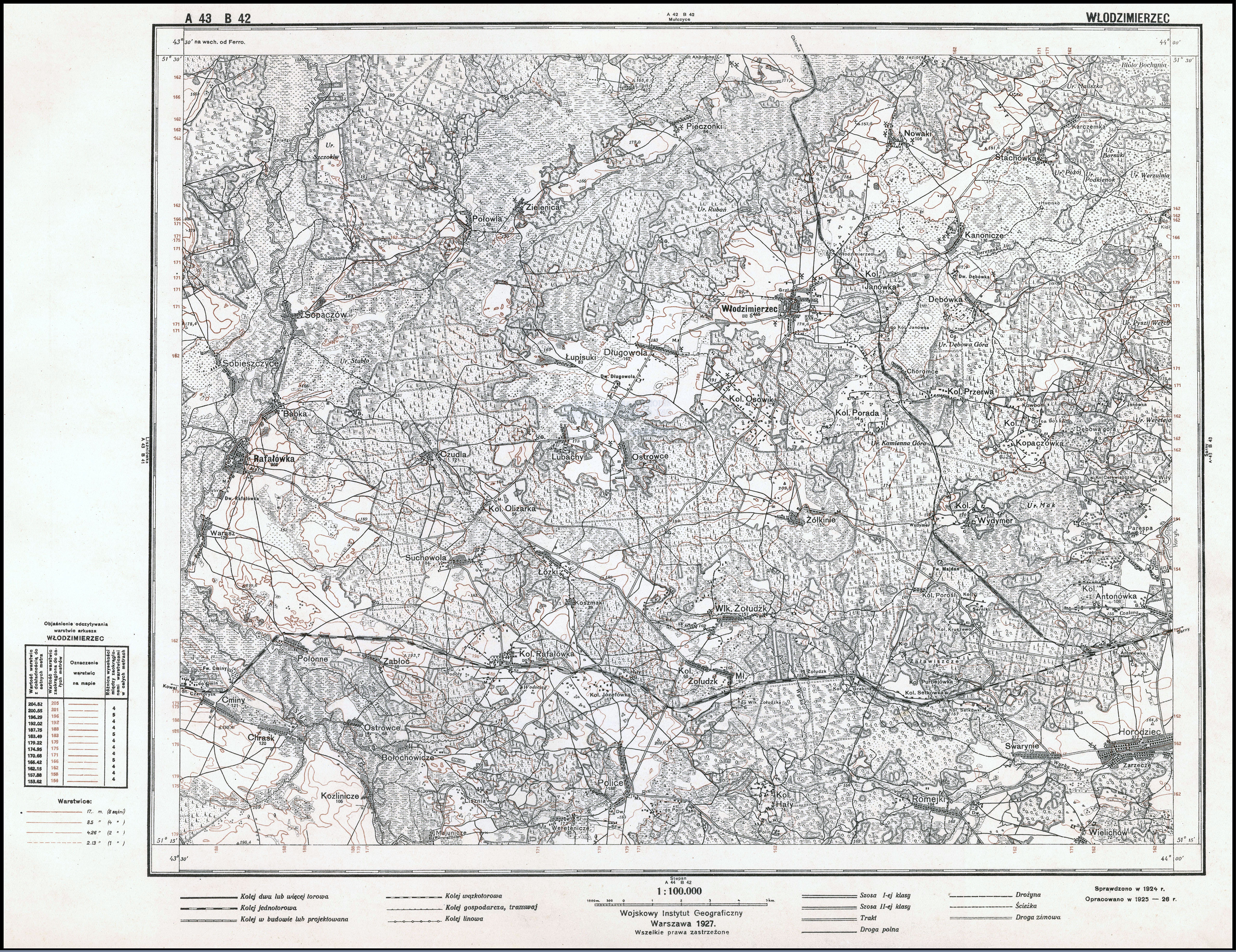
| map file | A43_B42_WLODZIMIERZEC_1927_300dpi_bcuj302466-289717.jpg |
|---|---|
| file size | 6753958 (6.4 MB) |
| sheet number | Row 43 Col 42 (A43 B42) |
| sheet title | WŁODZIMIERZEC |
| modern name | Володимирець |
| alternative name | Włodzimierzec |
| publication year | 1927 |
| publisher | Wojskowy Instytut Geograficzny |
| map type | Typ II |
| description | A type of 1926. Without the QS grid, zero meridian Greenwich. A two-colour map (basic content in black, contours in brown). |
| map/scan condition | good |
| scan resolution | 300 dpi |
| scan colors | rgb |
| file added | 2015-12-02 |
| entry edited | 2012-03-21 19:14:26 |
| from the collection of | Jagiellońska Biblioteka Cyfrowa |
