


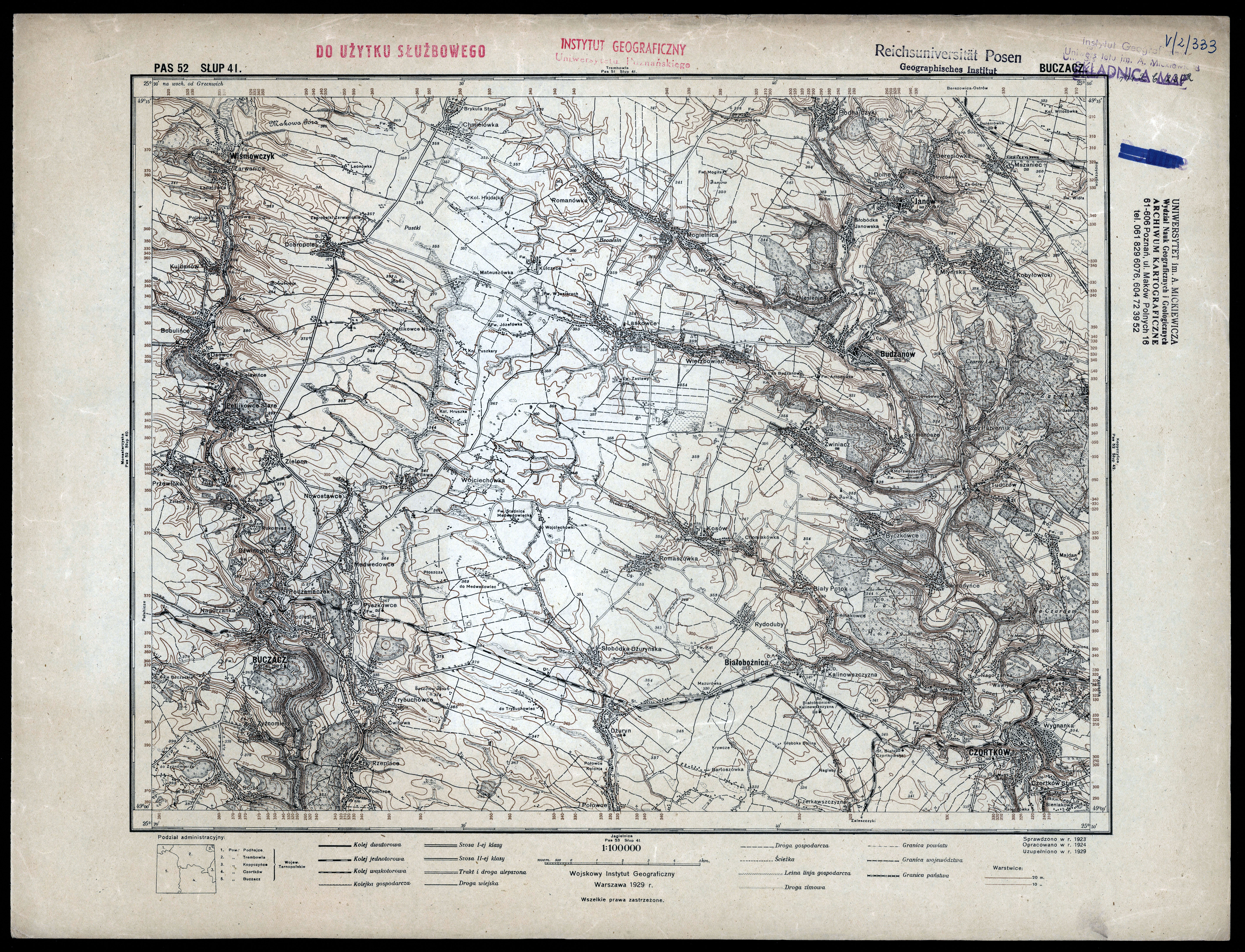
| map file | P52_S41_BUCZACZ_1929_300dpi.jpg |
|---|---|
| file size | 7471700 (7.1 MB) |
| sheet number | Row 52 Col 41 (A52 B41) |
| sheet title | BUCZACZ |
| modern name | Бучач |
| alternative name | Buczacz |
| publication year | 1929 |
| publisher | Wojskowy Instytut Geograficzny |
| map type | Typ II |
| description | A type of 1926. Without the QS grid, zero meridian Greenwich. A two-colour map (basic content in black, contours in brown). |
| map/scan condition | good |
| scan resolution | 300 dpi |
| scan colors | rgb |
| entry edited | 2008-01-10 21:32:25 |
| from the collection of | Wydziałowe Archiwum Kartograficzne / Biblioteka Collegium Geographicum, Wydział Nauk Geograficznych Uniwersytetu im. Adama Mickiewicza w Poznaniu |
