MAPSTER - Appendix details
The category to which the appendix belongs:
TK25GER
1:25 000 Topographische Karte (Messtischblatt) - Niemcy /1870 - 1945/ (Topographische Karte 1:25 000 (Meßtischblatt) - Niemcy /1870 - 1945/)
The appendix (id 1760468) :
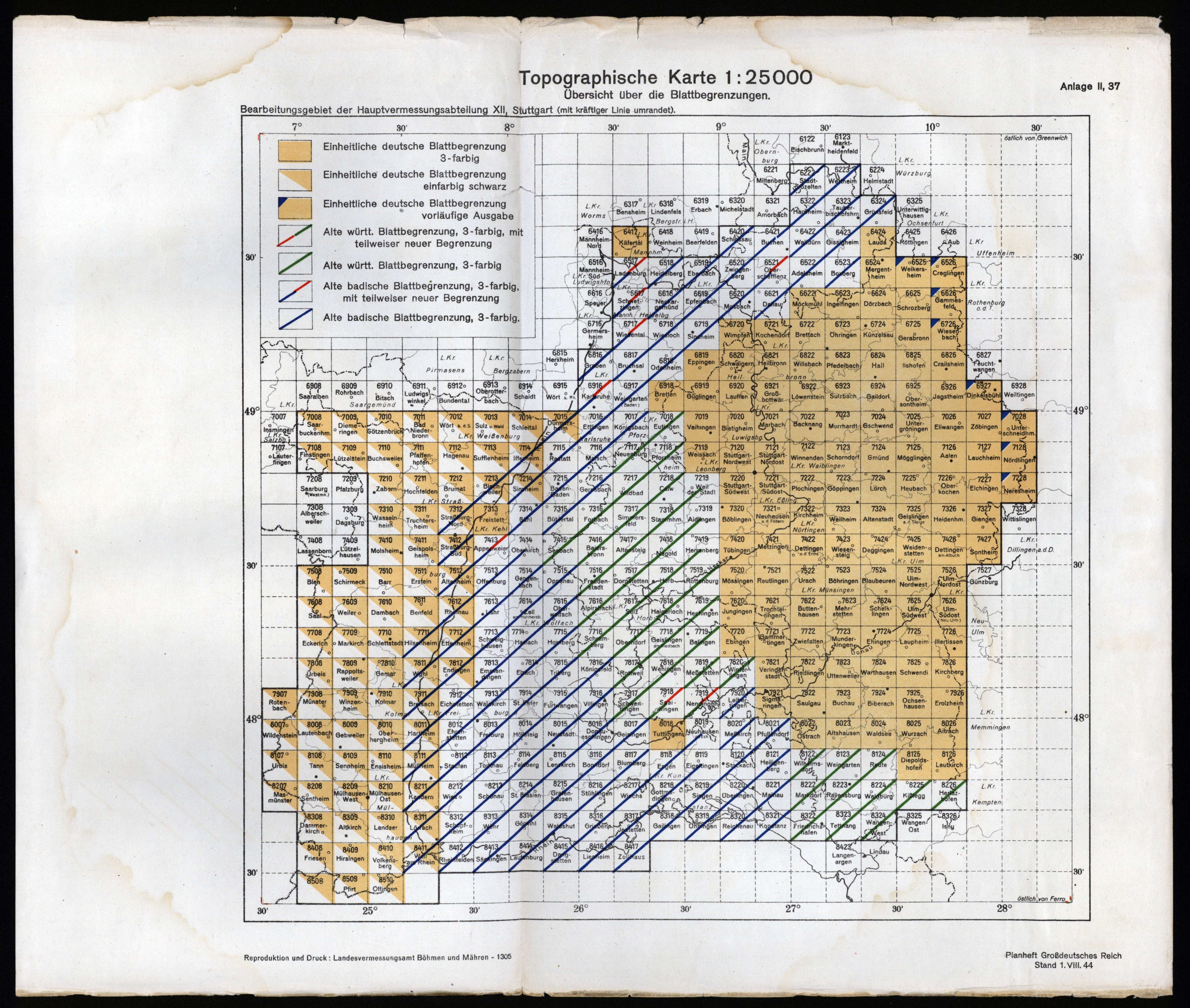
| file name | TK25K_HVA_XII_Planheft_DR_1944.jpg |
|---|
| file size | 4405317 (4.2 MB) |
|---|
| appendix title | Topographische Karte 1:25 000 Übersicht über die Blattbegrenzungen |
|---|
| annotation | Bearbeitungsgebiet der Hauptvermessungsabteilung XII, Stuttgart[ Anlage zu: Planheft Grossdeutschen Reich, 1944] |
|---|
| publication year | 1944 |
|---|
| entry edited | 2019-11-17 18:40:09 |
|---|
| file added | 2019-11-17 |
|---|
| from the collection of | Archiwum Map WIG |
|---|


