


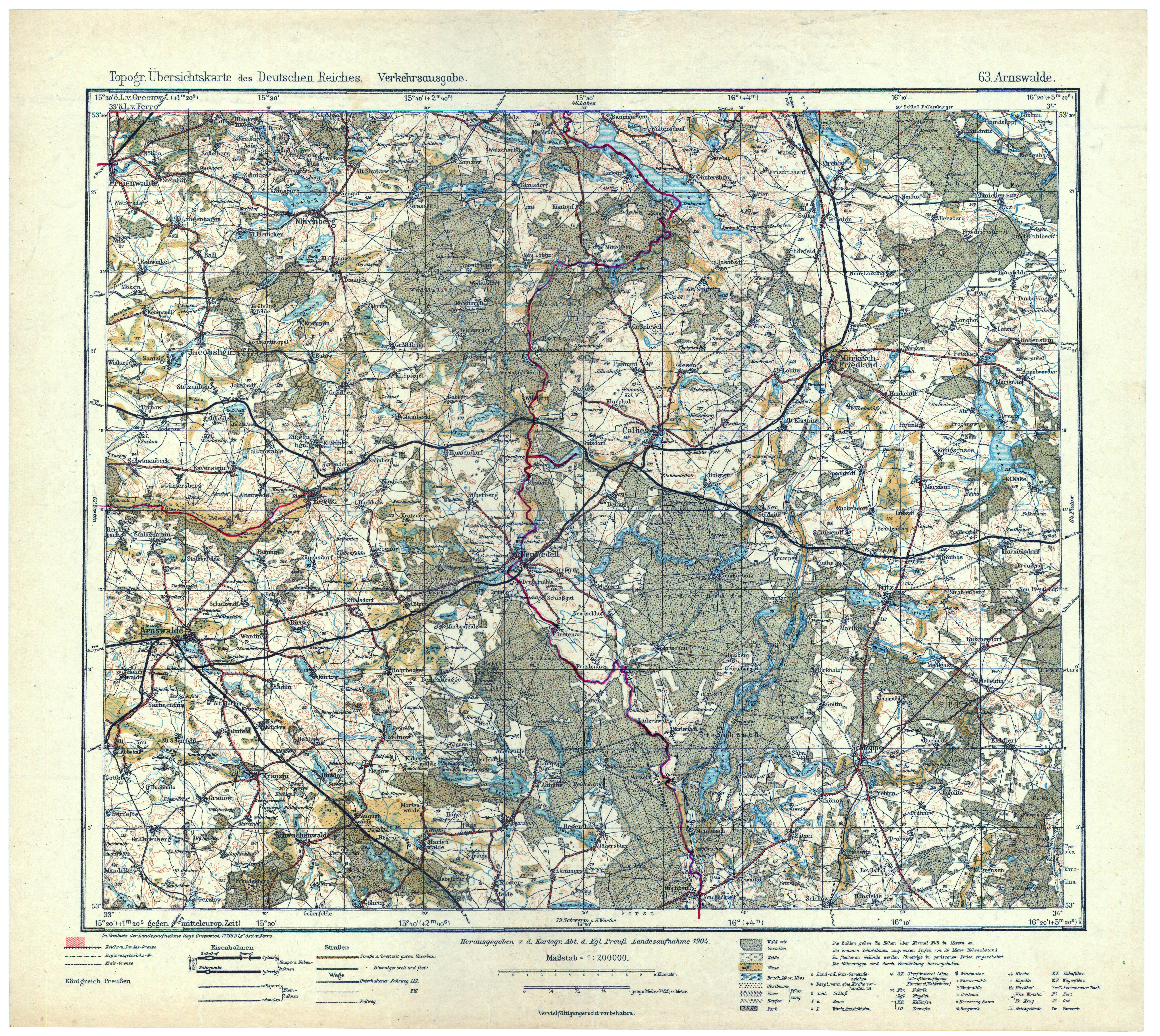
| map file | Topograph.Special-Karte_von_Mittel-Europa_Verkehrsausgabe_63_Arnswalde_1917_2.jpg |
|---|---|
| file size | 8081360 (7.7 MB) |
| sheet number | 063 |
| map sheet scale | 1:200,000 |
| sheet title | Arnswalde (Verkehrsausgabe) |
| modern name | Choszczno |
| publication year | 1917 |
| publisher | Königlich-Preussische Landesaufnahme |
| scan resolution | 400 dpi |
| remarks | Mapa lotnicza |
| entry edited | 2011-02-28 15:34:57 |
| from the collection of | Archiwum Map WIG |
