


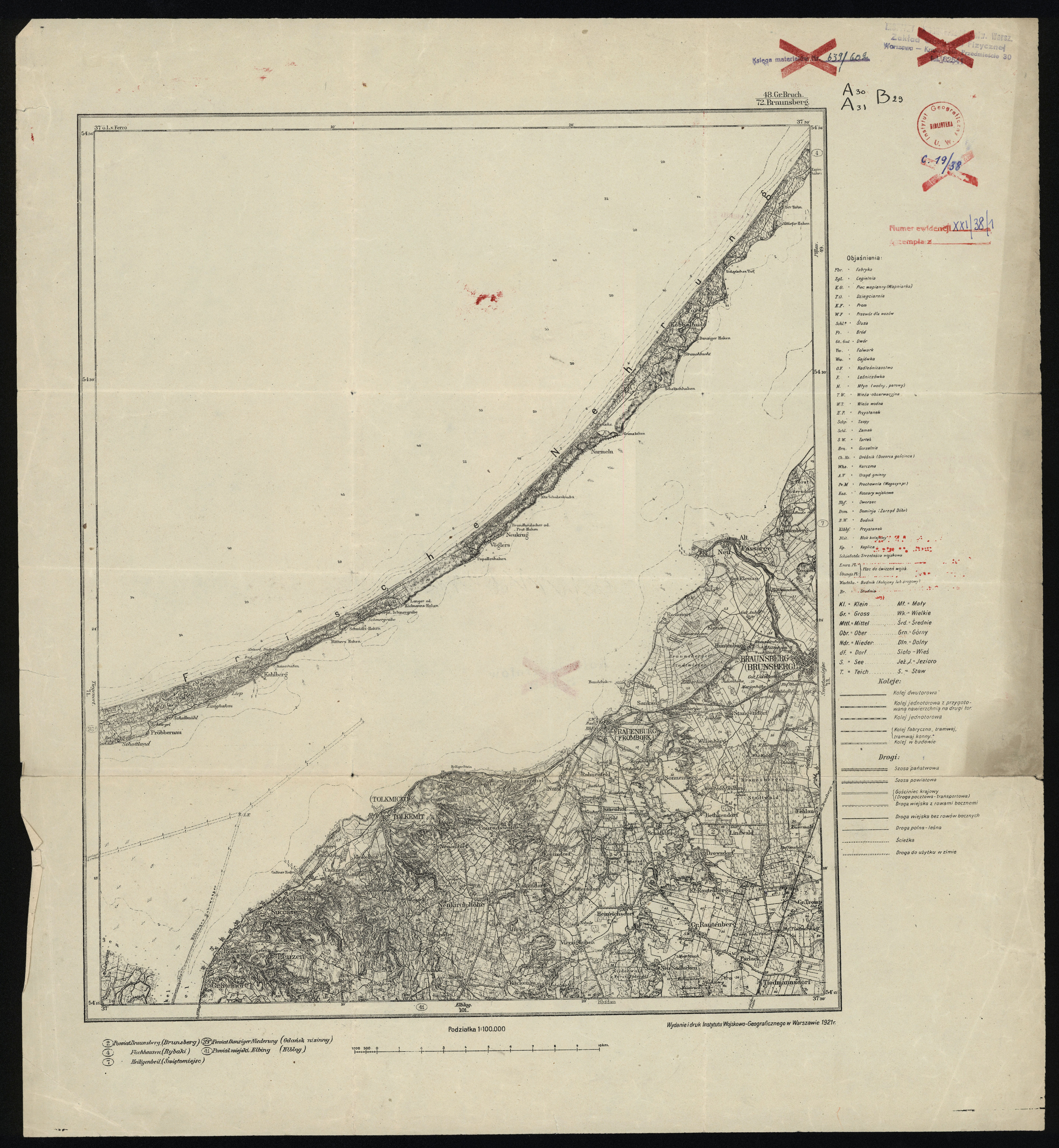
| map file | 48_Gr._Bruch_72_Braunsberg_IWG_1921_300dpi.jpg |
|---|---|
| file size | 6029225 (5.7 MB) |
| sheet number | Row 31 Col 29 (A31 B29) |
| sheet title | (48) Gr. Bruch - Braunsberg |
| modern name | Braniewo |
| alternative name 2 | Braunsberg |
| publication year | 1921 |
| publisher | Wojskowy Instytut Geograficzny |
| map type | Typ 0 |
| description | An early edition. The cartographic content is taken from German/Russian/Austrian maps. |
| it was used the cartographic material | It was partially used the content of a map: published by Königlich-Preussische Landesaufnahme |
| keywords | permitted for general use |
| map/scan condition | good |
| scan resolution | 300 dpi |
| scan colors | rgb |
| file added | 2013-11-23 |
| entry edited | 2013-11-23 19:35:35 |
| from the collection of | Wydział Geografii i Studiów Regionalnych Uniwersytetu Warszawskiego |
