


| Kartedatei | Zahorce_1do2500_1932_150ppi.jpg |
|---|---|
| Dateigröße | 11972043 (11.4 MB) |
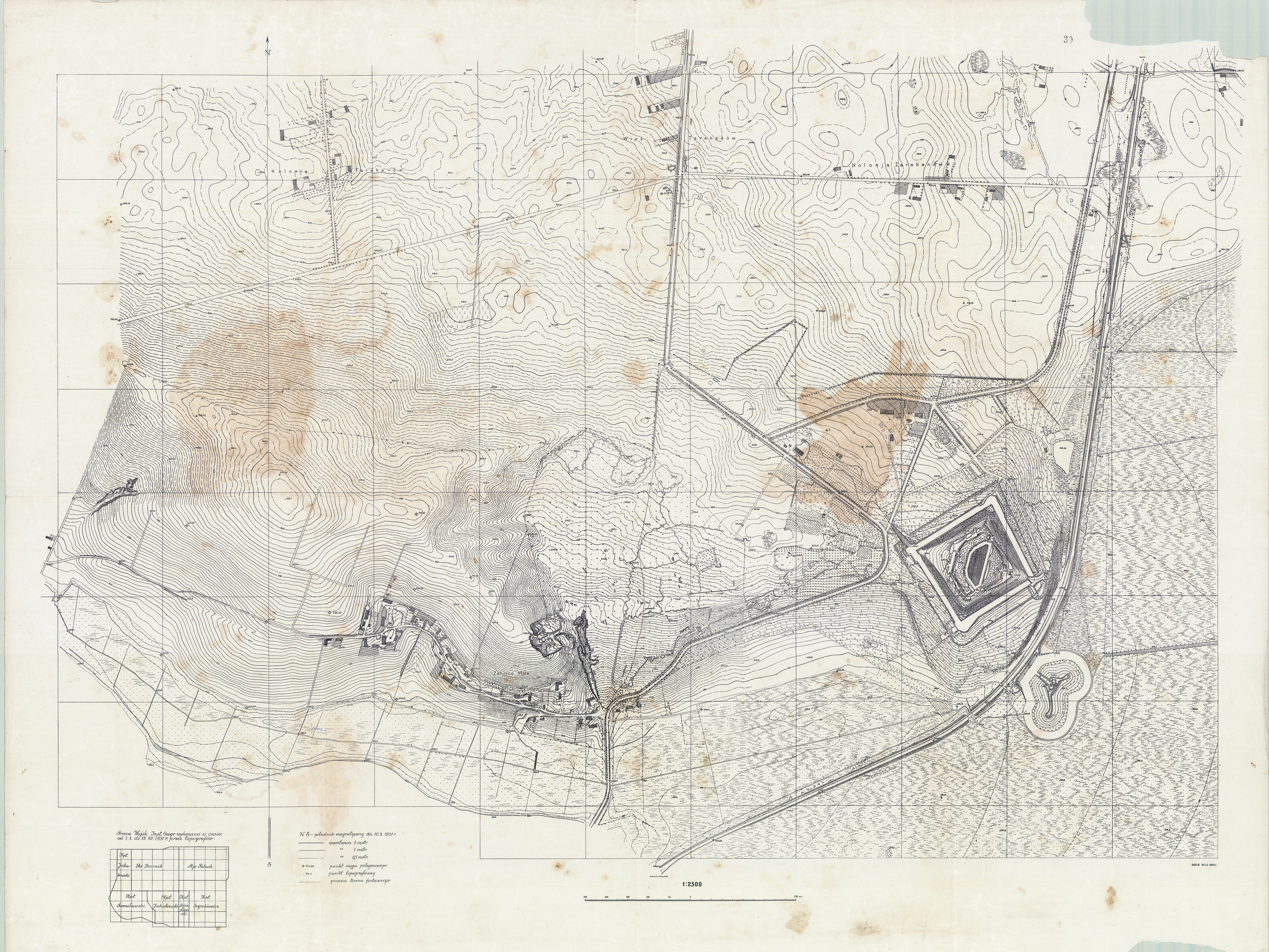
| Blattnummer | ZAHORCE |
| Blatttitel | Zahorce |
| gegenwärtige Name | Zahorce |
| Veröffentlichungsjahr | 1932 |
| Hersteller | Wojskowy Instytut Geograficzny |
| Scanauflösung | 150 dpi |
| Hinweise | Mapa okolic fortu Zahorce (Tarakanówka) pod Dubnem (woj. wolynskie). Pomiarów dokonano pod koniec 1931 r., mapa wydrukowana w 1932 r. Duza mapa (120 cm x 90 cm) w skali 1:2500 (1 cm = 25 m). Map of the fort area Zahorce (Tarakanówka) in Dubna (province Wolyn). Measurements were made at the end of 1931, printed in 1932. Large map (120 cm x 90 cm) in 1:2,500 scale (1 cm = 25 m). |
| Datei hinzugefügt | 2013-11-30 |
| Eintrag editiert | 2013-11-30 18:22:08 |
| aus der Sammlung von | Archiwum Map WIG |
