| map file | Zanonni_Carte_De_La_Pologne_sbc37392_Nr_17_Woiewodztwo_Krakowskie_Starostwo_Spizkie_Hrabstwa_Pozońskie.jpg |
|---|
| file size | 9902576 (9.4 MB) |
|---|
| sheet number | 17 |
|---|
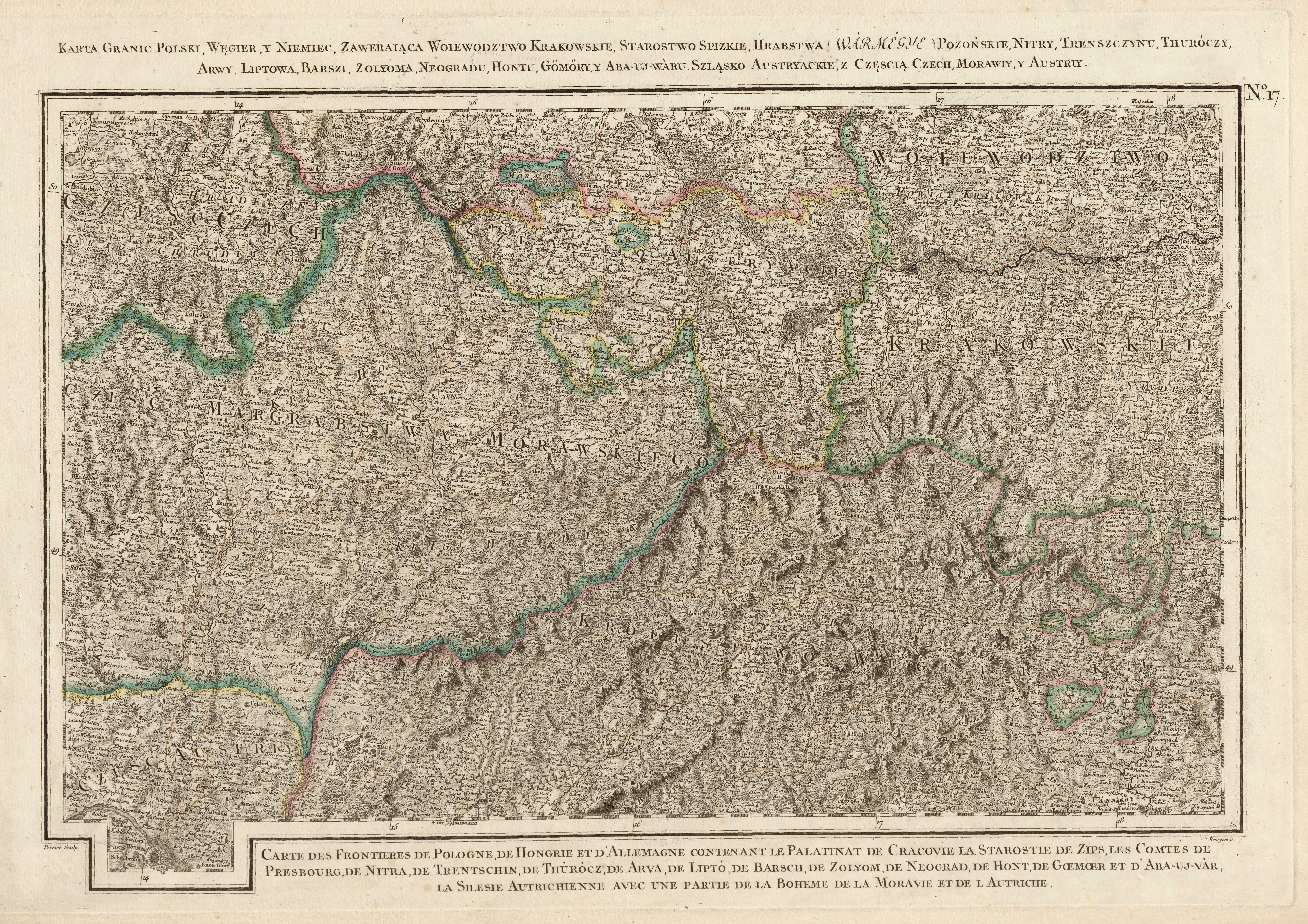
| sheet title | Karta granic Polski, Węgier y Niemiec, zawieraiąca Woiewodztwo Krakowskie, Starostwo Spizkie, Hrabstwo (Warmegye) Pozońskie, Nitry, Trenszczynu, Thuróczy, Arwy, Liptowa, Barszi Zolyoma, Neogradu, Hontu, Gömöry y Aba-UJ-Wàru. Szląsko-Austryackie. |
|---|
| modern name | A map of the borders of Poland, Hungary and Germany, containing the Voivodship of Cracow, the district (starostwo) of Spisz, the County (Varmegye) of Pozsony, Nitra, Trenczyn, Thurocs, Arva, Liptow, Barszi Zolyoma, Neograd, Hont, Gömöra and Aba-Uj-Var. The Austrian Silesia. |
|---|
| alternative name | Ołomuniec, Cieszyn, Kraków |
|---|
| alternative name 2 | Olmouc, Těšín |
|---|
| annotation | egz. Śląskiej BC / copy of the Silesian DL |
|---|
| publication year | 1772 |
|---|
| scan resolution | 300 dpi |
|---|
| file added | 2014-01-11 |
|---|
| entry edited | 2014-01-11 21:08:24 |
|---|
| from the collection of | Śląska Biblioteka Cyfrowa |
|---|
| source reference | bc id: 37392 |
|---|


