| map file | Zanonni_Carte_De_La_Pologne_sbc37482_Nr_20_Część_Pd_Ukrainy_y_Przeciąg_Dniepru.jpg |
|---|
| file size | 8689718 (8.3 MB) |
|---|
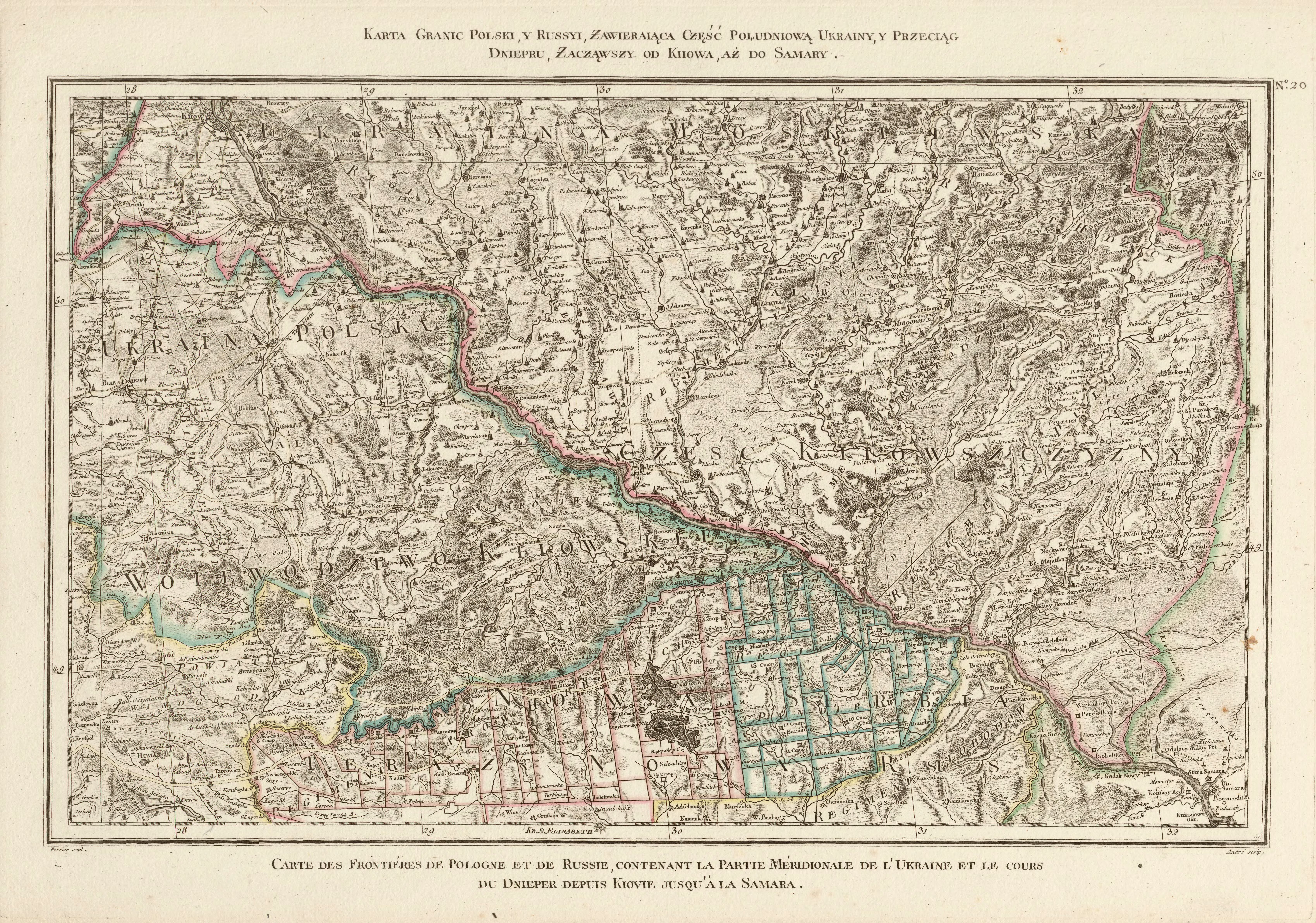
| sheet number | 20 |
|---|
| sheet title | Karta granic Polski, y Russyi, zawierająca część południową Ukrainy y przeciąg Dniepru, zacząwszy od Kiiowa, aż do Samary. |
|---|
| modern name | A map of the borders of Poland and Russia, containing the southern part of the Ukraine and the course of Dniepr starting from Kijów, up to Samara. |
|---|
| alternative name | Biała Cerkiew, Połtawa |
|---|
| alternative name 2 | Бiла Церква, Полтава |
|---|
| annotation | egz. Śląskiej BC / copy of the Silesian DL |
|---|
| publication year | 1772 |
|---|
| scan resolution | 300 dpi |
|---|
| file added | 2014-01-11 |
|---|
| entry edited | 2014-01-11 21:08:24 |
|---|
| from the collection of | Śląska Biblioteka Cyfrowa |
|---|
| source reference | bc id: 37482 |
|---|


