| Kartedatei | Zanonni_Carte_De_La_Pologne_sbc37484_Nr_23_od_Końca_Gór_Karpackich_w_Siedmiogrodzie_aż_do_Osady_Tatarow_Bessarab.jpg |
|---|
| Dateigröße | 4232326 (4.0 MB) |
|---|
| Blattnummer | 23 |
|---|
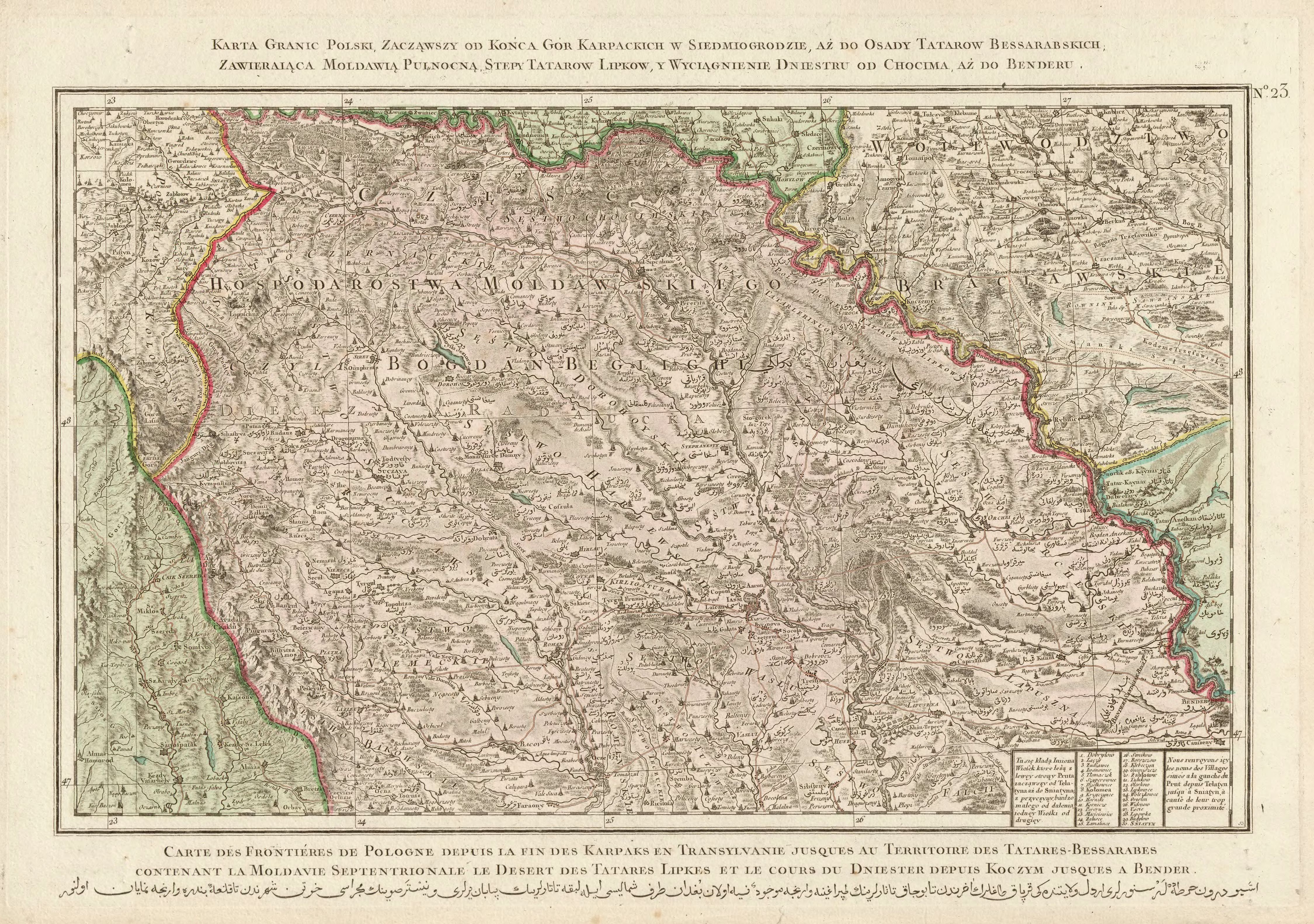
| Blatttitel | Karta granic Polski, zacząwszy od końca gór Karpackich w Siedmiogrodzie, aż do osady Tatarów Bessarabskich, Zawieraiąca Moldawią Pułnocną, stepy Tatarów Lipków, y wyciągnienie Dniestru od Chocima aż do Benderu. |
|---|
| gegenwärtige Name | A map of the borders of Poland, starting from the end of the Carpathian Mountains in Transylvania till the living place of Bessarabian Tatars, which contains the north Moldavia, the steppes of Lipkowie Tatars and the course of Dniestr from Chocim till Bendery. |
|---|
| alternative Name | Śniatyń, Mohylów Podolski |
|---|
| alternative Name 2 | Снятин, Могилів-Подільський |
|---|
| Notiz | egz. Śląskiej BC / copy of the Silesian DL |
|---|
| Veröffentlichungsjahr | 1772 |
|---|
| Scanauflösung | 300 dpi |
|---|
| Datei hinzugefügt | 2014-01-11 |
|---|
| Eintrag editiert | 2014-01-11 21:08:25 |
|---|
| aus der Sammlung von | Śląska Biblioteka Cyfrowa |
|---|
| Quelleanmerkung | bc id: 37484 |
|---|


