| plik mapy | bbc03262_SŁUPSK-Plan_von_der_in_Hinterpommern_belegenen_Stadt_Stolp,_nebst_der_umliegenden_Gegend._1811.jpg |
|---|
| rozmiar pliku | 6663507 (6.4 MB) |
|---|
| godło arkusza | Słupsk |
|---|
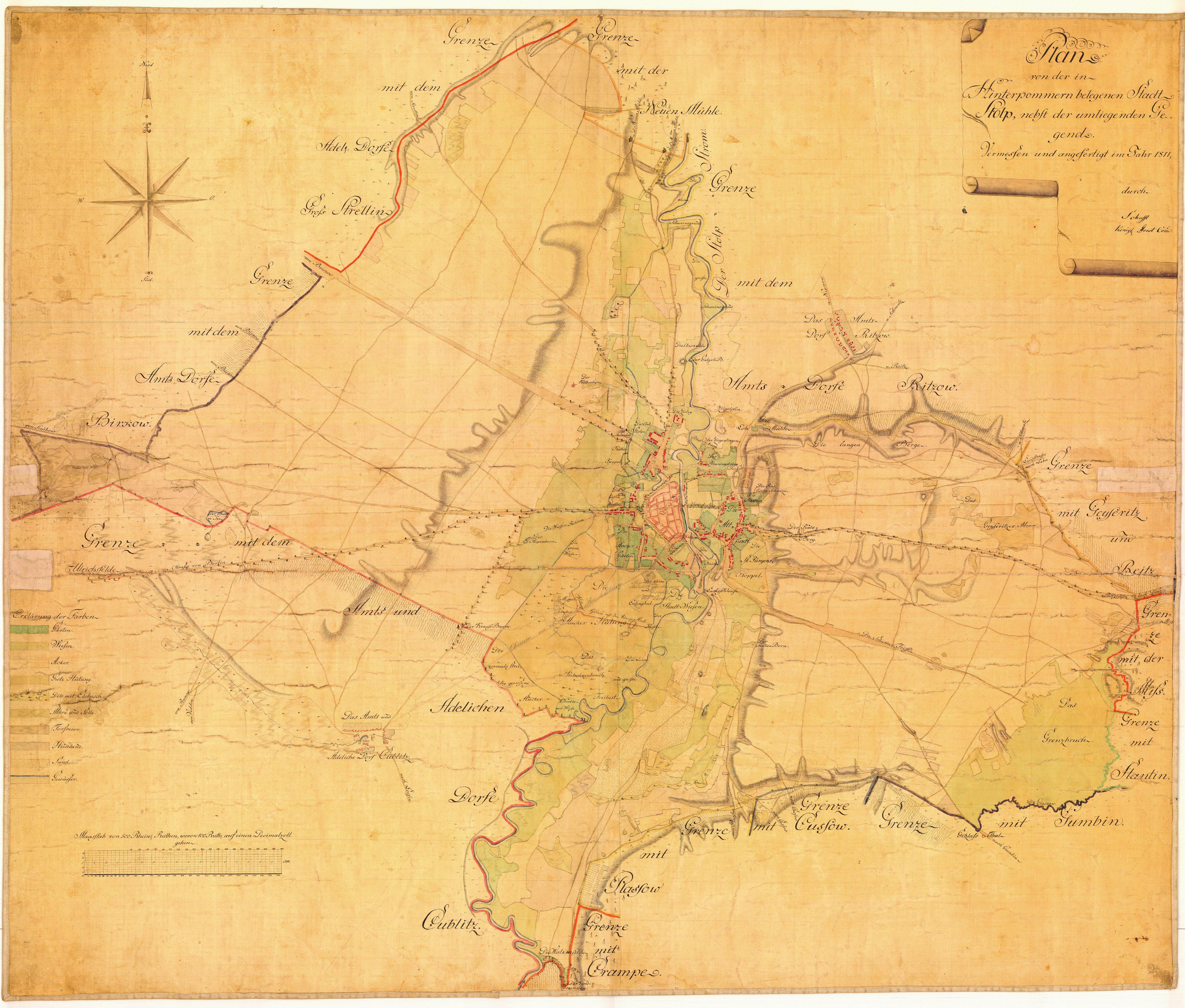
| tytuł arkusza | Plan von der in Hinterpommern belegenen Stadt Stolp, nebst der umliegenden Gegend.Vermessen und angefertigt im Jahr 1811 durch Schafft Konigl Forst Cond. |
|---|
| nazwa współczesna | Plan położonego na Pomorzu Tylnym miasta Słupska wraz z okolicą |
|---|
| nazwa alternatywna | Słupsk |
|---|
| rok wydania | 1811 |
|---|
| rozdzielczość | 300 dpi |
|---|
| uwagi | Creator: Schafft size: 92 x 110 cm |
|---|
| plik dodano | 2014-02-08 |
|---|
| wpis edytowano | 2014-02-08 12:53:54 |
|---|
| ze zbiorów | Bałtycka Biblioteka Cyfrowa |
|---|
| odnośnik do źródła | The Museum of the Middle Pomerania in Slupsk ; MPŚ/BAK-14; bc id: 3262 |
|---|


