


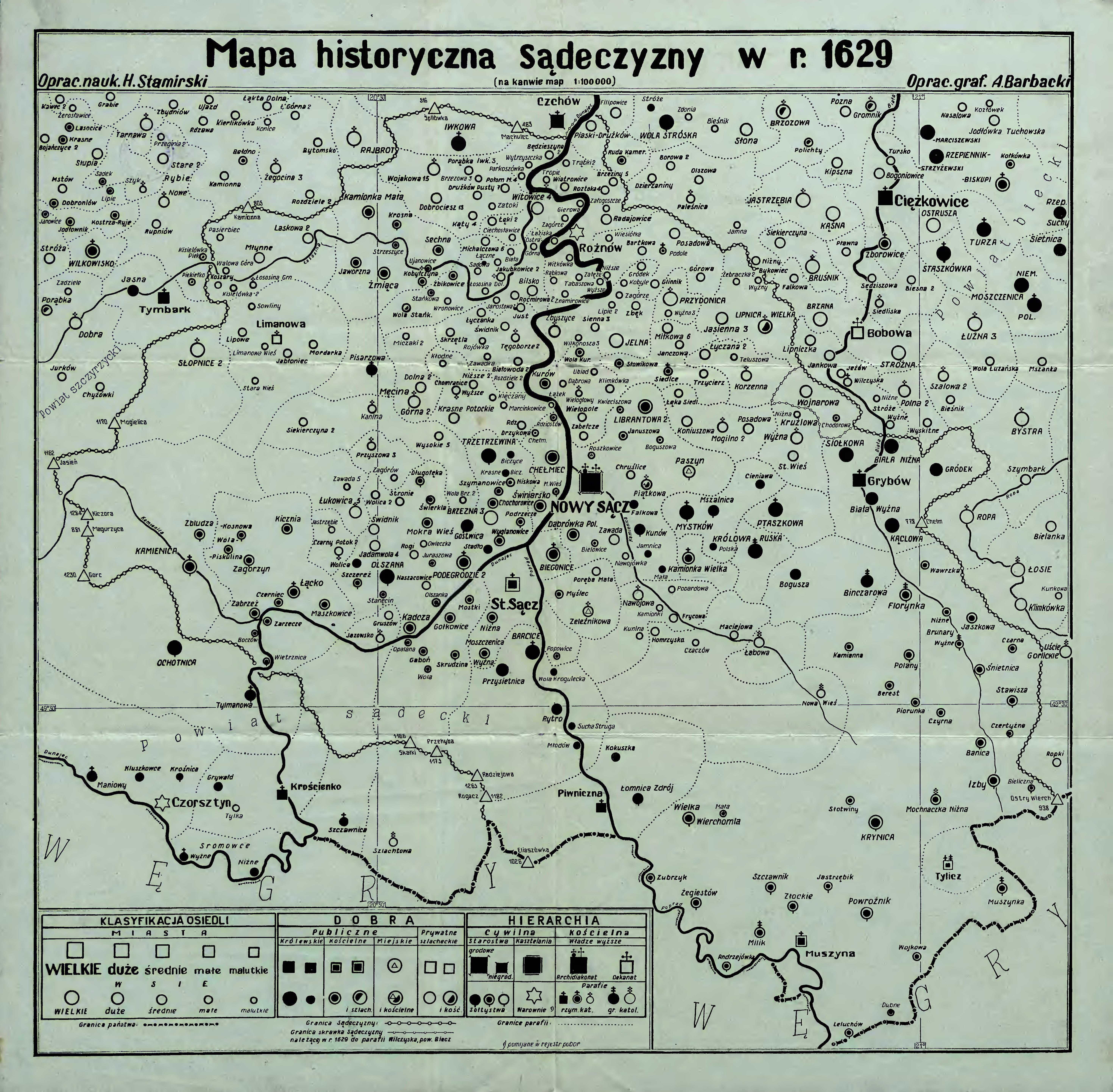
| map file | mbc01510_Mapa_histor_sadacczyzny_1629.jpg |
|---|---|
| file size | 5031183 (4.8 MB) |
| sheet number | PODHALE |
| sheet title | Mapa historyczna Sądecczyzny 1629 r. Oprac. nauk. H. Stamirski. |
| modern name | A historic map of the Nowy Sącz region. Scholarly edited by H. Stamirski. |
| publication year | ±1957 |
| map/scan condition | average |
| scan resolution | 300 dpi |
| scan colors | rgb |
| file added | 2014-03-31 |
| entry edited | 2014-03-31 23:22:19 |
| from the collection of | Małopolska Biblioteka Cyfrowa |
| source reference | bc id: 1510 |
