| Kartedatei | kpbc21562_Geologisch-agronomische_Karte_der_Gegend_östlich_von_Bromberg_1908-MAP1.jpg |
|---|
| Dateigröße | 17873683 (17.0 MB) |
|---|
| Blattnummer | POMORZE |
|---|
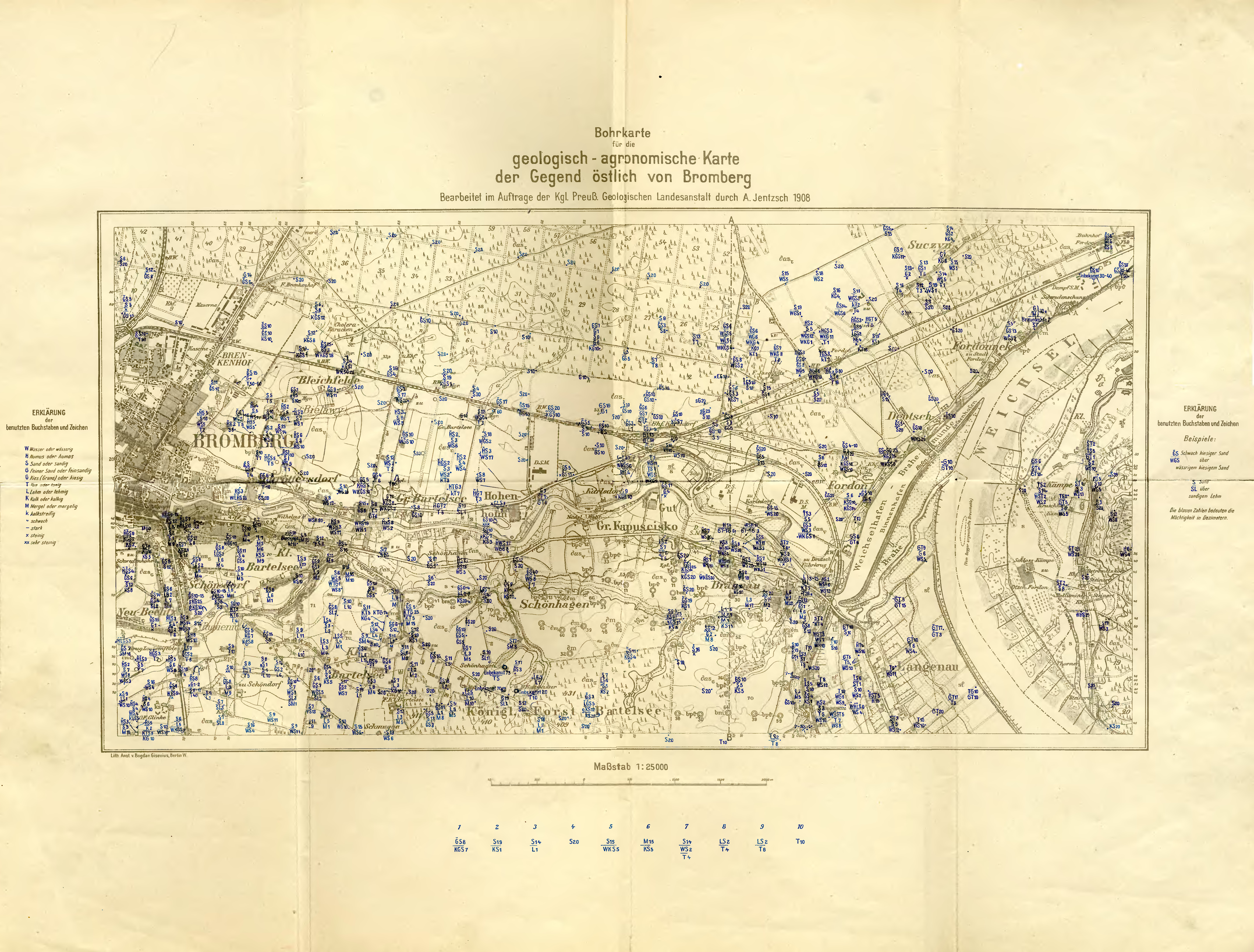
| Blatttitel | Geologisch-agronomische Karte der Gegend östlich von Bromberg |
|---|
| gegenwärtige Name | Mapa geologiczno-agronomiczna okolic na wschód od Bydgoszczy |
|---|
| alternative Name | Geological and agronomical map of areas east of Bydgoszcz |
|---|
| Notiz | mapa 1 / map 1 |
|---|
| Veröffentlichungsjahr | 1908 |
|---|
| Karte/Scanzustand | durchschnittlich |
|---|
| Scanauflösung | 300 dpi |
|---|
| Scanfarben | rgb |
|---|
| Hinweise | lokalne miejsca pogorszonej ostrości / local specks of deteriorated sharpness |
|---|
| Datei hinzugefügt | 2014-04-09 |
|---|
| Eintrag editiert | 2014-04-09 00:08:52 |
|---|
| aus der Sammlung von | Kujawsko-Pomorska Biblioteka Cyfrowa |
|---|
| Quelleanmerkung | bc id: 21562 |
|---|


