


| plik mapy | ssees0166_Post_karte_von_der_Halbinsel_Taurien_oder_Krim-1788.jpg |
|---|---|
| rozmiar pliku | 5645022 (5.4 MB) |
| godło arkusza | UKRAINE |
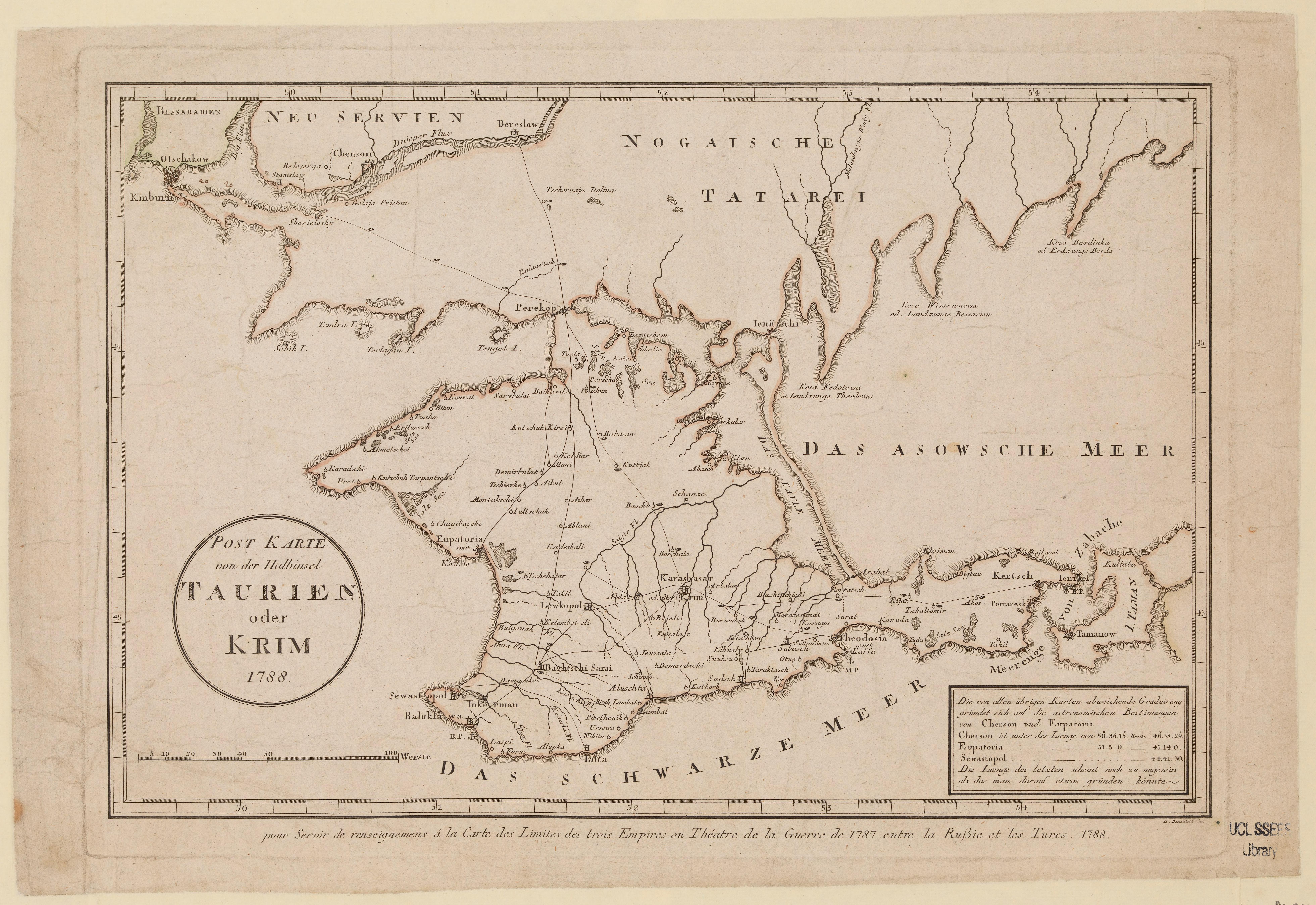
| tytuł arkusza | Post karte von der Halbinsel Taurien oder Krim |
| rok wydania | 1788 |
| stan mapy/skanu | dobry |
| rozdzielczość | 300 dpi |
| kolory skanu | rgb |
| uwagi | Post karte von der Halbinsel Taurien oder Krim :pour servir de renseignemens à la carte des limites des trois empires ou théâtre de la guerre de 1787 entre la Russie et les Turcs, 1788 /H. Benedicti, sc.. Benedicti, Hieronymus. From the collections of UCL SSEES Library [S.l.] : H. Benedicti , 1788 |
| plik dodano | 2014-04-10 |
| wpis edytowano | 2014-04-11 22:14:39 |
| ze zbiorów | University College of London, School of Slavonic and East European Studies |
| licencja dostawcy | Copyright UCL Library Services, 2010, licensed under Creative Commons Attribution-NonCommercial-ShareAlike 2.0 UK: England and Wales Licence. For further information on this Licence please refer to: http://creativecommons.org/licenses/by-nc-sa/2.0/uk/ |
