


| plik mapy | ssees0197_Totius_regni_Hungariae-ca1690.jpg |
|---|---|
| rozmiar pliku | 7898421 (7.5 MB) |
| godło arkusza | HUNGARY |
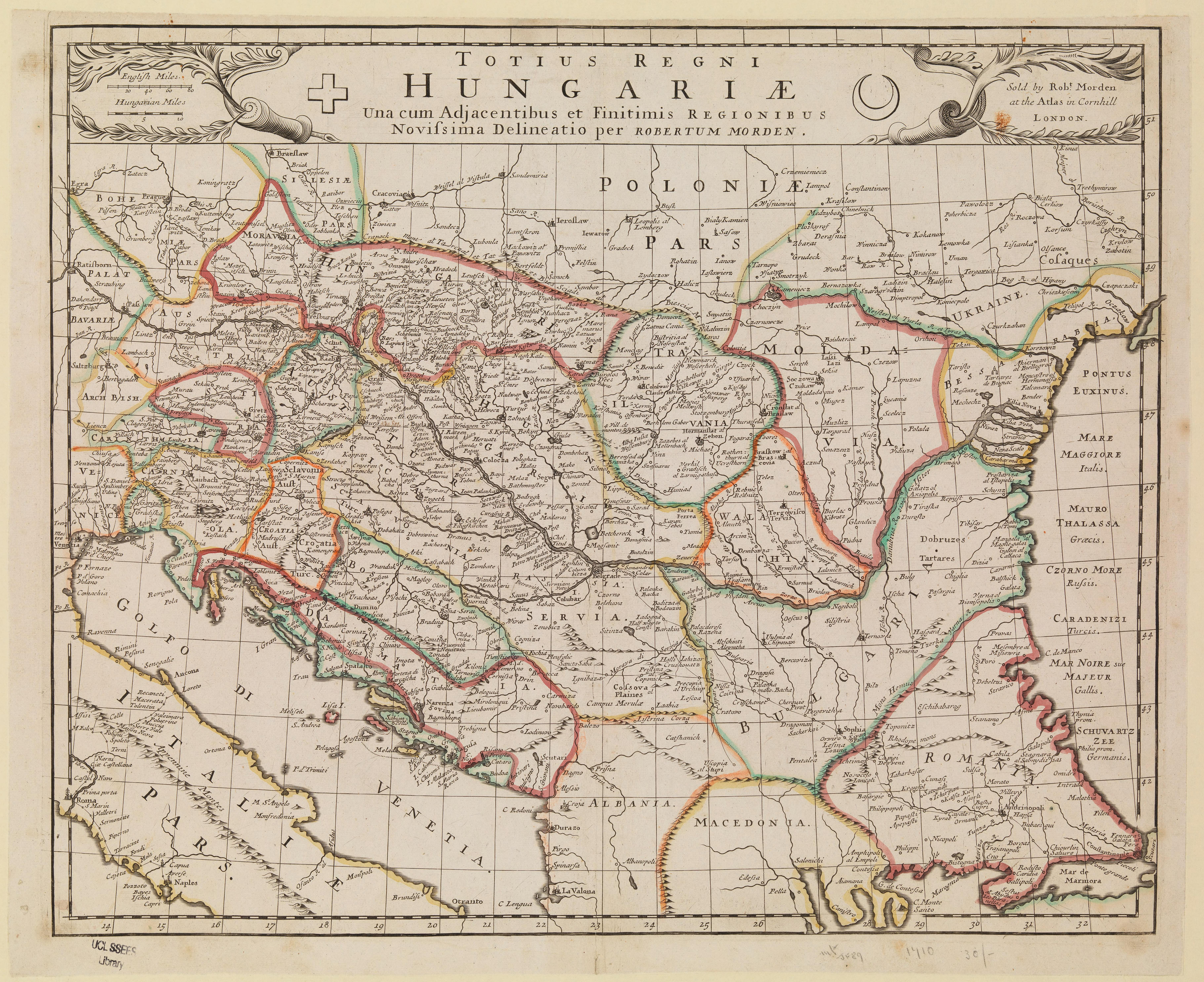
| tytuł arkusza | Totius regni Hungariae |
| rok wydania | ±1690 |
| stan mapy/skanu | dobry |
| rozdzielczość | 300 dpi |
| kolory skanu | rgb |
| uwagi | Totius regni Hungariae :una cum adjacentibus et finitimis regionibus : novissima delineatio /per Robertum Morden. Morden, Robert, d. 1703. From the collections of UCL SSEES Library London : sold by Robt. Morden at the Atlas in Cornhill , [between 1680 and 1700] |
| plik dodano | 2014-04-10 |
| wpis edytowano | 2014-04-11 22:14:40 |
| ze zbiorów | University College of London, School of Slavonic and East European Studies |
| licencja dostawcy | Copyright UCL Library Services, 2010, licensed under Creative Commons Attribution-NonCommercial-ShareAlike 2.0 UK: England and Wales Licence. For further information on this Licence please refer to: http://creativecommons.org/licenses/by-nc-sa/2.0/uk/ |
