


| Kartedatei | ssees0016_The_Crimea-ca1855.jpg |
|---|---|
| Dateigröße | 5570690 (5.3 MB) |
| Blattnummer | UKRAINE |
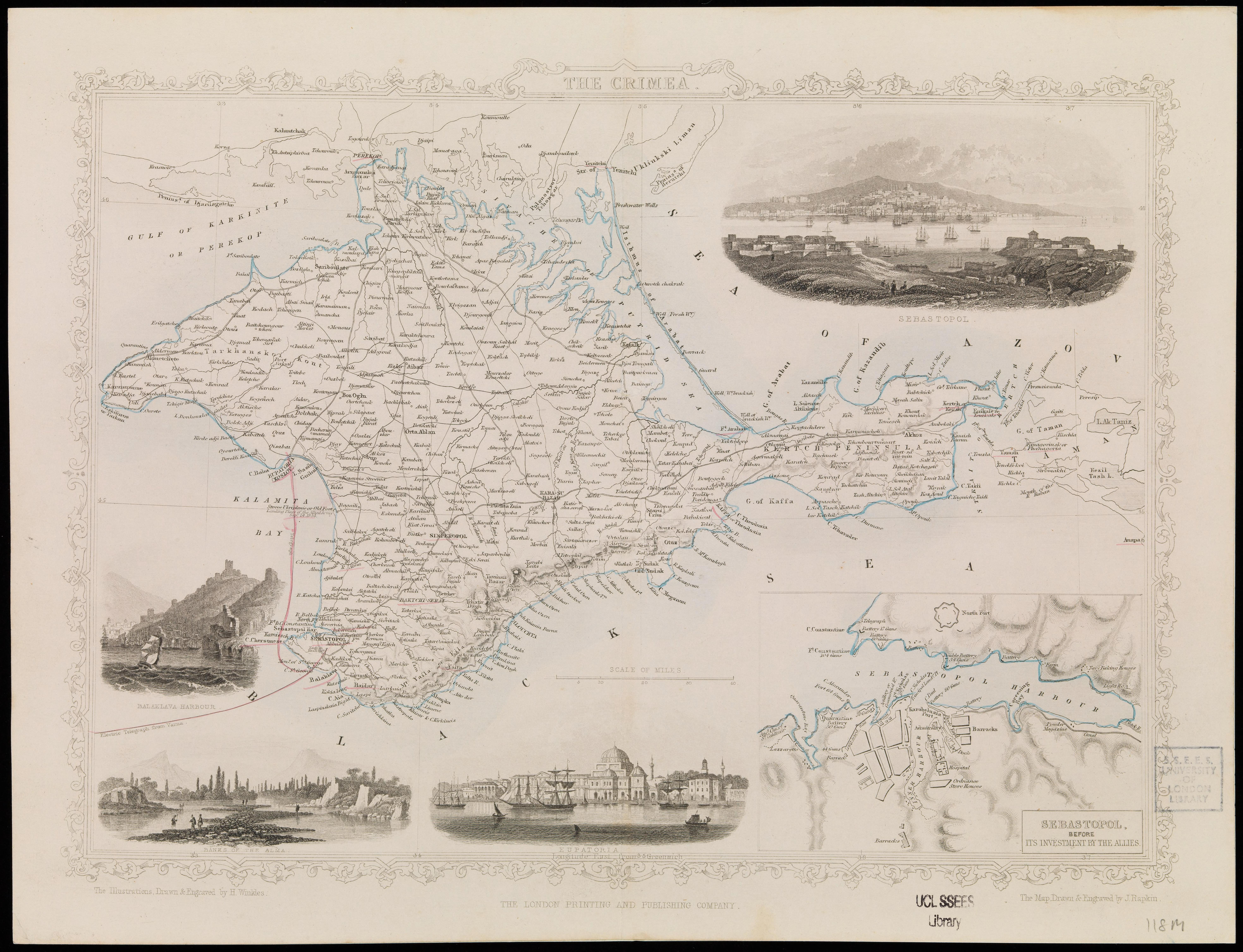
| Blatttitel | The Crimea |
| Veröffentlichungsjahr | ±1855 |
| Karte/Scanzustand | gut |
| Scanauflösung | 300 dpi |
| Scanfarben | rgb |
| Hinweise | The Crimea /the map drawn and engraved by J. Rapkin, the illustrations drawn and engraved by H. Winkles. Rapkin, John. Winkles, H. From the collections of UCL SSEES Library [London] : London Printing and Publishing Company , [1855?] |
| Datei hinzugefügt | 2014-04-12 |
| Eintrag editiert | 2014-04-12 12:27:20 |
| aus der Sammlung von | University College of London, School of Slavonic and East European Studies |
| Lieferers Lizenz | Copyright UCL Library Services, 2010, licensed under Creative Commons Attribution-NonCommercial-ShareAlike 2.0 UK: England and Wales Licence. For further information on this Licence please refer to: http://creativecommons.org/licenses/by-nc-sa/2.0/uk/ |
