


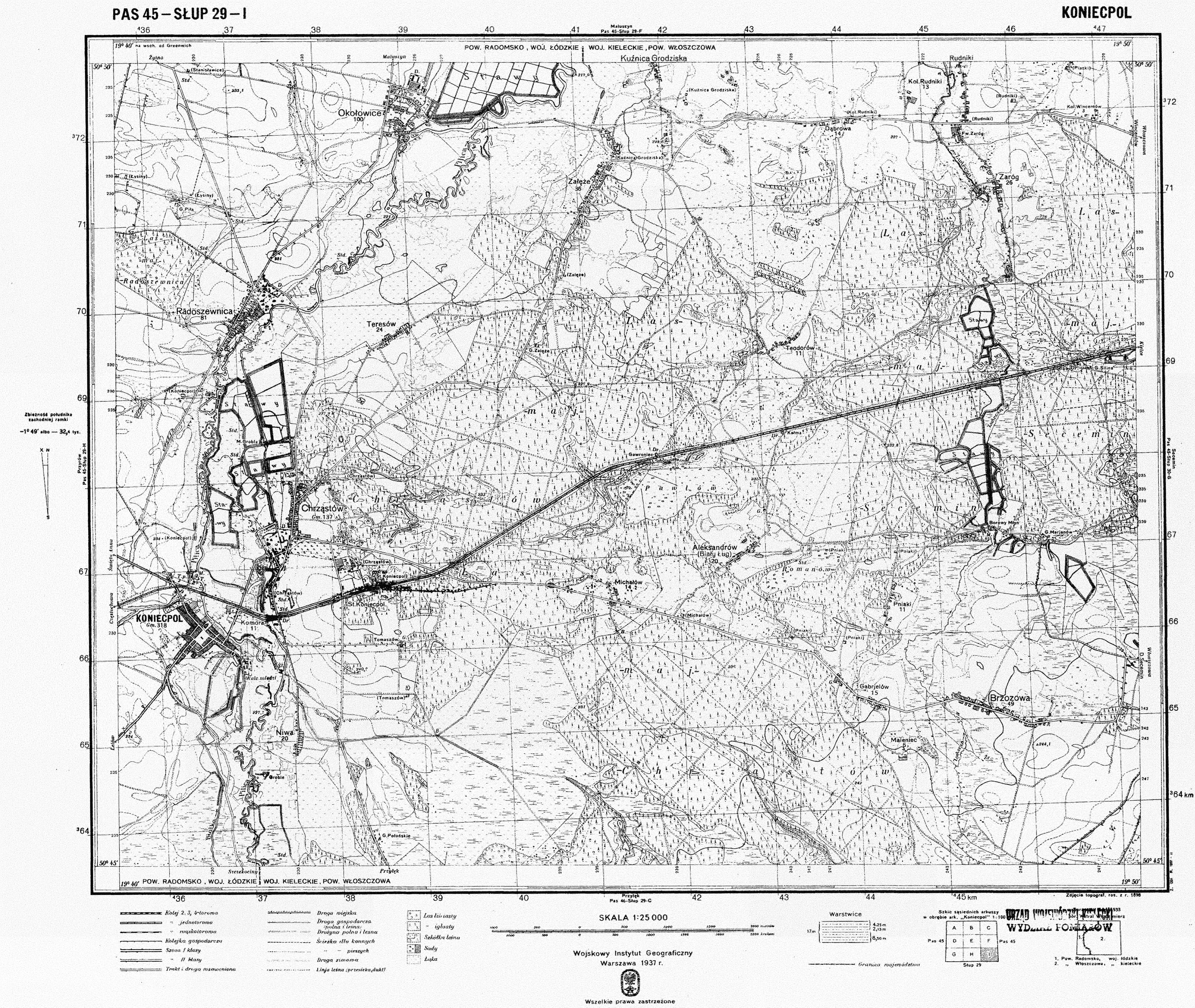
| map file | P45-S29-I_KONIECPOL_1937_copy.jpg |
|---|---|
| file size | 9448681 (9.0 MB) |
| sheet number | P45 S29 I (4529 I) |
| sheet title | KONIECPOL (2) |
| publication year | 1937 |
| publisher | Wojskowy Instytut Geograficzny |
| map type | WIG 1:25tys normalny-cz/b |
| description | The WIG map 1:25,000. Normal edition, black/white. |
| map/scan condition | average |
| scan resolution | 300 dpi |
| scan colors | rgb |
| file added | 2014-09-21 |
| entry edited | 2014-09-21 12:19:54 |
| from the collection of | Archiwum Map WIG |
