


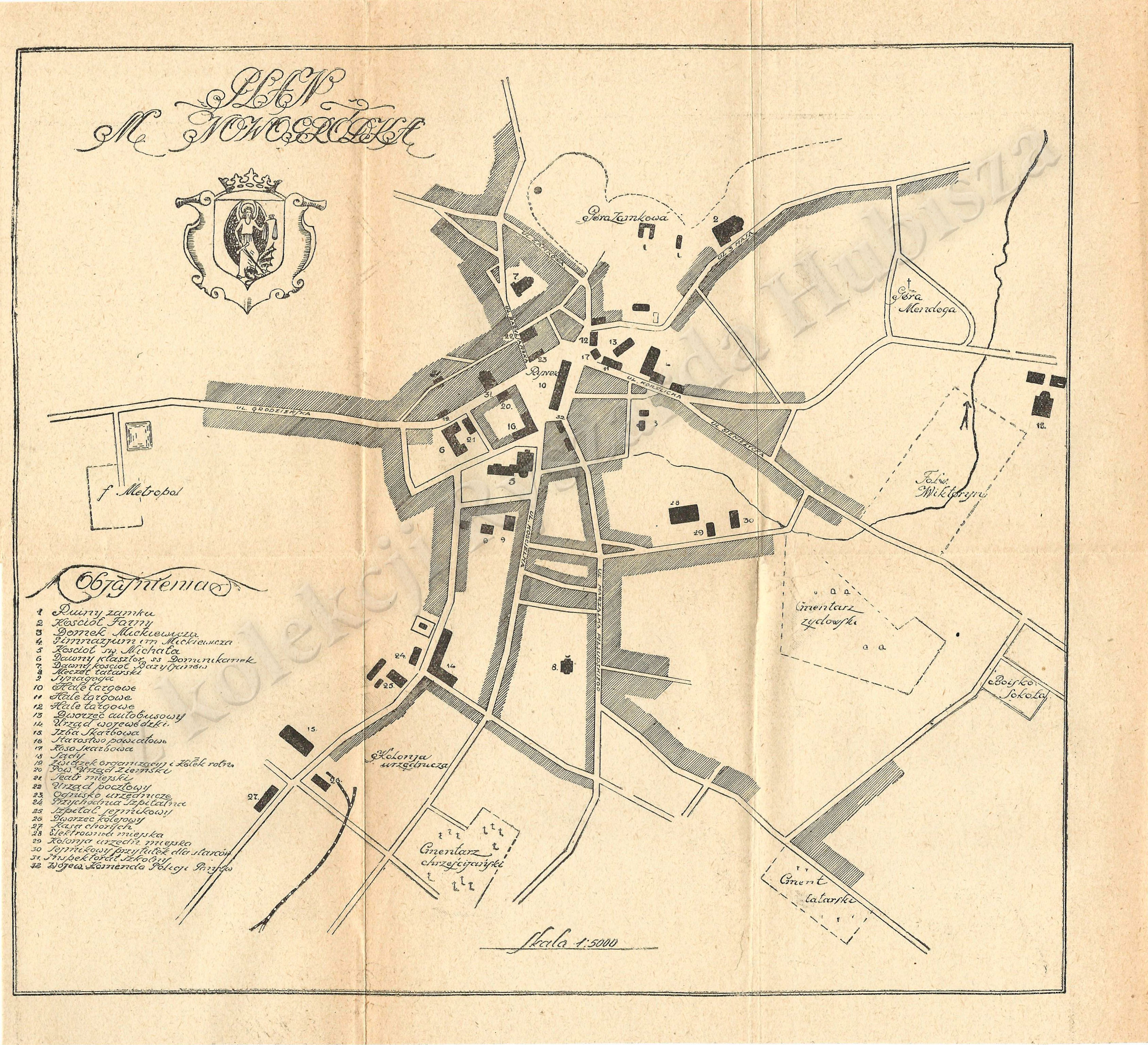
| map file | PLAN_M_NOWOGRODKA_5K_1931.jpg |
|---|---|
| file size | 1990166 (1.9 MB) |
| sheet number | Nowogródek |
| map sheet scale | 1:5,000 |
| sheet title | PLAN M. NOWOGRÓDKA |
| modern name | Навагрудак |
| alternative name | Nowogródek |
| publication year | 1931 |
| map/scan condition | good |
| scan resolution | 300 dpi |
| scan colors | rgb |
| file added | 2014-11-20 |
| entry edited | 2014-11-20 15:05:58 |
| from the collection of | Ryszard Hubisz |
