


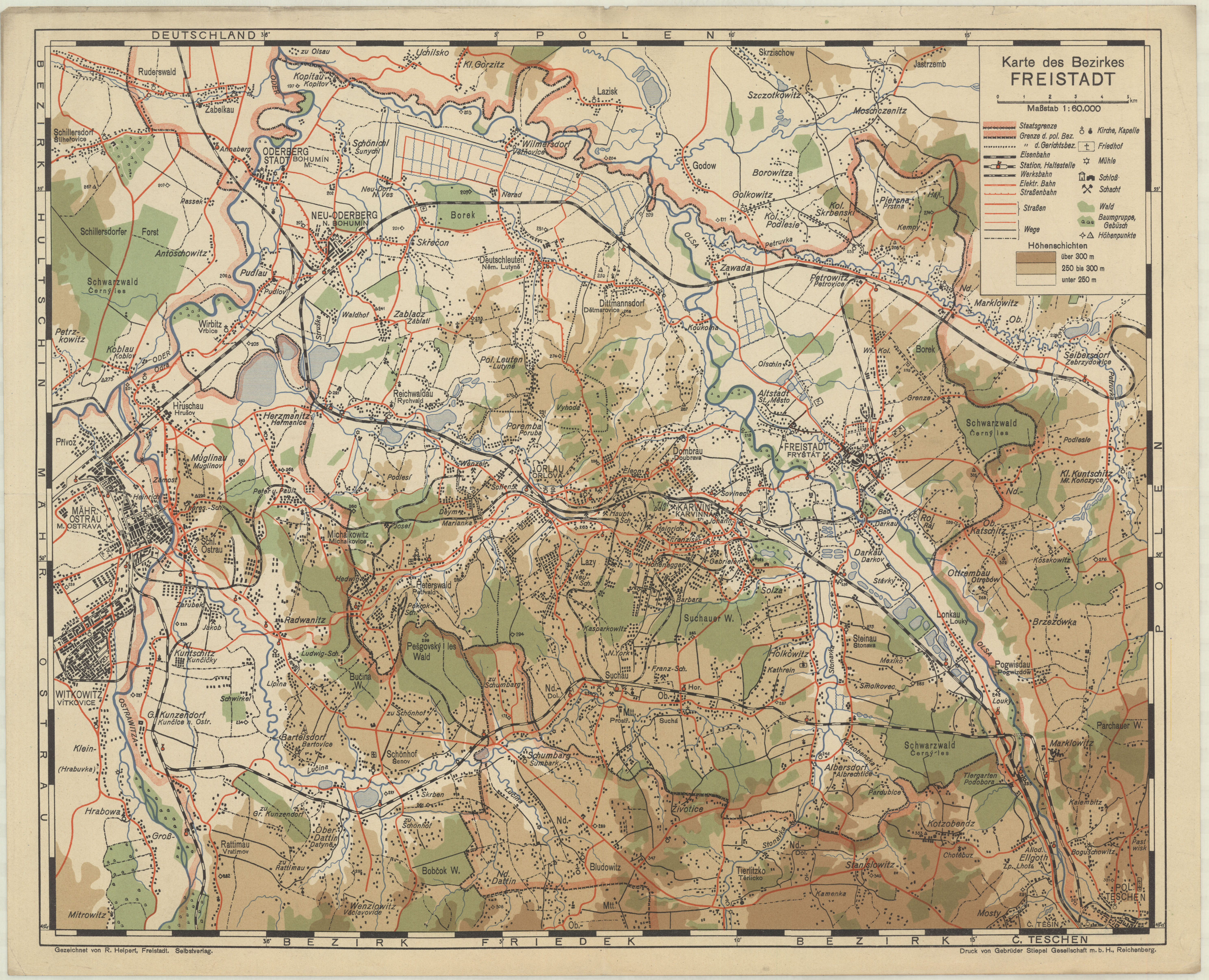
| map file | Karte_des_Bezirkes_FREISTADT_60K.jpg |
|---|---|
| file size | 5546051 (5.3 MB) |
| sheet number | ŚLĄSK |
| map sheet scale | 1:60,000 |
| sheet title | Karte des Bezirkes FREISTADT |
| publication year | ±1932 |
| map/scan condition | good |
| scan resolution | 300 dpi |
| scan colors | rgb |
| remarks | gezeichnet von R. Helpert, Freistadt. Selbstverlag. Druck: Gebrueder Stiepel G.m.b.H, Reichenberg |
| file added | 2016-05-07 |
| entry edited | 2016-05-07 21:04:26 |
| from the collection of | Składnica Map Biblioteki Wydziału Nauk o Ziemi Uniwersytetu Śląskiego |
