


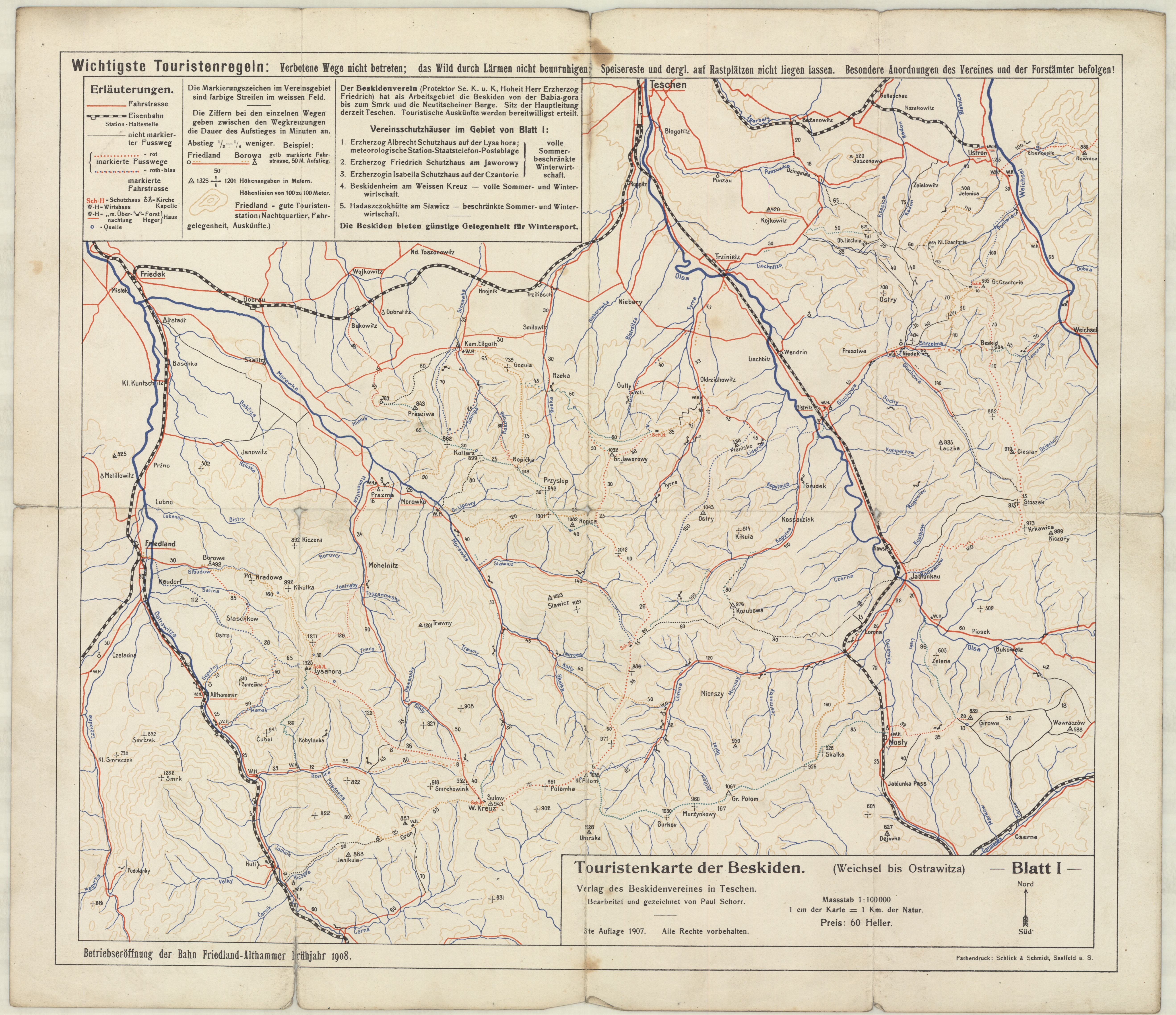
| map file | Touristenkarte_der_Beskiden_Bl_I_Weichsel-Ostrawitza_100K_1907.jpg |
|---|---|
| file size | 3851037 (3.7 MB) |
| sheet number | ŚLĄSK |
| map sheet scale | 1:100,000 |
| sheet title | Touristenkarte der Beskiden (Weichsel bis Ostrawitza) Blatt I |
| annotation | 3te Auflage, beerbeitet u. gezeichnet von Paul Schorr |
| publication year | 1907 |
| publisher | -inne- (-others-) |
| map/scan condition | good |
| scan resolution | 300 dpi |
| scan colors | rgb |
| remarks | Verlag des Beskidenvereines in Teschen. Druck: Schlick & Schmidt, Saalfeld a. S. |
| file added | 2016-05-07 |
| entry edited | 2016-05-07 21:58:24 |
| from the collection of | Składnica Map Biblioteki Wydziału Nauk o Ziemi Uniwersytetu Śląskiego |
