


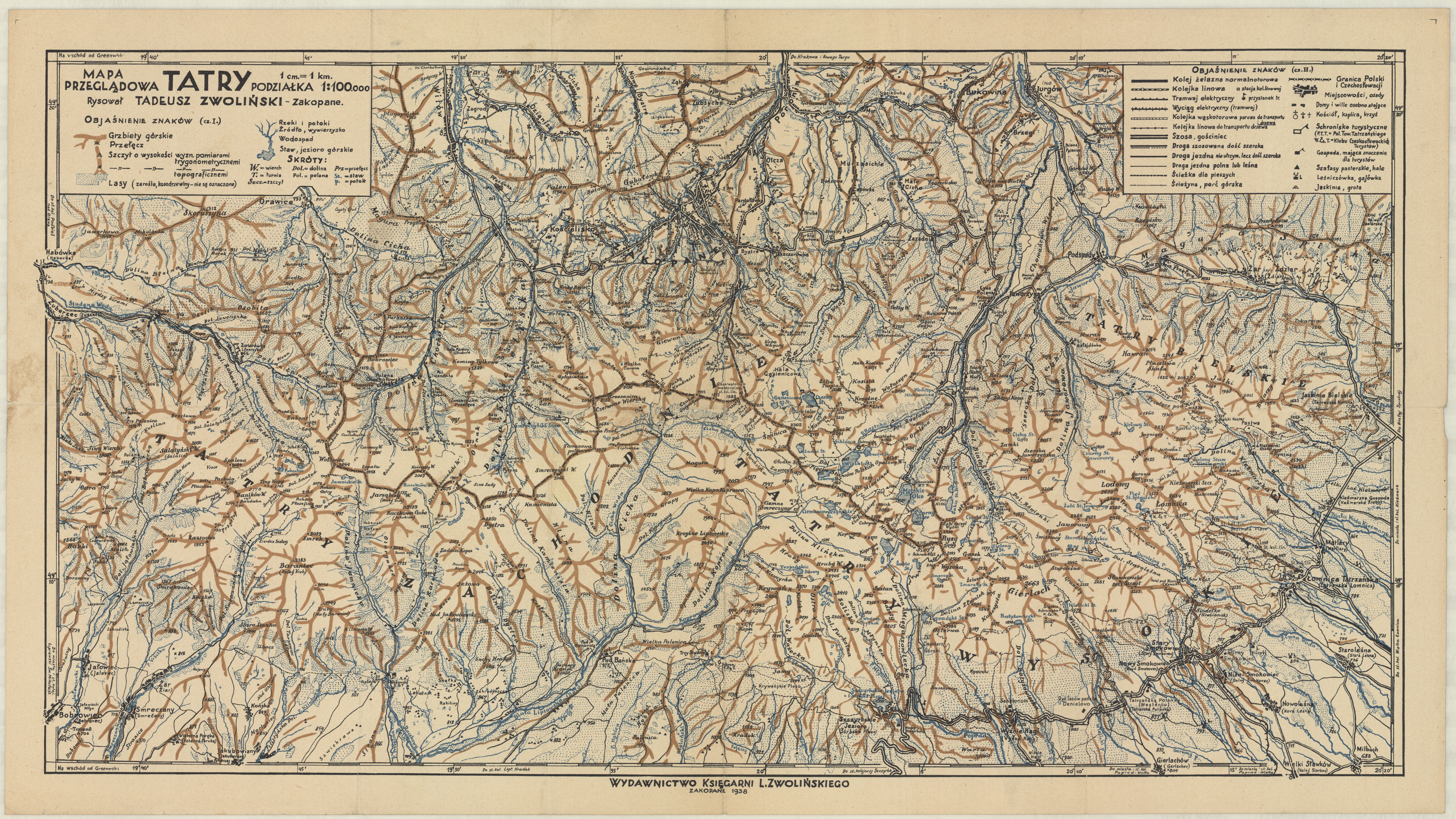
| map file | TATRY_MAPA_PRZEGLADOWA_100K_T.ZWOLINSKI_1938.jpg |
|---|---|
| file size | 7190892 (6.9 MB) |
| sheet number | KARPATY |
| map sheet scale | 1:100,000 |
| sheet title | TATRY MAPA PRZEGLĄDOWA |
| publication year | 1938 |
| publisher | -inne- (-others-) |
| map/scan condition | good |
| scan resolution | 300 dpi |
| scan colors | rgb |
| remarks | rysował Tadeusz Zwoliński, Wydawnictwo Księgarń L. Zwolińskiego |
| file added | 2016-05-09 |
| entry edited | 2016-05-09 00:09:31 |
| from the collection of | Składnica Map Biblioteki Wydziału Nauk o Ziemi Uniwersytetu Śląskiego |
