


| Kartedatei | Mil-Topogr_Karte_Mogilew_u._Umgebung_10K_Bl_11_c.1942_G7094.M3_s10_.M5.jpg |
|---|---|
| Dateigröße | 4492059 (4.3 MB) |
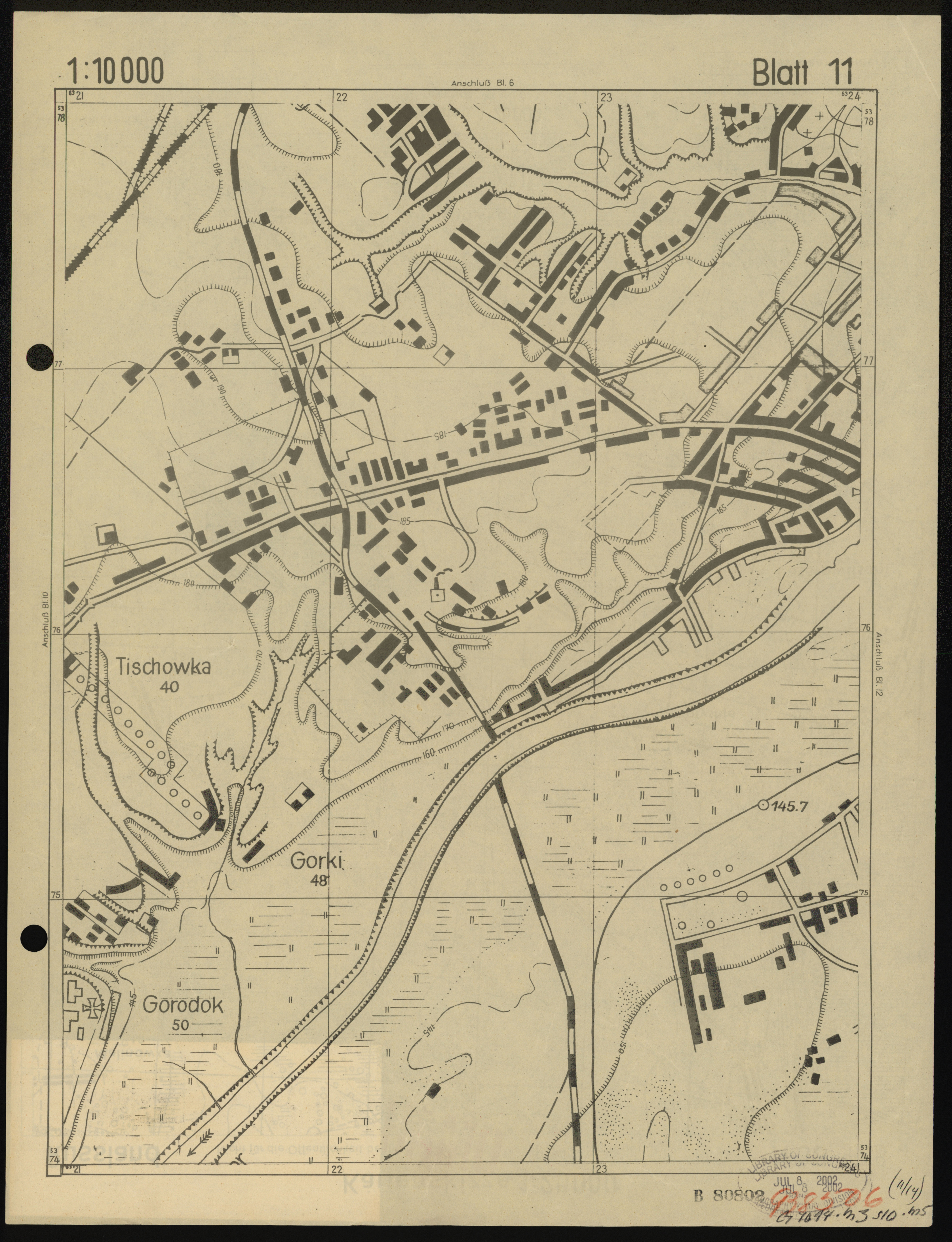
| Blattnummer | 11 |
| Blattmaßstab | 1:10 000 |
| Blatttitel | Militär-topogr. Karte v. Mogilew und Umgebung Blatt 11 |
| Veröffentlichungsjahr | ±1942 |
| Karte/Scanzustand | gut |
| Scanauflösung | 400 dpi |
| Scanfarben | rgb |
| Datei hinzugefügt | 2018-02-05 |
| Eintrag editiert | 2018-02-05 22:47:43 |
| aus der Sammlung von | The Library of Congress, Washington, DC, USA |
| G7094.M3 s10 .M5 | |
| Quelleanmerkung | https://lccn.loc.gov/2002620848 |
