


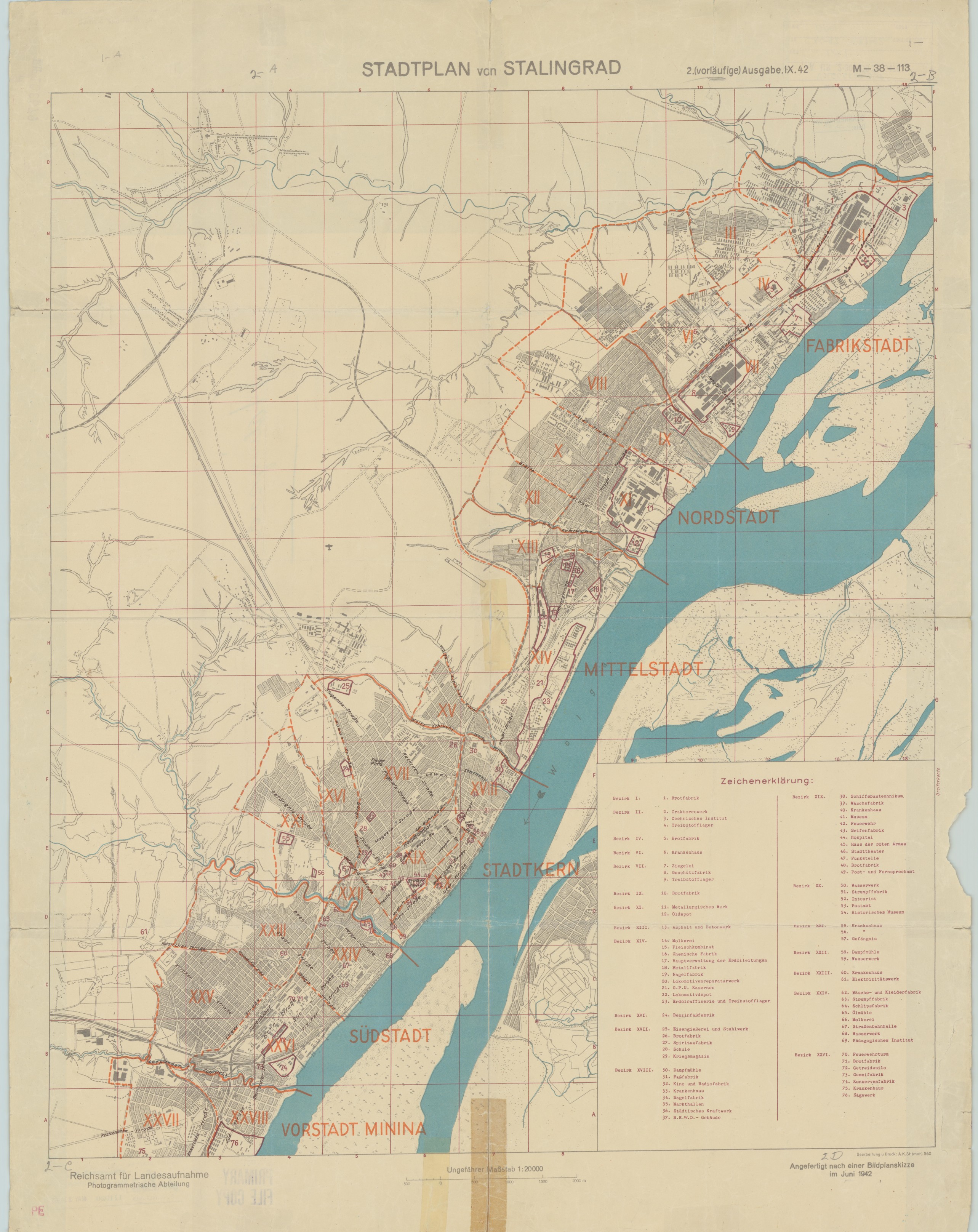
| map file | STADTPLAN_von_STALINGRAD_20K_IX.1942.jpg |
|---|---|
| file size | 1794256 (1.7 MB) |
| sheet number | Волгоград |
| map sheet scale | 1:20,000 |
| sheet title | STADTPLAN von STALINGRAD |
| publication year | 1942 |
| map/scan condition | bad |
| scan resolution | 150 dpi |
| scan colors | rgb |
| remarks | Reichsamt fuer Landesaufnahme (Photogramm. Abt.), Bearb.: A.K. St. (mot) 560 |
| file added | 2019-12-11 |
| entry edited | 2019-12-11 13:27:31 |
| from the collection of | The Library of Congress, Washington, DC, USA |
